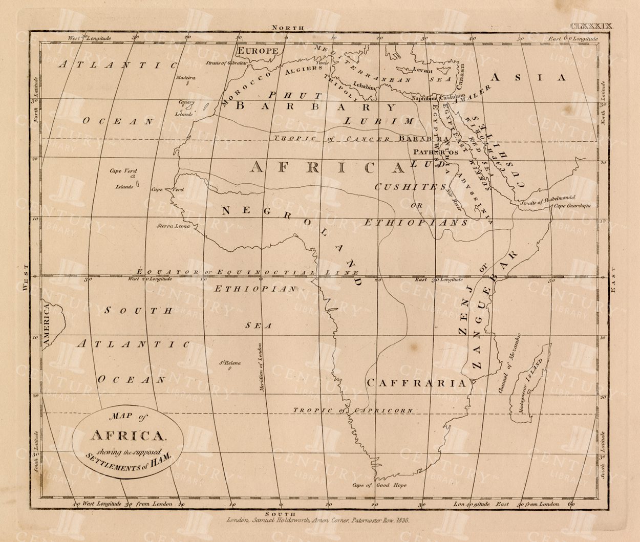
• Explore
  • Collections
  • Studio

  • Log In
  • Suggestions
  • Become an Affiliate!
  • Licensing/FAQs
  • Contact us
Century Library
  • Explore
  • Collections
  • Studio
Sign in
  • Log In
  • Suggestions
  • Become an Affiliate!
  • Licensing/FAQs
  • Contact us
Join
Map of Africa with Biblical Regions – 19th Century Engraved Cartography
  1. Archive
  2. › Maps
  3. › #50084

Map of Africa with Biblical Regions – 19th Century Engraved Cartography

An 1836 engraved map of Africa showing regional divisions with period nomenclature including Barbary, Negroland, and Caffraria. The simple linework and decorative cartouche make this ideal for book interiors, educational materials, or framed wall art with a scholarly feel

Yours free

This image is free to download and use.

But the best pieces in the archive are for members. Join to see the full collection.

Download free
Join the library for more
Moodboard 12

Details

Resolution
8690px x 7365px
Year
1836
Format
JPG
Artist
Charles Taylor
Downloads
12 total

Counting since May 2026

Discover more like this

  • Africa
  • Antique
  • Atlas
  • book interior
  • cartography
  • coastline
  • continent
  • educational
  • engraved map
  • Geography
  • latitude
  • longitude
  • Maps
  • Victorian
  • wall art

Within these Collections

Dark Academia

Dark Academia

448 items
Historical Maps & Antique Charts

Historical Maps & Antique Charts

688 items

Similar finds

Century Library

A treasury of vintage inspiration. Hand-scanned from our collection and waiting to spark your next creative idea.

Total downloads
1,106,737
Last 7 days
14,217

Discover

  • Explore
  • Collections
  • Studio

My Library

  • Log In
  • Suggestions
  • Become an Affiliate!
  • Licensing/FAQs
  • Contact us

Our Story

  • About
  • Contact
  • FAQ

© MMXXVI Century Library

Privacy Terms License

Century Library

Welcome back.

Ready to explore more? Sign in to your library.

Forgot password?

New here? Join thousands of collectors and creatives.