

1897 Map of Italy: Comprehensive View Including Rome and Venice
A detailed 1897 map of Italy, encompassing the entire peninsula including key cities like Rome and Venice. This map highlights the topographical features, transportation networks, and regional boundaries of Italy during the late 19th century. It offers a broad view of Italy's geography and historical development, making it a significant resource for historical studies.
- Resolution: 7153 x 5100
- Image Type(s): JPG
From this collection
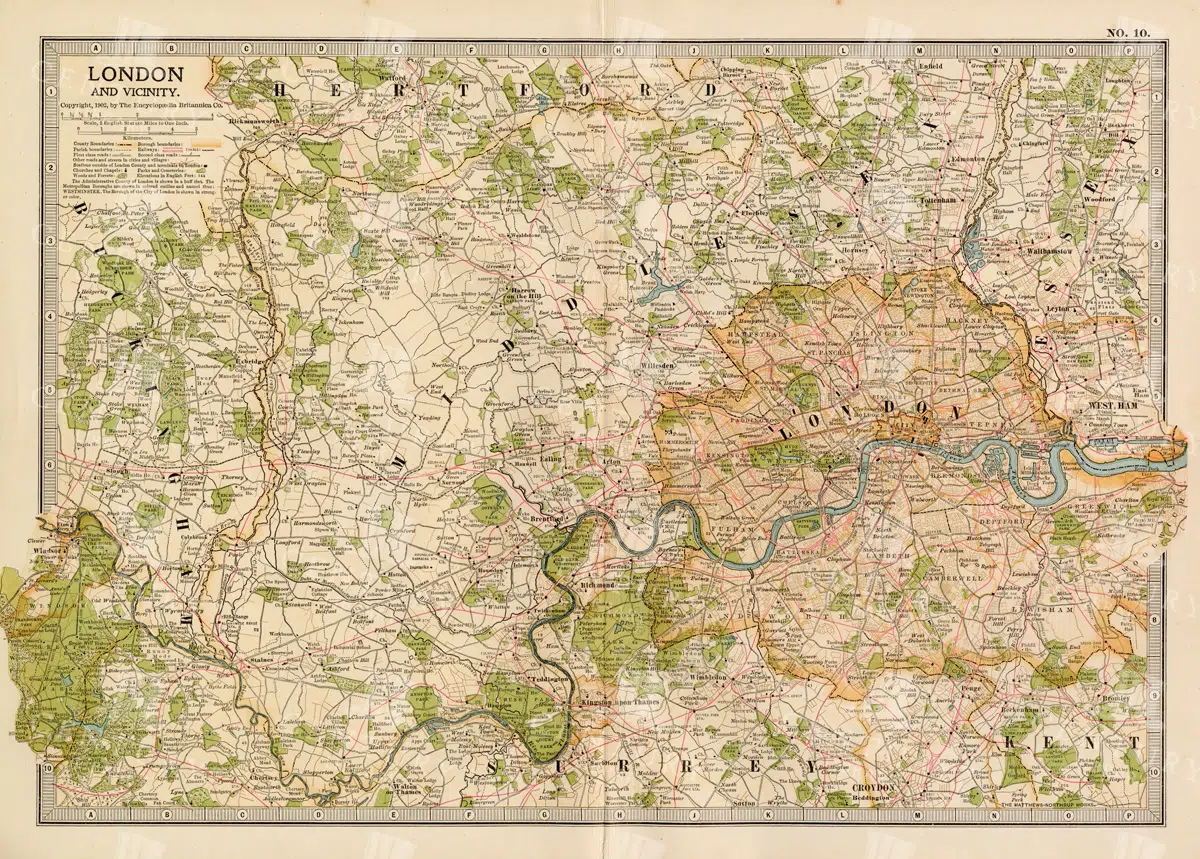
1897 Map of London and Surrounding Areas in the Late 19th Century
A detailed map from 1897 showcasing London and its surrounding areas, including key roads, railways, and landmarks. The map offers a comprehensive view of the city's layout and development during the late 19th century, providing valuable historical insights into London's urban expansion and infrastructure. The vintage aesthetic adds to its charm as a historical document.
- Resolution: 7158 x 5100
- Image Type(s): JPG
From this collection

1897 Map of Japan and Korea Detailing Regional Divisions
An intricate 1897 map of Japan and Korea, illustrating regional divisions, cities, and transportation routes. The map provides a detailed view of the geography and political landscape of East Asia during the late 19th century, highlighting the interconnectedness of Japan and Korea. Its vintage cartography offers a glimpse into the historical context of the region.
- Resolution: 7155 x 5100
- Image Type(s): JPG
From this collection

1897 Map of Jamaica and the Lesser Antilles
This vintage 1897 map features Jamaica and the Lesser Antilles, highlighting the islands' geography, political boundaries, and colonial possessions. The map provides a historical overview of the Caribbean region, showing the various territories under colonial rule during the late 19th century. Its detailed depiction of the islands offers valuable insight into the Caribbean's colonial past.
- Resolution: 7154 x 5100
- Image Type(s): JPG
From this collection

1897 Map of New Zealand and Pacific Islands
This vintage 1897 map provides a detailed view of New Zealand and surrounding Pacific islands, including Samoa, Fiji, Tonga, and others. It illustrates the geographical and political boundaries of the region during the late 19th century, offering insight into the exploration and colonization of the Pacific. The map's historical significance is enhanced by its detailed cartography and the representation of various island groups.
- Resolution: 7150 x 5100
- Image Type(s): JPG
From this collection

1897 Map of Maine Highlighting Counties and Coastal Areas
This 1897 map of Maine provides a detailed view of the state's counties, towns, and coastal areas. The map illustrates the geographical features and administrative divisions of Maine during the late 19th century, offering a historical perspective on the region's development. Its vintage design makes it a significant resource for those interested in Maine's history.
- Resolution: 7159 x 5100
- Image Type(s): JPG
From this collection

1897 Map of Italy: Central and Southern Regions
A detailed 1897 map highlighting the central and southern regions of Italy, including Sicily. The map showcases the topography, cities, and transportation routes of the time, providing a rich historical context of Italy during the late 19th century. The map includes notable cities such as Naples, Rome, and Palermo, along with detailed depictions of the surrounding areas.
- Resolution: 7151 x 5100
- Image Type(s): JPG
From this collection

1897 Map of Italy: Northern Regions
This 1897 map offers a comprehensive view of Northern Italy, detailing its cities, mountain ranges, and infrastructure. The map covers important regions such as Piedmont, Lombardy, and Veneto, highlighting the area's rich history and development during the 19th century. It serves as a valuable historical document for understanding Italy's northern landscape at the time.
- Resolution: 7152 x 5100
- Image Type(s): JPG
From this collection

1897 Map of Kansas with Detailed County Lines and Railroads
A historical map from 1897 showing Kansas with a focus on county lines, railroads, and major cities. The map provides a detailed representation of the state's infrastructure and development during the late 19th century, offering valuable insights into the region's history and growth. The vintage design adds to its appeal as a historical artifact.
- Resolution: 7156 x 5100
- Image Type(s): JPG
From this collection

1897 Map of Kentucky Featuring Counties, Railways, and Rivers
This 1897 map of Kentucky highlights the state's counties, railways, and rivers, offering a detailed look at the region's geography and infrastructure during the late 19th century. The map serves as a valuable resource for understanding Kentucky's development, with a focus on transportation and regional divisions. The vintage cartography style enhances its historical significance.
- Resolution: 7157 x 5100
- Image Type(s): JPG
From this collection

Support the Library
Our supporters and members help us continue collecting and restoring these wonderful pieces of art for the modern creator
Unlock Everything and Become a Member!
While a lot of the library is available for free, some is kept behind closed dusty doors only to be accessed by our lovely members.