
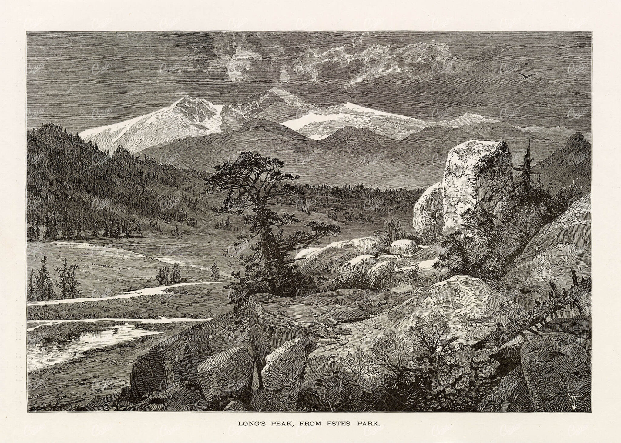
NORTH AMERICA – Rocky Mountains – Long’s Peak from Estes Park 1874
You're looking at a beautifully detailed engraved illustration from the 'Picturesque America' series. Published by D. Appleton and Company of New York in 1872 and 1874 and edited by the romantic poet and journalist William Cullen Bryant. The "Picturesque America; or, The Land We Live In. A Delineation by Pen and Pencil of the Mountains, Rivers, Lakes, Forests, Water-falls, Shores, Cañons, Valleys, Cities, and Other Picturesque Features of Our Country. With Illustrations on Steel and Wood, by Eminent American Artists" series was published and delivered as a subscription; semi-monthly parts were sent out to subscribers. Once complete, the subscription would be bound into volumes. The stately, bound two volume set was proudly displayed in parlors of subscriber homes as a show of status. Engravers included Robert Hinshelwood (1812-1885), Edward Paxman Brandard (1819-1898), Samuel Valentine Hunt (1803-1893), William Wellstood (1819-1900), William Chapin (1802-1888), Henry Bryan Hall (1808-1884).
- License Info
- Resolution: 9000 x 6400
- Year of Print: 1874
- Artist: D. Appleton
From this collection
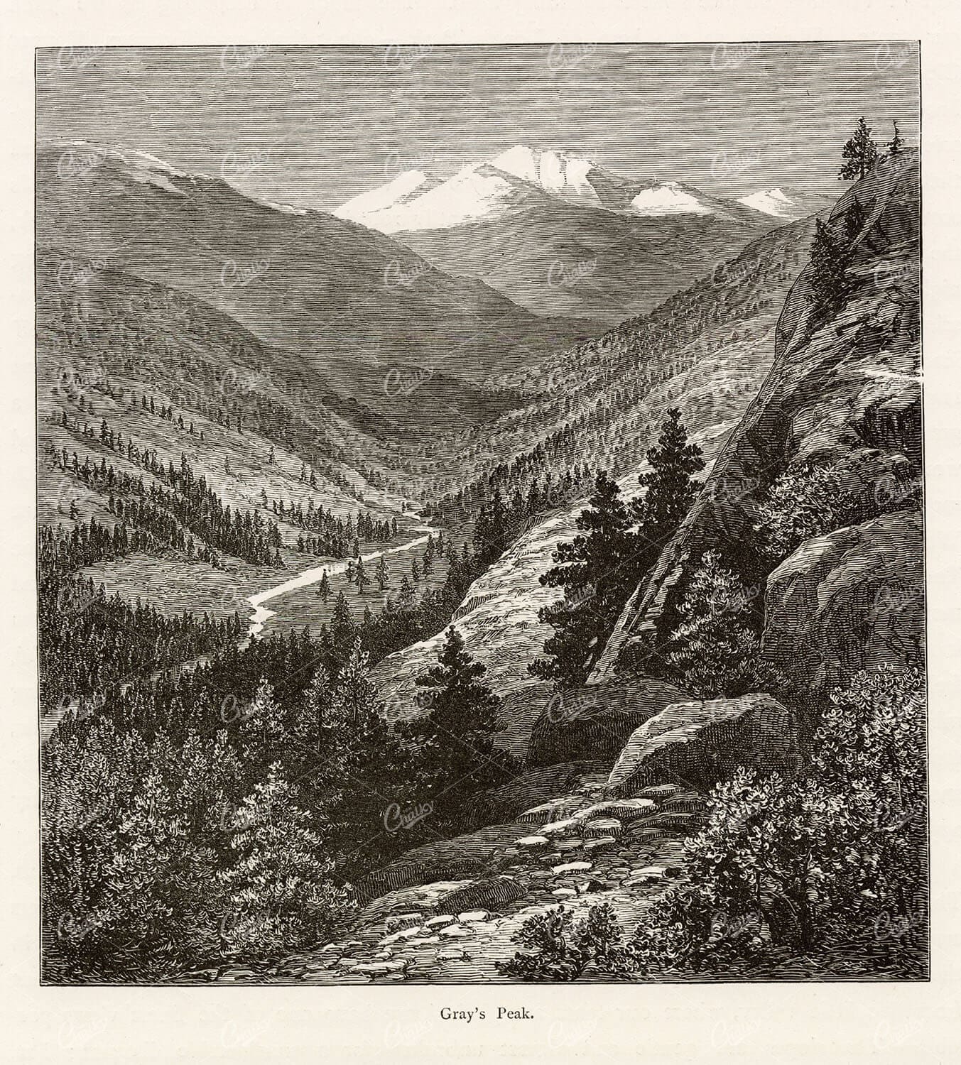
NORTH AMERICA – Rocky Mountains – Grey’s Peak Colorado 1874
You're looking at a beautifully detailed engraved illustration from the 'Picturesque America' series. Published by D. Appleton and Company of New York in 1872 and 1874 and edited by the romantic poet and journalist William Cullen Bryant. The "Picturesque America; or, The Land We Live In. A Delineation by Pen and Pencil of the Mountains, Rivers, Lakes, Forests, Water-falls, Shores, Cañons, Valleys, Cities, and Other Picturesque Features of Our Country. With Illustrations on Steel and Wood, by Eminent American Artists" series was published and delivered as a subscription; semi-monthly parts were sent out to subscribers. Once complete, the subscription would be bound into volumes. The stately, bound two volume set was proudly displayed in parlors of subscriber homes as a show of status. Engravers included Robert Hinshelwood (1812-1885), Edward Paxman Brandard (1819-1898), Samuel Valentine Hunt (1803-1893), William Wellstood (1819-1900), William Chapin (1802-1888), Henry Bryan Hall (1808-1884).
- License Info
- Resolution: 5900 x 6600
- Year of Print: 1874
- Artist: D. Appleton
From this collection
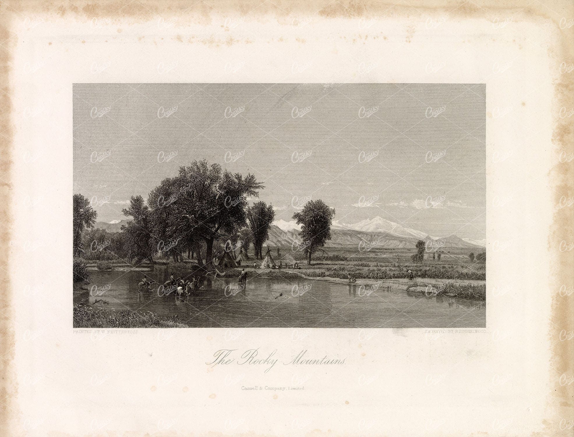
VIEW of The ROCKY MOUNTAINS w/ Natives, Teepee, Horses, River
You're looking at a beautifully detailed engraved illustration from the 'Picturesque America' series. Published by D. Appleton and Company of New York in 1872 and 1874 and edited by the romantic poet and journalist William Cullen Bryant. The "Picturesque America; or, The Land We Live In. A Delineation by Pen and Pencil of the Mountains, Rivers, Lakes, Forests, Water-falls, Shores, Cañons, Valleys, Cities, and Other Picturesque Features of Our Country. With Illustrations on Steel and Wood, by Eminent American Artists" series was published and delivered as a subscription; semi-monthly parts were sent out to subscribers. Once complete, the subscription would be bound into volumes. The stately, bound two volume set was proudly displayed in parlors of subscriber homes as a show of status. Engravers included Robert Hinshelwood (1812-1885), Edward Paxman Brandard (1819-1898), Samuel Valentine Hunt (1803-1893), William Wellstood (1819-1900), William Chapin (1802-1888), Henry Bryan Hall (1808-1884).
- License Info
- Resolution: 11119 x 8463 300dpi
- Year of Print: 1874
- Artist: D. Appleton
From this collection
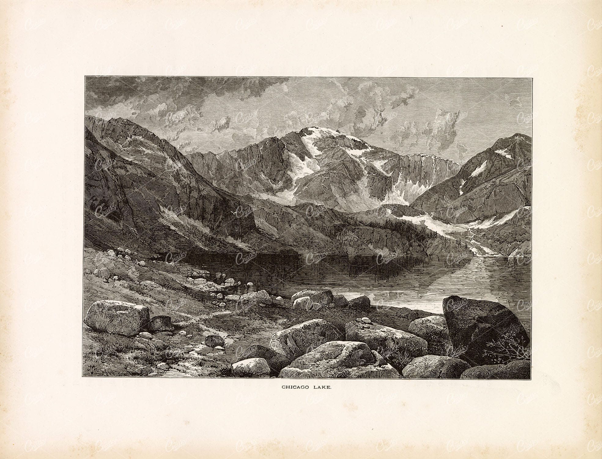
CHICAGO LAKE – Rocky Mountains, Mount Evans – 1874 Engraving Print
You're looking at a beautifully detailed engraved illustration from the 'Picturesque America' series. Published by D. Appleton and Company of New York in 1872 and 1874 and edited by the romantic poet and journalist William Cullen Bryant. The "Picturesque America; or, The Land We Live In. A Delineation by Pen and Pencil of the Mountains, Rivers, Lakes, Forests, Water-falls, Shores, Cañons, Valleys, Cities, and Other Picturesque Features of Our Country. With Illustrations on Steel and Wood, by Eminent American Artists" series was published and delivered as a subscription; semi-monthly parts were sent out to subscribers. Once complete, the subscription would be bound into volumes. The stately, bound two volume set was proudly displayed in parlors of subscriber homes as a show of status. Engravers included Robert Hinshelwood (1812-1885), Edward Paxman Brandard (1819-1898), Samuel Valentine Hunt (1803-1893), William Wellstood (1819-1900), William Chapin (1802-1888), Henry Bryan Hall (1808-1884).
- License Info
- Resolution: 11113 x 8466 300dpi
- Year of Print: 1874
- Artist: D. Appleton
From this collection
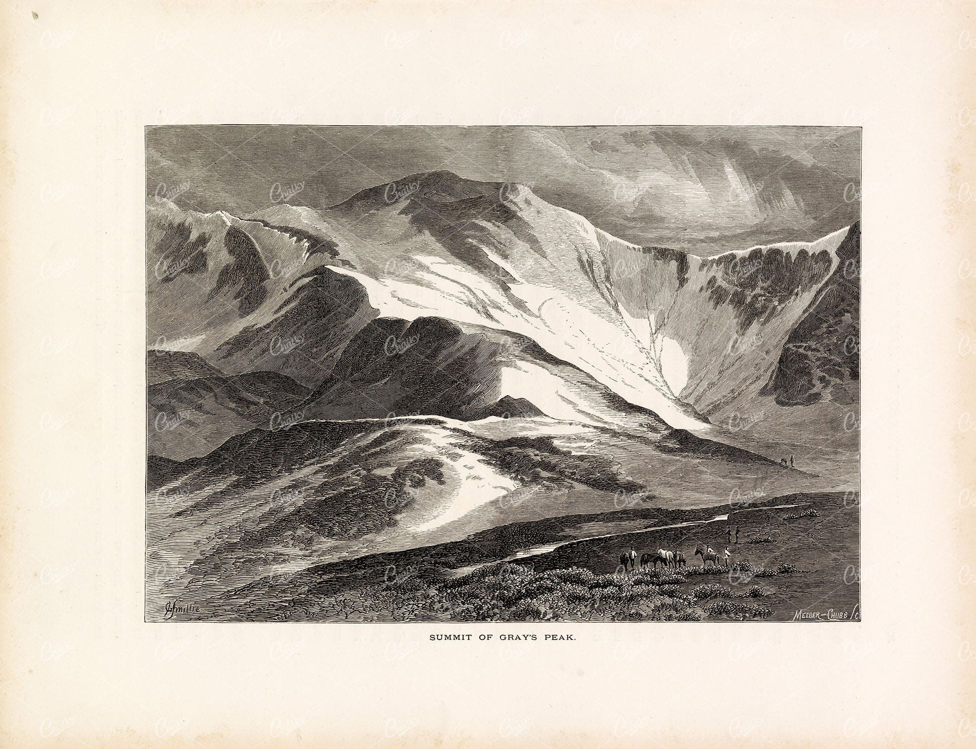
THE ROCKY MOUNTAINS – Summit of Gray’s Peak – Colorado – 1874 Print
You're looking at a beautifully detailed engraved illustration from the 'Picturesque America' series. Published by D. Appleton and Company of New York in 1872 and 1874 and edited by the romantic poet and journalist William Cullen Bryant. The "Picturesque America; or, The Land We Live In. A Delineation by Pen and Pencil of the Mountains, Rivers, Lakes, Forests, Water-falls, Shores, Cañons, Valleys, Cities, and Other Picturesque Features of Our Country. With Illustrations on Steel and Wood, by Eminent American Artists" series was published and delivered as a subscription; semi-monthly parts were sent out to subscribers. Once complete, the subscription would be bound into volumes. The stately, bound two volume set was proudly displayed in parlors of subscriber homes as a show of status. Engravers included Robert Hinshelwood (1812-1885), Edward Paxman Brandard (1819-1898), Samuel Valentine Hunt (1803-1893), William Wellstood (1819-1900), William Chapin (1802-1888), Henry Bryan Hall (1808-1884).
- License Info
- Resolution: 10919 x 8372 300dpi
- Year of Print: 1874
- Artist: D. Appleton
From this collection
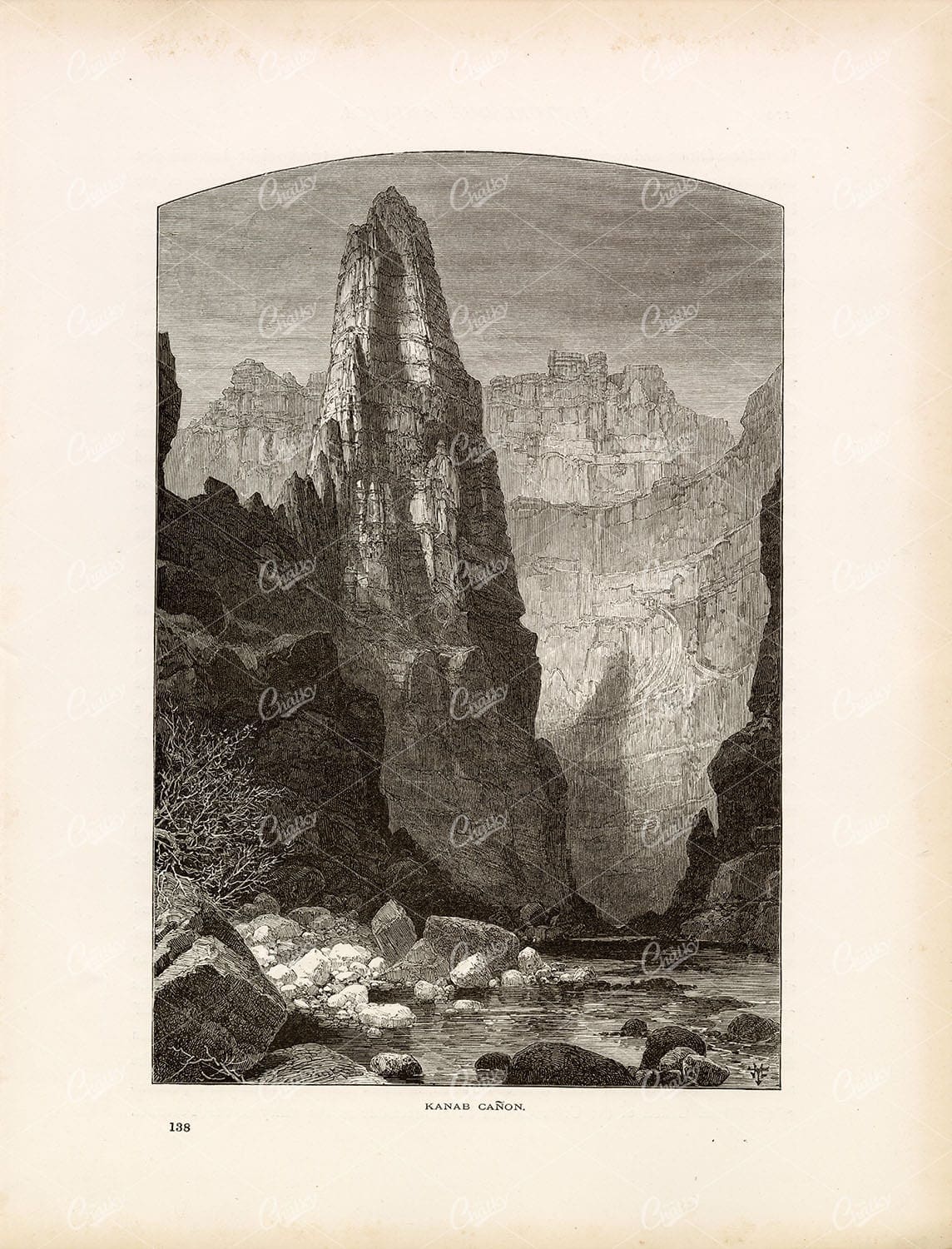
ARIZONA Rocky Mountains – View of Kanab Canyon – Antique Original Print
You're looking at a beautifully detailed engraved illustration from the 'Picturesque America' series. Published by D. Appleton and Company of New York in 1872 and 1874 and edited by the romantic poet and journalist William Cullen Bryant. The "Picturesque America; or, The Land We Live In. A Delineation by Pen and Pencil of the Mountains, Rivers, Lakes, Forests, Water-falls, Shores, Cañons, Valleys, Cities, and Other Picturesque Features of Our Country. With Illustrations on Steel and Wood, by Eminent American Artists" series was published and delivered as a subscription; semi-monthly parts were sent out to subscribers. Once complete, the subscription would be bound into volumes. The stately, bound two volume set was proudly displayed in parlors of subscriber homes as a show of status. Engravers included Robert Hinshelwood (1812-1885), Edward Paxman Brandard (1819-1898), Samuel Valentine Hunt (1803-1893), William Wellstood (1819-1900), William Chapin (1802-1888), Henry Bryan Hall (1808-1884).
- License Info
- Resolution: 8477 x 11117 300dpi
- Year of Print: 1874
- Artist: D. Appleton
From this collection
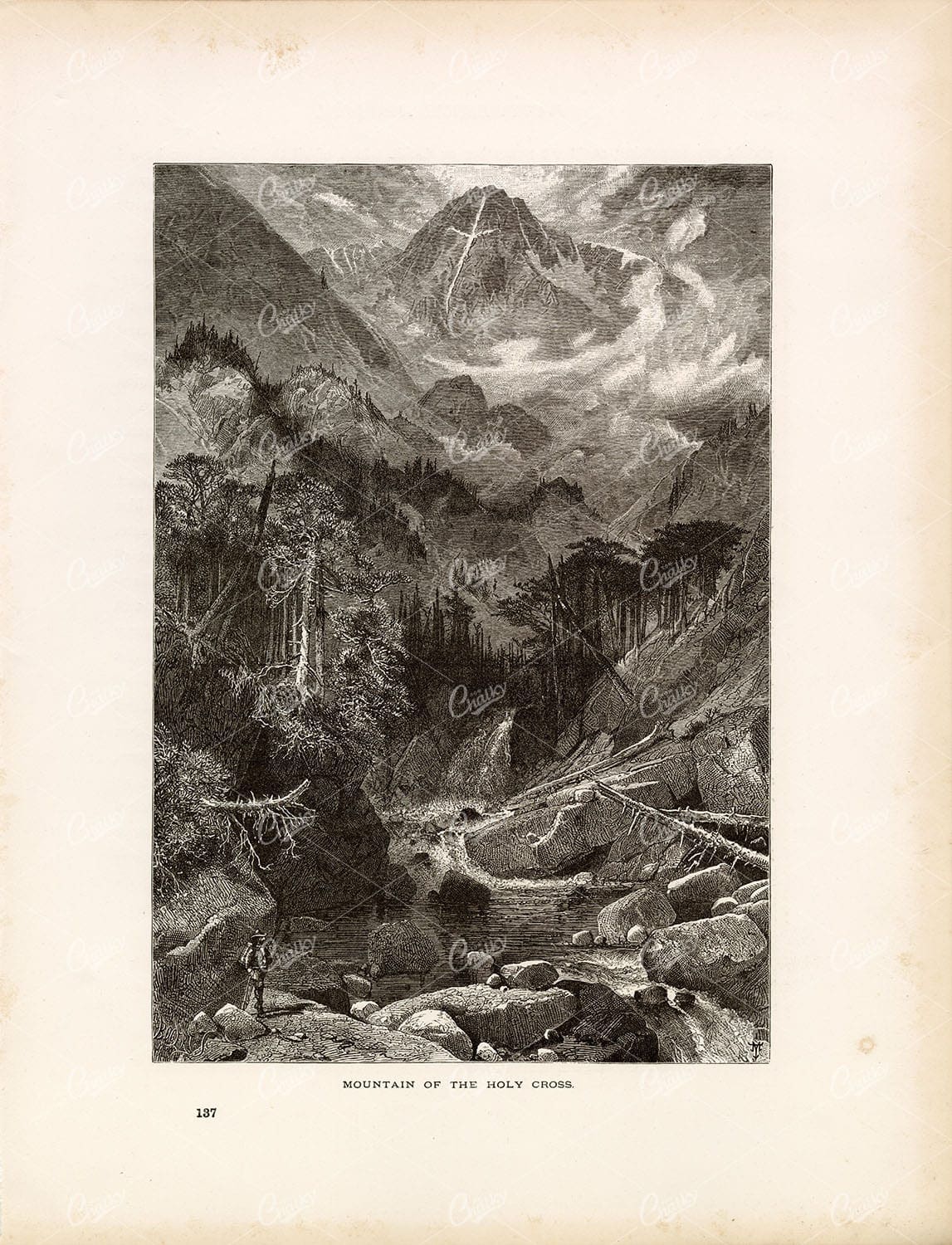
ROCKY MOUNTAINS – View of the Mountain of the Holy Cross – Original 1874
You're looking at a beautifully detailed engraved illustration from the 'Picturesque America' series. Published by D. Appleton and Company of New York in 1872 and 1874 and edited by the romantic poet and journalist William Cullen Bryant. The "Picturesque America; or, The Land We Live In. A Delineation by Pen and Pencil of the Mountains, Rivers, Lakes, Forests, Water-falls, Shores, Cañons, Valleys, Cities, and Other Picturesque Features of Our Country. With Illustrations on Steel and Wood, by Eminent American Artists" series was published and delivered as a subscription; semi-monthly parts were sent out to subscribers. Once complete, the subscription would be bound into volumes. The stately, bound two volume set was proudly displayed in parlors of subscriber homes as a show of status. Engravers included Robert Hinshelwood (1812-1885), Edward Paxman Brandard (1819-1898), Samuel Valentine Hunt (1803-1893), William Wellstood (1819-1900), William Chapin (1802-1888), Henry Bryan Hall (1808-1884).
- License Info
- Resolution: 8507 x 11127 300dpi
- Year of Print: 1874
- Artist: D. Appleton
From this collection

Support the Library
Our supporters and members help us continue collecting and restoring these wonderful pieces of art for the modern creator
Unlock Everything and Become a Member!
While a lot of the library is available for free, some is kept behind closed dusty doors only to be accessed by our lovely members.