
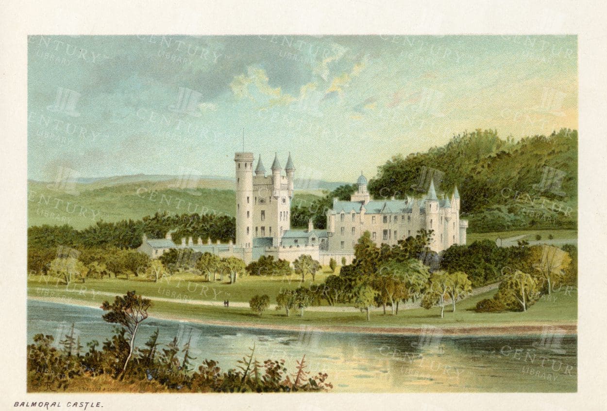
BALMORAL CASTLE – Vintage 1895 Chromolithograph Illustration
- Resolution: 4833px x 3327px
- Year of Print: 1895
- Artist: T. Nelson and Sons
Related Images

VINTAGE Scottish Illustration – 1895 – The Trongate – Glasgow
- Resolution: 4819px x 3284px
- Year of Print: 1895
- Artist: T. Nelson and Sons
Related Images

Historic Map of New Jersey
A detailed antique map of New Jersey, highlighting its counties, cities, and significant landmarks, reflecting the state's geography and development during the late 19th century.
- Resolution: 7239 x 5100
- Image Type(s): JPG
From this collection

Vintage Map of Nevada and Utah
An antique map detailing the states of Nevada and Utah, showcasing the topography, settlements, and infrastructure from the late 19th to early 20th century, with insets of major cities.
- Resolution: 7237 x 5100
- Image Type(s): JPG
From this collection

Historic Map of North Carolina
A detailed antique map of North Carolina, highlighting its counties, cities, and key geographical features, showcasing the state's landscape during the late 19th century.
- Resolution: 7243 x 5100
- Image Type(s): JPG
From this collection

Detailed Vintage Map of Southeast Australia Including Victoria, New South Wales, and South Australia
A detailed vintage map showing the southeast part of Australia, including Victoria, New South Wales, and parts of South Australia and Queensland. The map highlights major cities, railways, and geographical features, offering a historical perspective on the region's layout during the period.
- Resolution: 7110 x 5100
- Image Type(s): JPG
From this collection

Antique Map of Western New York
A detailed historic map showcasing the western part of New York, highlighting counties, cities, and geographical features, including insets of major urban areas like Buffalo and Rochester.
- Resolution: 7241 x 5100
- Image Type(s): JPG
From this collection

Vintage Map of Northern New York
An antique map focusing on the northern and eastern parts of New York, showing the state's counties, cities, and significant natural features, typical of late 19th-century cartography.
- Resolution: 7240 x 5100
- Image Type(s): JPG
From this collection

Antique Map of Maryland and Delaware with Washington D.C.
An antique map highlighting Maryland and Delaware, including insets of Washington D.C. and Baltimore, featuring roads, rivers, and county lines from the late 19th to early 20th century.
- Resolution: 7161 x 5100
- Image Type(s): JPG
- development
- early
- 20th
- administrative
- urbanization
- 19th
- late
- county
- dc
- century
- infrastructure
- boundaries
- colonial
- cartography
- transportation
- regional
- political
- landmarks
- historic
- heritage
- urban
- Roads
- vintage
- representation
- Lines
- Antique
- History
- Washington
- Delaware
- Baltimore
- Maryland
- Geography
- Atlas
- American
- City
- World
- Rivers
- Map
- Capital
From this collection

Vintage Map of Montana
An antique map showcasing the state of Montana, highlighting counties, cities, and geographical features in fine detail, typical of late 19th to early 20th century cartography.
- Resolution: 7235 x 5100
- Image Type(s): JPG
From this collection

JOHN KNOX’S House and Canongate – Edinburgh – Vintage 1895 Illustration
- Resolution: 3246px x 4817px
- Year of Print: 1895
- Artist: T. Nelson and Sons
Related Images
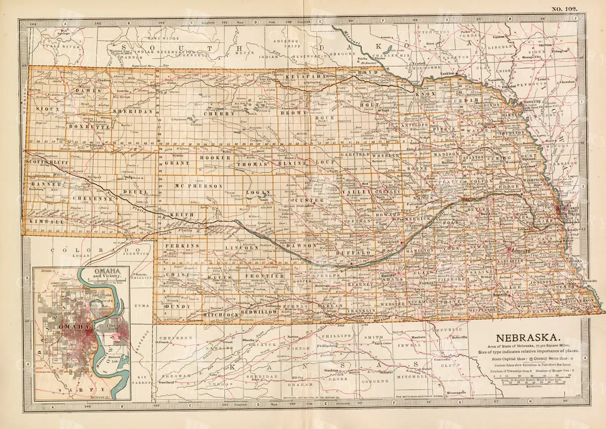
Historic Map of Nebraska
A detailed historic map of Nebraska, illustrating counties, towns, and important routes, reflecting the geography and infrastructure of the state during the late 19th to early 20th century.
- Resolution: 7236 x 5100
- Image Type(s): JPG
From this collection

Antique Map of North Dakota
A historic map of North Dakota from the late 19th century, detailing the state's counties, cities, and major geographical landmarks, reflecting its development and settlement patterns.
- Resolution: 7244 x 5100
- Image Type(s): JPG
From this collection


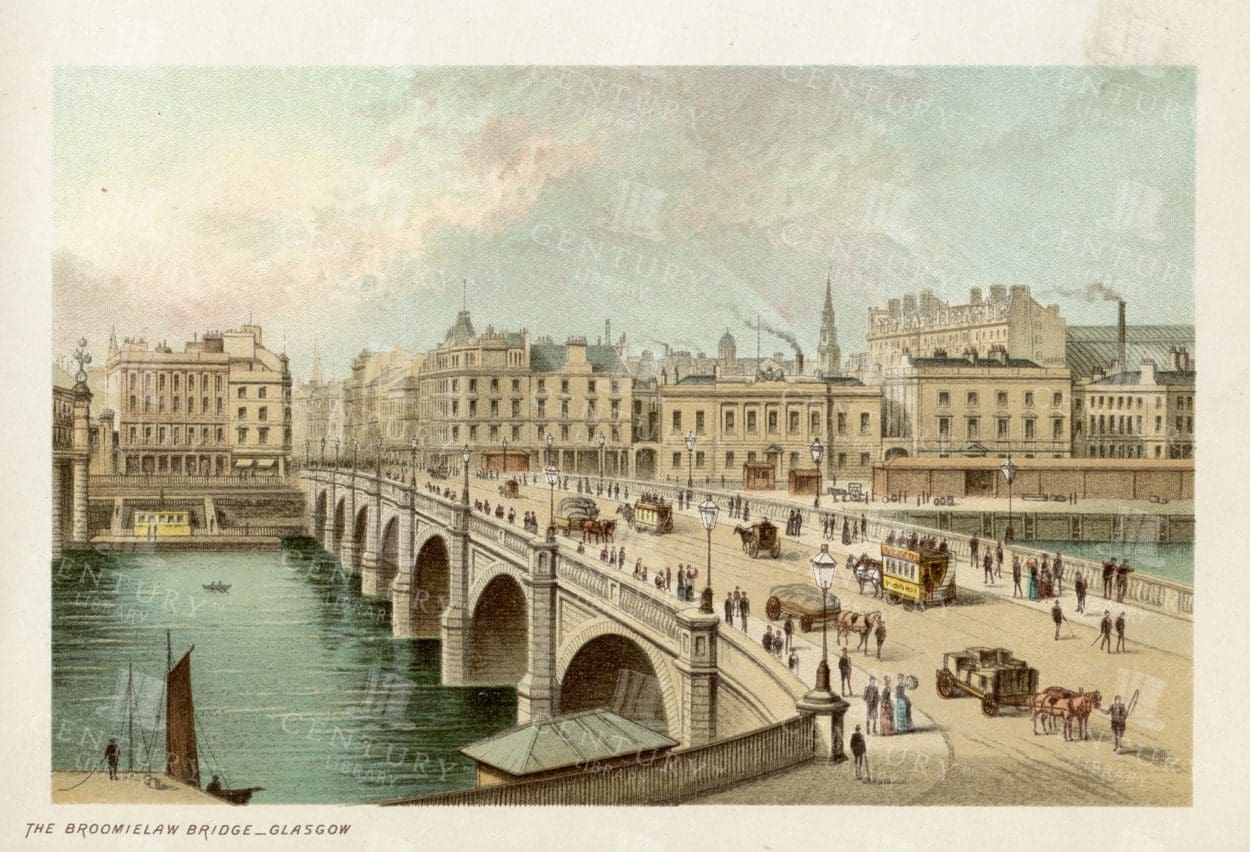
GLASGOW – The Broomielaw – Looking West – 1895 Vintage Illustration
- Resolution: 4732px x 3227px
- Year of Print: 1895
- Artist: T. Nelson and Sons
Related Images


GLASGOW – The New Municipal Buildings – Vintage Illustration
- Resolution: 4761px x 3255px
- Year of Print: 1895
- Artist: T. Nelson and Sons
Related Images
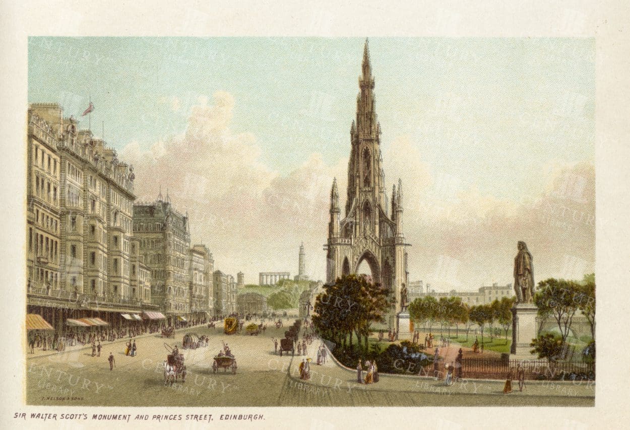
SIR WALTER SCOTT’s Monument – Edinburgh – Vintage 1895 Illustration
- Resolution: 4804px x 3284px
- Year of Print: 1895
- Artist: T. Nelson and Sons
Related Images
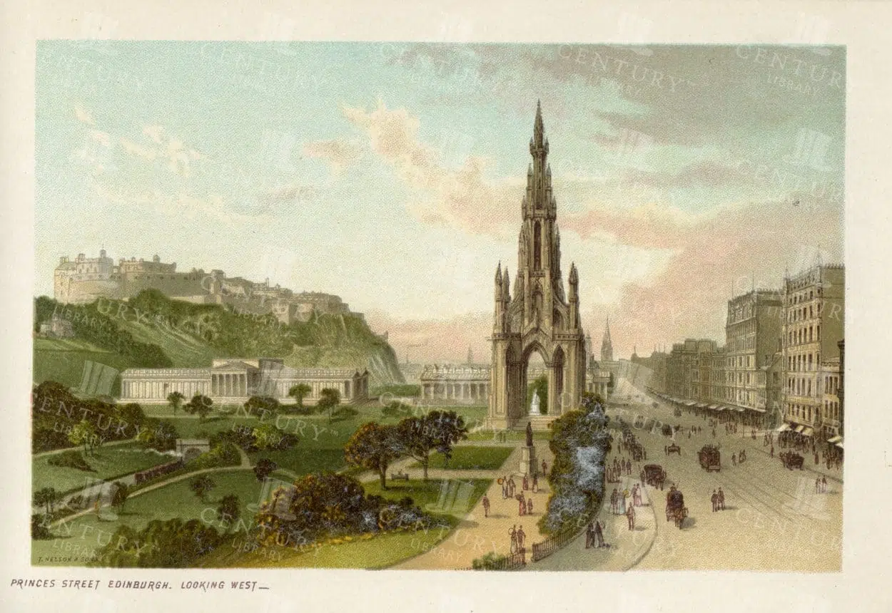
VINTAGE 1895 Illustration of Princes Street Edinburgh, Looking West
- Resolution: 4804px x 3284px
- Year of Print: 1895
- Artist: T. Nelson and Sons
Related Images

Antique Shell Illustration with Striped Beige and Brown Pattern – Transparent PNG Clipart
This vintage sea shell illustration was carefully isolated from a hand-colored engraving published in the mid-1800s. Part of a detailed natural history collection, it showcases the intricate textures and rich tones typical of 19th-century scientific illustration. Perfect for collage, print, or digital design work, this transparent PNG retains the charm and precision of antique artwork while offering modern usability.
- Image Type(s): PNG
- antique shell
- Architecture
- beachcomber art
- bivalve shell
- Building
- City
- coastal shell
- conch shell
- hand-colored shell
- historic shell
- marine biology
- marine shell
- mollusk shell
- Natural History
- ocean shell
- ocean specimen
- office
- scientific illustration
- sea life illustration
- Sea Shell
- seashell PNG
- seashell study
- shell artwork
- shell chart
- shell cutout
- shell decor
- shell drawing
- shell engraving
- shell graphic
- shell illustration
- shell specimen
- shell taxonomy
- skyscraper
- spiral shell
- tower
- Victorian shell
From this collection

Vintage Heraldry Naval Flag with the Union Jack
A vintage line art illustration of a heraldry naval flag with the Union Jack, perfect for maritime and historical-themed designs.
- Image Type(s): PNG
Related Images

1895 Vintage Illustration of the Stock Exchange in Glasgow Scotland
- Resolution: 4761px x 3255px
- Year of Print: 1895
- Artist: T. Nelson and Sons
Related Images


1895 Vintage Illustration – Princes Street in Edinburgh – West End
- Resolution: 4833px x 3270px
- Year of Print: 1895
- Artist: T. Nelson and Sons
Related Images
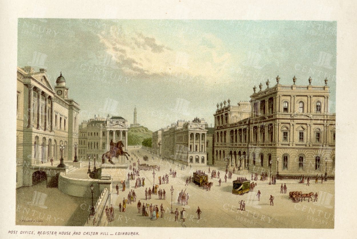
EDINBURGH – Post Office, Register House and Calton Hill – Vintage Illustration
- Resolution: 4775px x 3284px
- Year of Print: 1895
- Artist: T. Nelson and Sons
Related Images

VINTAGE Landscape Illustration – New Town Edinburgh from the Castle
- Resolution: 4747px x 3284px
- Year of Print: 1895
- Artist: T. Nelson and Sons
Related Images
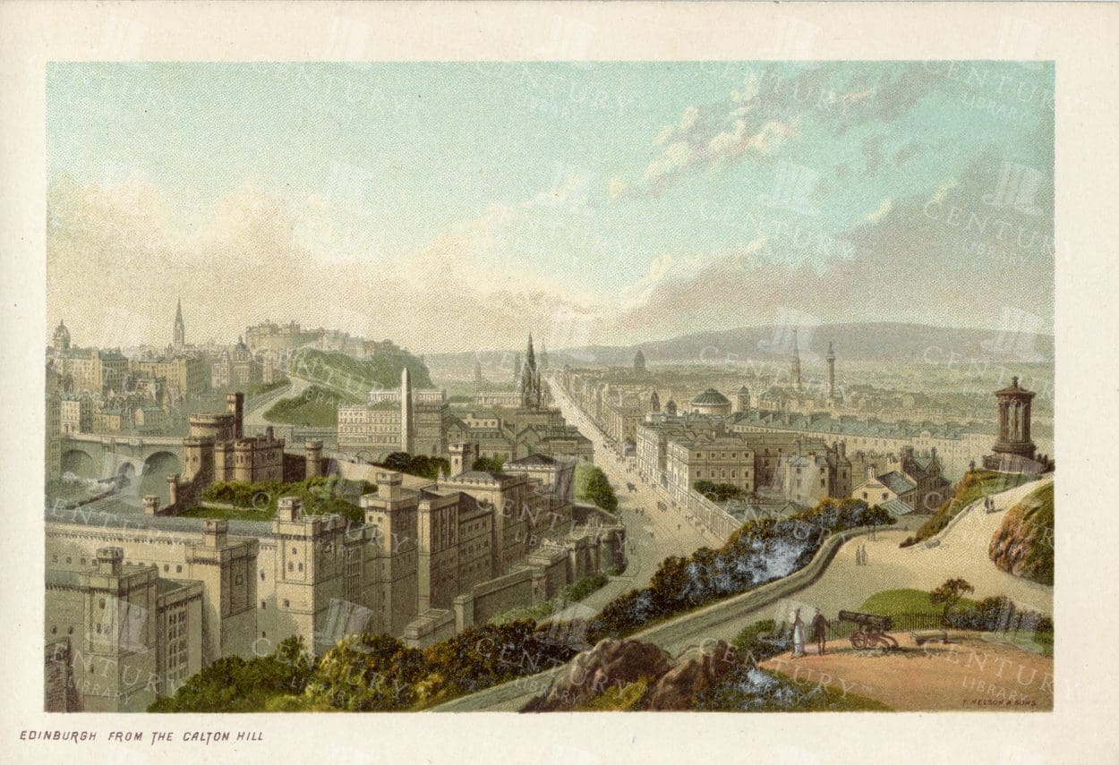
EDINBURGH from the Calton Hill – Vintage 1895 Chromo Illustration
- Resolution: 4862px x 3255px
- Year of Print: 1895
- Artist: T. Nelson and Sons
Related Images


MILITARY Sciences – Watch and Siege Towers – Antique 1851 J. Heck Print
You’re looking at a well preserved original plate from Johann Georg Heck's “Iconographic Encyclopedia of Sciences, Literature and Art” published in 1851 by Rudolphe Garrigue in New York. We were extremely fortunate to acquire the full collection of illustrative prints from the series, which after many months of looking, proved to be very difficult!
- License Info
- Resolution: 7773 x 9475 300dpi
- Year of Print: 1851
- Artist: Johann Georg Heck
Related Images
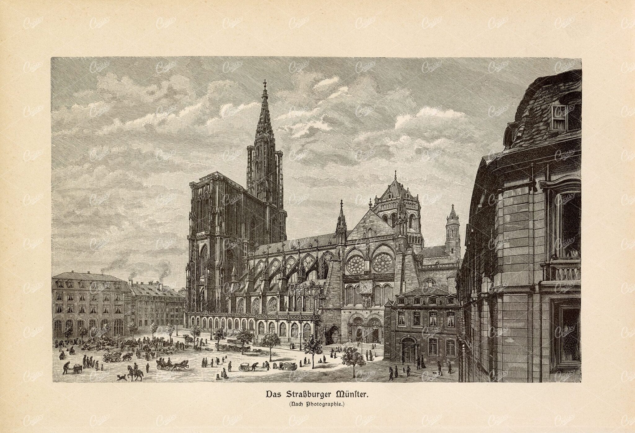
VINTAGE 1877 Print – The Strassburger Muenster
- License Info
- Resolution: 8832px x 6024px
- Year of Print: 1877
Related Images

ANTIQUE 1853 Engraving – Utrecht from the Vernon Gallery Picture
- License Info
- Resolution: 8199 x 11424 300dpi
- Year of Print: 1853
Related Images
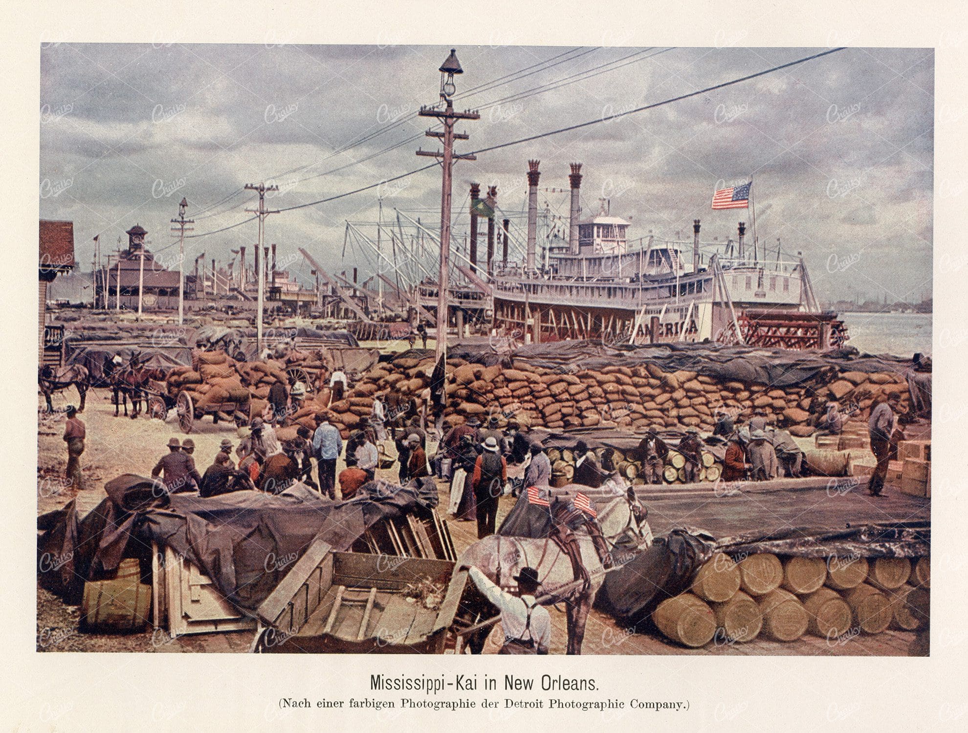
MISSISSIPPI QUAY in New Orleans – Vintage German Print 1877
- License Info
- Resolution: 7292px x 5525px
- Year of Print: 1877
Related Images

SOUTHWARE – Vintage 1840 Engraved Illustration by William Tombleson
- Resolution: 7931px x 6013px
- Year of Print: 1840
- Artist: William Tombleson
Related Images


EGYPT Alexandria City Aerial View 1880 Antique Print
An original Antique Plate scan from the National Encyclopaedia: A Dictionary of Universal Knowledge. Published by William Mackenzie in 1880. Click on the Artist's name to see the full collection from this series!
- License Info
- Resolution: 8600 x 5500 300dpi
- Year of Print: 1880
- Artist: William Mackenzie
From this collection

HAMMERSMITH BRIDGE – 1840 Decorative Vintage Illustration
- Resolution: 7817px x 6037px
- Year of Print: 1840
- Artist: William Tombleson
Related Images


Support the Library
Our supporters and members help us continue collecting and restoring these wonderful pieces of art for the modern creator
Unlock Everything and Become a Member!
While a lot of the library is available for free, some is kept behind closed dusty doors only to be accessed by our lovely members.