

19th Century World Map – Chief Countries and Their Colonies
An antique world map from the 19th century showcasing chief countries and their colonies during the period. The map uses Mercator's projection and highlights the global political landscape, including colonial possessions.
- Resolution: 7272 x 5100
- Image Type(s): JPG
From this collection
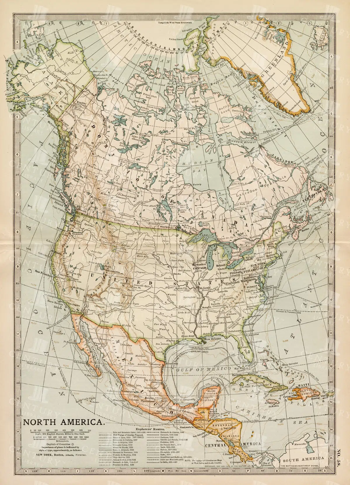
Vintage Map of North America
A historic map of North America, offering a comprehensive view of the continent's geography, including the United States, Canada, and Mexico, from the late 19th century.
- Resolution: 7242 x 5100
- Image Type(s): JPG
From this collection

Toile De Jouy Chinoiserie PNG Illustration with Ornamental Decorative Motifs and Line Art
The image is 1 of 59 from the following collection: 'Discover Toile De Jouy’s gorgeous style within this meticulously edited collection of 59 isolated PNG illustrations. Inside, you'll discover a wonderfully detailed set of vintage illustrations with a subtle texture applied, making the illustration look like it has been printed with dark blue ink! It’s super effective and looks fantastic on light backgrounds.
- Image Type(s): PNG
From this collection

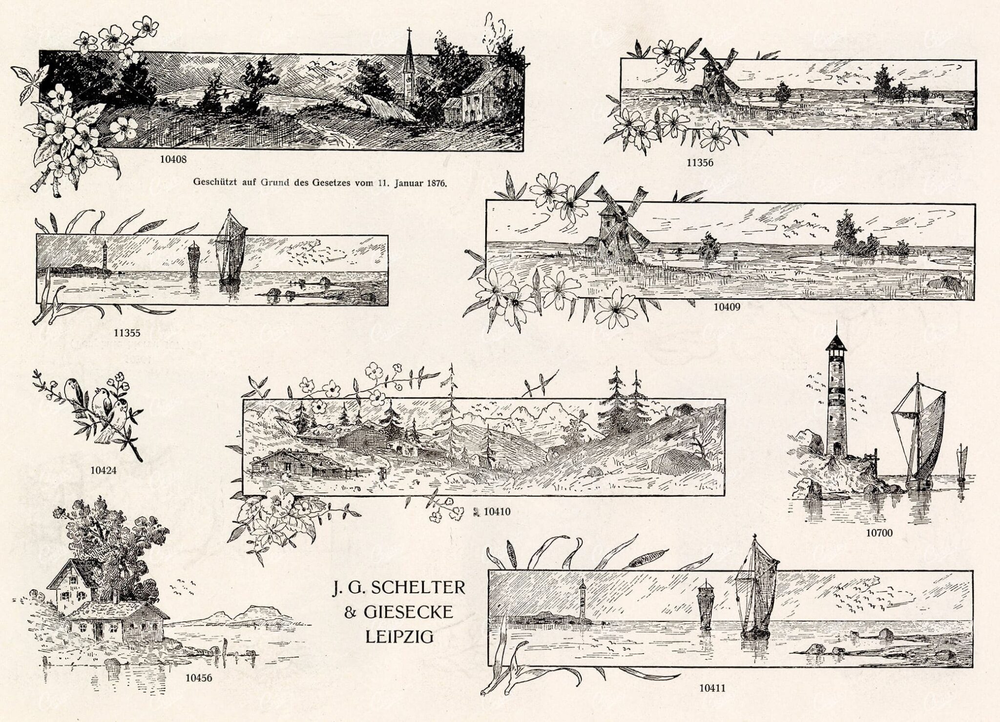
MISCELLANEOUS Selection of Vintage Design Elements – 1800s Antique Stock Artwork
The type foundry and print shop of old would create books, like the one this image was discovered within, to help customers and clients with their design choices. Naturally, these books were jam packed with useful illustrative elements that could be combined to create a final piece. Today, these books are extremely difficult to get a hold of. Especially those that were published in the late 1800s. They were not mainstream publications, they simply served as 'catalogs' and thus were only produced in small numbers. Fortunately, we were introduced to a collector who had precisely what we had been searching for for so long. After some costly negotiations, we're very excited to be able to share the wonderful gems within.
- License Info
- Resolution: 7472 x 5482
- Year of Print: Late 1800s
- Artist: Schelter & Giesecke Type Foundry
From this collection


Vintage Map of Ireland Highlighting Political Boundaries and Topographical Features
This vintage map of Ireland highlights the country's political boundaries and key topographical features, including rivers, mountains, and major cities. The map provides a historical overview of Ireland during the late 19th century, offering insight into the geopolitical landscape and cultural heritage of the island. It includes detailed insets of Dublin and its surrounding areas, reflecting Ireland's rich history and complex political past.
- Resolution: 7149 x 5100
- Image Type(s): JPG
- late 19th century
- geopolitical
- Irish history
- Ireland history
- cultural heritage
- topography
- cities
- historical geography
- antique map
- historical map
- exploration
- old map
- cartography
- political boundaries
- Dublin
- vintage
- representation
- Antique
- History
- Island
- Geography
- Atlas
- World
- Landscape
- Ireland
- Rivers
- Mountains
- Map
- United Kingdom
- Europe
From this collection

Engraved Village Scene with Tower, Mountain Landscape, and Winding Path
This image is part of a beautiful collection of highly detailed, engraved illustrations from the early 1800s - Originally discovered within a small book full of stories inspired by the English countryside. While I’m sure the stories are lovely, I couldn’t get over how incredible these illustrations were!
- Image Type(s): PNG
From this collection

Toile De Jouy Chinoiserie PNG Illustration with Ornamental Garden, Decorative Motifs, and Aristocratic Figures
The image is 1 of 59 from the following collection: 'Discover Toile De Jouy’s gorgeous style within this meticulously edited collection of 59 isolated PNG illustrations. Inside, you'll discover a wonderfully detailed set of vintage illustrations with a subtle texture applied, making the illustration look like it has been printed with dark blue ink! It’s super effective and looks fantastic on light backgrounds.
- Image Type(s): PNG
From this collection

Historic Map of Oceanica Including Australia, New Zealand, and Pacific Islands
An extensive historical map of Oceanica, encompassing Australia, New Zealand, and various Pacific Islands. This 19th-century map details major routes, colonial regions, and key geographical features.
- Resolution: 7246 x 5100
- Image Type(s): JPG
From this collection
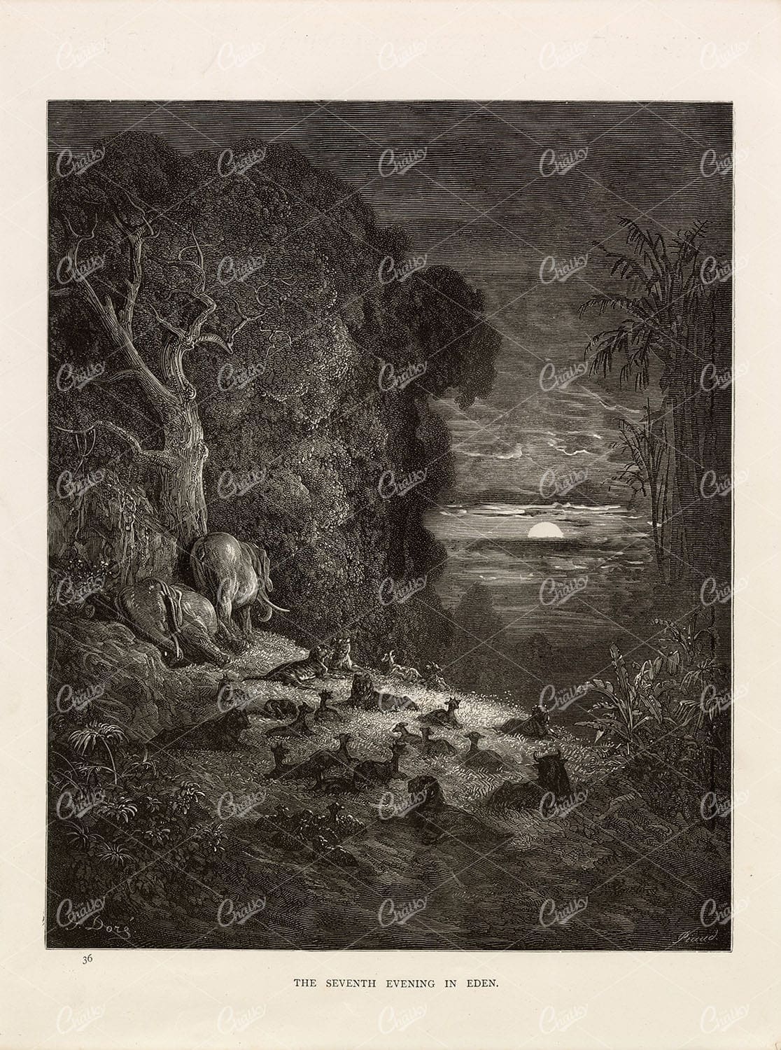
SEVENTH Evening in Eden – Antique Bible Engraving – Gustave Dore 1891
You’re looking at a beautifully detailed, lithograph print by Gustave Doré. A French artist, printmaker, illustrator, comics artist, caricaturist, and sculptor who worked primarily with wood-engraving. This particular engraving was sourced from the 1891 ‘Bible Gallery’ book that compiled a collection of Doré’s biblical themed artwork.
- License Info
- Resolution: 8037 x 10807 300dpi
- Year of Print: 1891
- Artist: Gustave Dore
From this collection
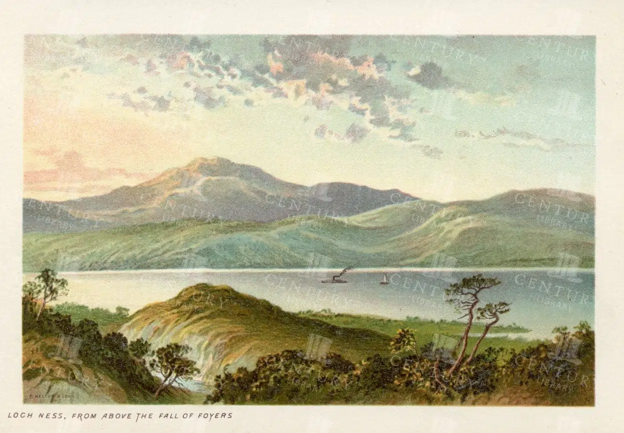
LOCH NESS from above the Fall of Foyers, Vintage 1895 Illustration
- Resolution: 4749px x 3240px
- Year of Print: 1895
- Artist: T. Nelson and Sons
Related Images

Classic Navy Toile De Jouy Children Playing Seesaw with Chinoiserie Motifs PNG
The image is 1 of 59 from the following collection: 'Discover Toile De Jouy’s gorgeous style within this meticulously edited collection of 59 isolated PNG illustrations. Inside, you'll discover a wonderfully detailed set of vintage illustrations with a subtle texture applied, making the illustration look like it has been printed with dark blue ink! It’s super effective and looks fantastic on light backgrounds.
- Image Type(s): PNG
From this collection

Detailed 19th Century Map of the Netherlands, Belgium, and Luxembourg
A detailed antique map from the 19th century featuring the Netherlands, Belgium, and Luxembourg. The map showcases the geographical and political landscape of the region, including major cities, rivers, and borders.
- Resolution: 7271 x 5100
- Image Type(s): JPG
From this collection
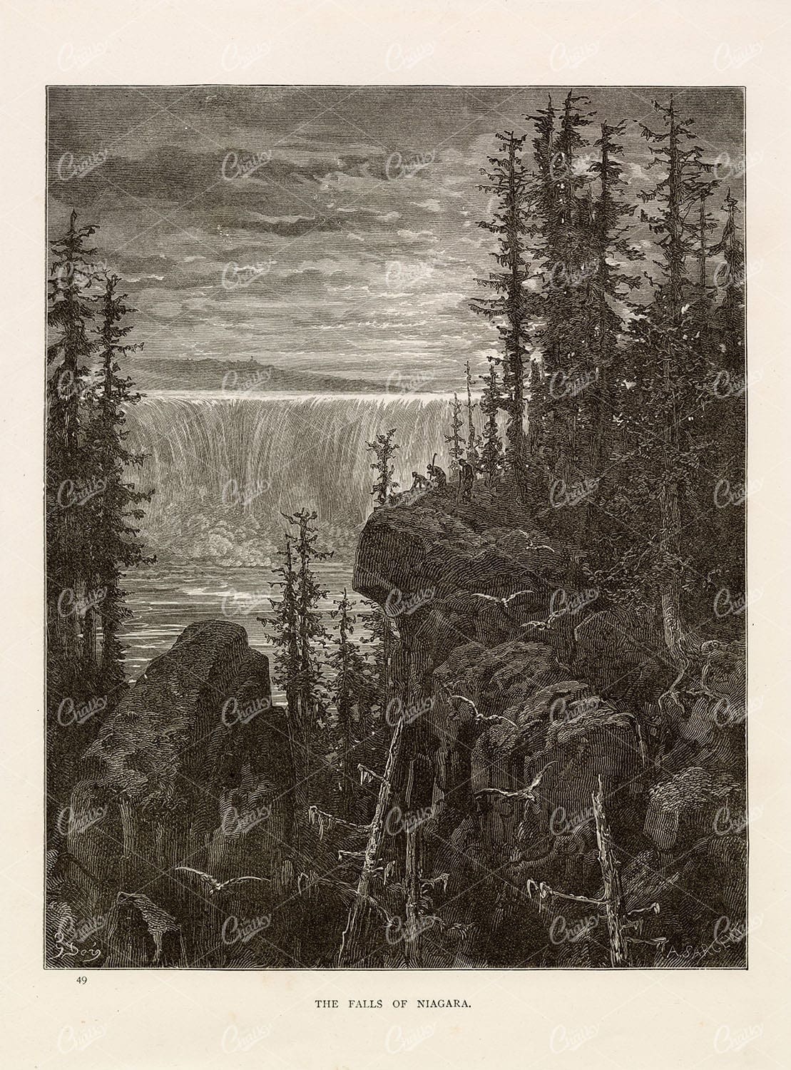
NIAGRA FALLS – Gustave Dore – Antique Original Engraving 1891
You’re looking at a beautifully detailed, lithograph print by Gustave Doré. A French artist, printmaker, illustrator, comics artist, caricaturist, and sculptor who worked primarily with wood-engraving. This particular engraving was sourced from the 1891 ‘Bible Gallery’ book that compiled a collection of Doré’s biblical themed artwork.
- License Info
- Resolution: 7842 x 10610 300dpi
- Year of Print: 1891
- Artist: Gustave Dore
From this collection

Toile De Jouy Chinoiserie PNG Illustration with Ornamental Rural Scene and Decorative Motifs
The image is 1 of 59 from the following collection: 'Discover Toile De Jouy’s gorgeous style within this meticulously edited collection of 59 isolated PNG illustrations. Inside, you'll discover a wonderfully detailed set of vintage illustrations with a subtle texture applied, making the illustration look like it has been printed with dark blue ink! It’s super effective and looks fantastic on light backgrounds.
- Image Type(s): PNG
From this collection

Toile De Jouy Chinoiserie PNG Illustration with Ornamental Architecture and Decorative Motifs
The image is 1 of 59 from the following collection: 'Discover Toile De Jouy’s gorgeous style within this meticulously edited collection of 59 isolated PNG illustrations. Inside, you'll discover a wonderfully detailed set of vintage illustrations with a subtle texture applied, making the illustration look like it has been printed with dark blue ink! It’s super effective and looks fantastic on light backgrounds.
- Image Type(s): PNG
From this collection

Toile De Jouy Chinoiserie PNG Illustration with Ornamental Ruins, Elegant Figures, and Decorative Motifs
The image is 1 of 59 from the following collection: 'Discover Toile De Jouy’s gorgeous style within this meticulously edited collection of 59 isolated PNG illustrations. Inside, you'll discover a wonderfully detailed set of vintage illustrations with a subtle texture applied, making the illustration look like it has been printed with dark blue ink! It’s super effective and looks fantastic on light backgrounds.
- Image Type(s): PNG
From this collection
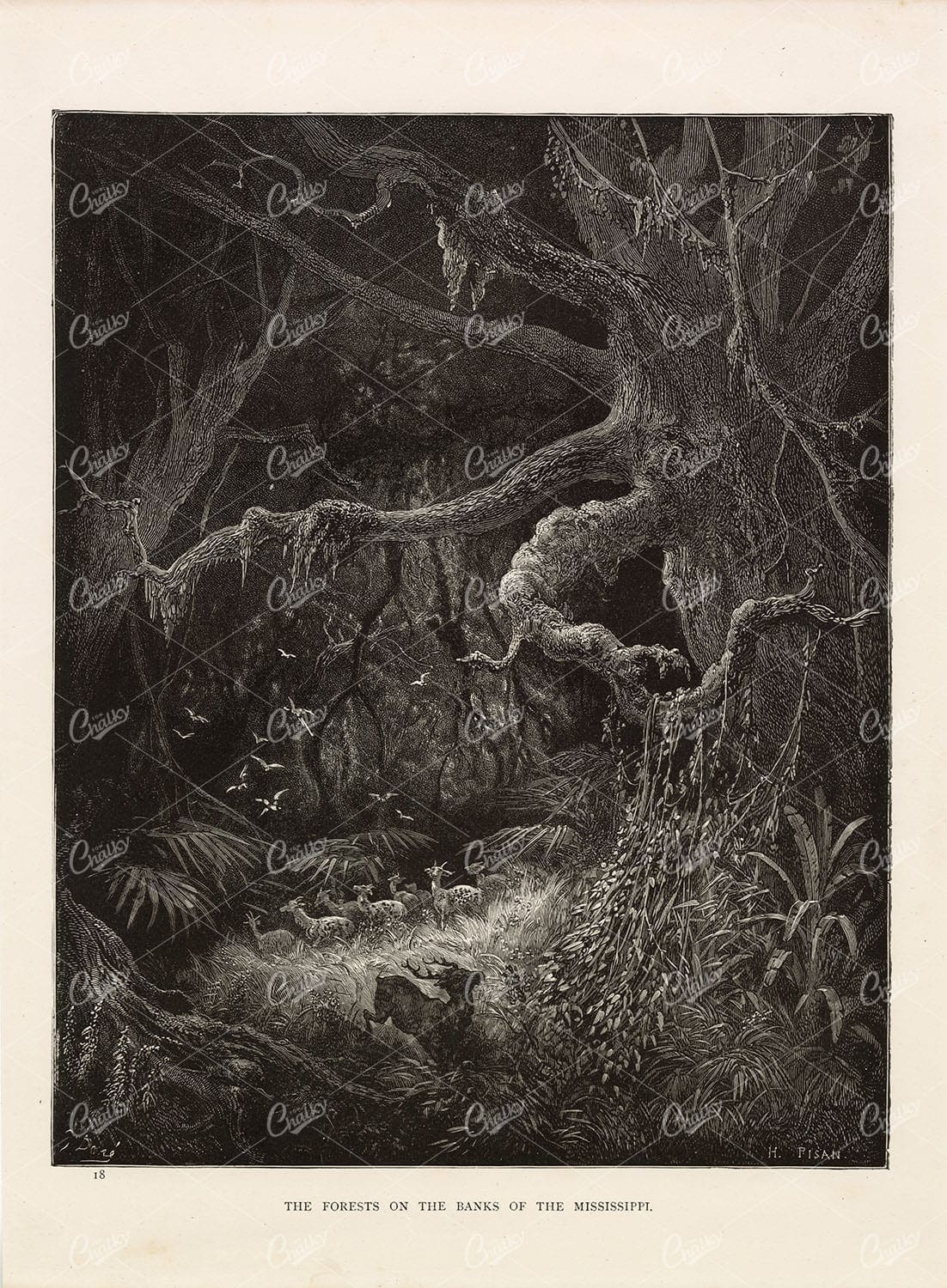
GUSTAVE DORE – The Forests on the Banks of the Mississippi – 1891 Print
You’re looking at a beautifully detailed, lithograph print by Gustave Doré. A French artist, printmaker, illustrator, comics artist, caricaturist, and sculptor who worked primarily with wood-engraving. This particular engraving was sourced from the 1891 ‘Bible Gallery’ book that compiled a collection of Doré’s biblical themed artwork.
- License Info
- Resolution: 7946 x 10811 300dpi
- Year of Print: 1891
- Artist: Gustave Dore
From this collection
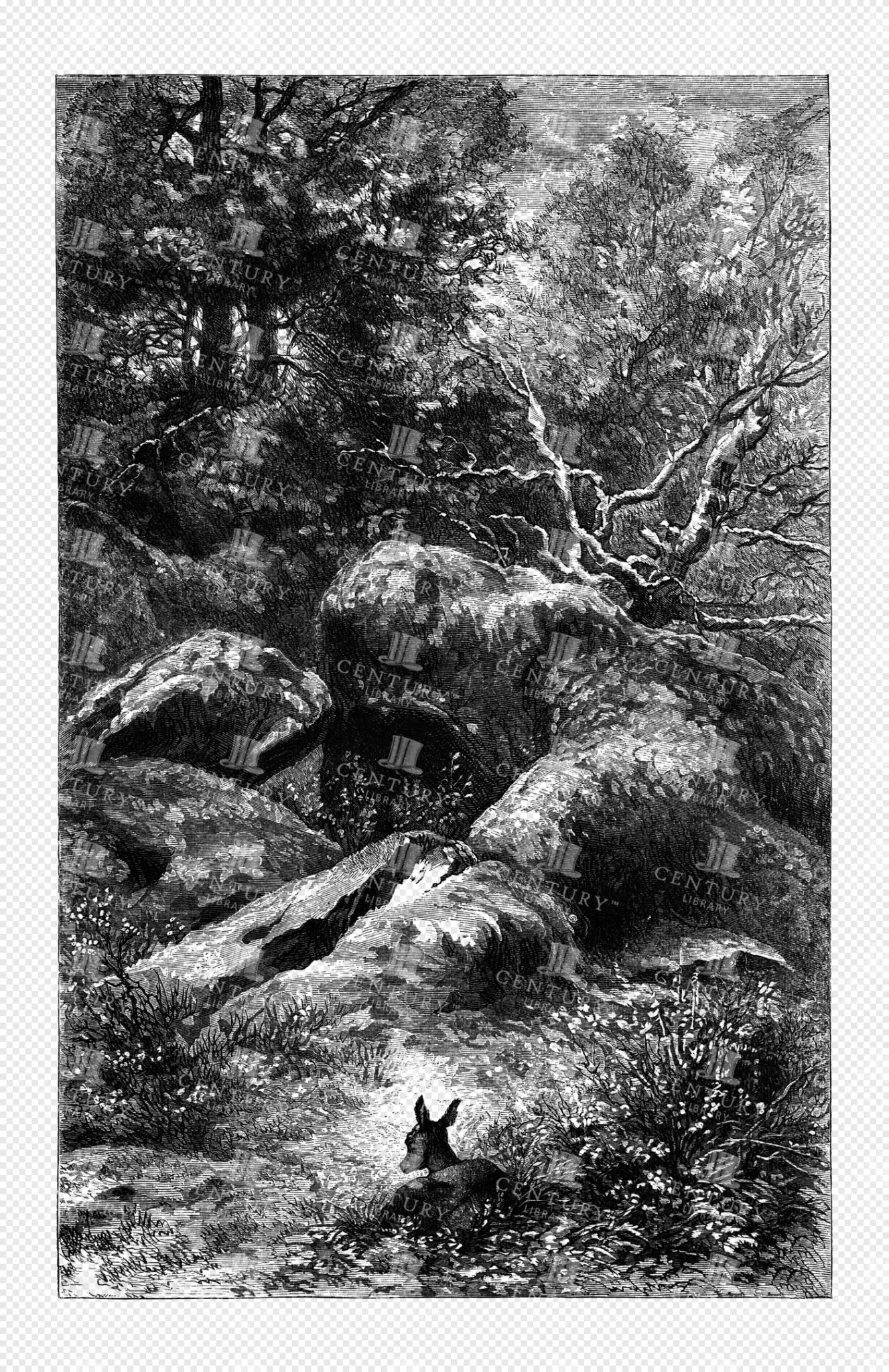
Engraved Woodland Scene with Rocky Terrain, Dense Trees, and a Lone Deer
This image is part of a beautiful collection of highly detailed, engraved illustrations from the early 1800s - Originally discovered within a small book full of stories inspired by the English countryside. While I’m sure the stories are lovely, I couldn’t get over how incredible these illustrations were!
- Image Type(s): PNG
From this collection

Antique 19th Century Map of Norway and Sweden with Topographical Details
A beautifully detailed antique map from the 19th century showcasing the countries of Norway and Sweden, with topographical features, major cities, and inset maps of Kristiana and Stockholm.
- Resolution: 7245 x 5100
- Image Type(s): JPG
From this collection

TROPICAL Landscapes – Antique Artwork by A. Wirth – Dekorative Vorbilder
This image was sourced from our original 'Dekorative Vorbilder' collection; A gorgeous collection of Art Nouveau decorative patterns, graphics and illustrations including plants, figures and animals. For draftsman, painters, graphic artists, decorators, sculptors and architects. Published in 1904 by Julius Hoffman, Stuttgart.
- License Info
- Resolution: 8700 x 12200 300dpi
- Year of Print: 1904
- Artist: Julius Hoffman
From this collection

Lush Botanical Scene with Grapes, Pears, Snails, and Stone Plant Pot in Nature
This image is part of a beautiful collection of highly detailed, engraved illustrations from the early 1800s - Originally discovered within a small book full of stories inspired by the English countryside. While I’m sure the stories are lovely, I couldn’t get over how incredible these illustrations were!
- Image Type(s): PNG
From this collection

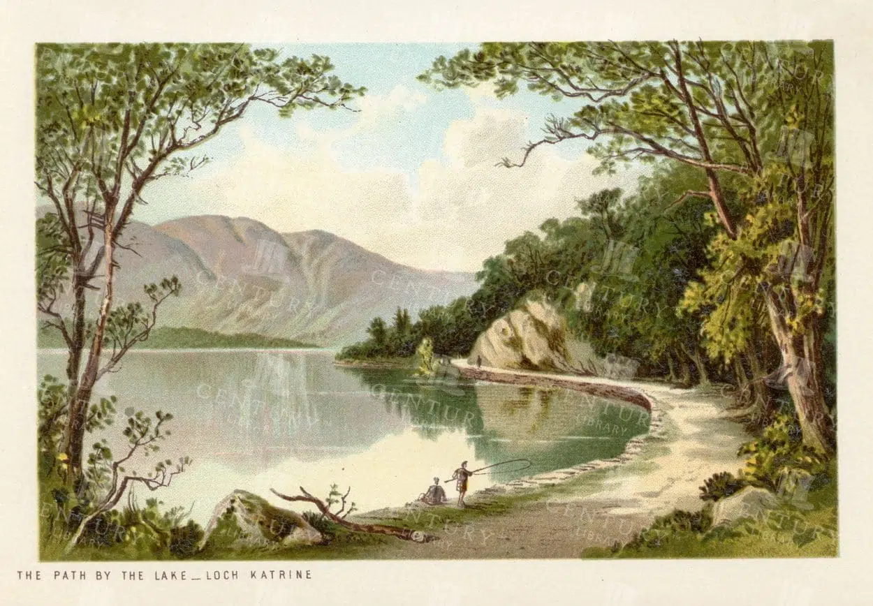
VINTAGE Landscape Illustration – The Path by the Lake, Loch Katrine
- Resolution: 4706px x 3239px
- Year of Print: 1895
- Artist: T. Nelson and Sons
Related Images

Toile De Jouy Chinoiserie PNG Illustration with Ornamental Ruins, Astronomical Instruments, and Aristocrats
The image is 1 of 59 from the following collection: 'Discover Toile De Jouy’s gorgeous style within this meticulously edited collection of 59 isolated PNG illustrations. Inside, you'll discover a wonderfully detailed set of vintage illustrations with a subtle texture applied, making the illustration look like it has been printed with dark blue ink! It’s super effective and looks fantastic on light backgrounds.
- Image Type(s): PNG
From this collection

Toile De Jouy Chinoiserie PNG Illustration Featuring Ornamental Garden, Aristocrats, and Decorative Motifs
The image is 1 of 59 from the following collection: 'Discover Toile De Jouy’s gorgeous style within this meticulously edited collection of 59 isolated PNG illustrations. Inside, you'll discover a wonderfully detailed set of vintage illustrations with a subtle texture applied, making the illustration look like it has been printed with dark blue ink! It’s super effective and looks fantastic on light backgrounds.
- Image Type(s): PNG
From this collection

Charming Chinoiserie Toile De Jouy Line Art – Ornamental PNG Illustration
The image is 1 of 59 from the following collection: 'Discover Toile De Jouy’s gorgeous style within this meticulously edited collection of 59 isolated PNG illustrations. Inside, you'll discover a wonderfully detailed set of vintage illustrations with a subtle texture applied, making the illustration look like it has been printed with dark blue ink! It’s super effective and looks fantastic on light backgrounds.
- Image Type(s): PNG
From this collection
MISCELLANEOUS Selection of Vintage Design Elements – 1800s Antique Stock Artwork
The type foundry and print shop of old would create books, like the one this image was discovered within, to help customers and clients with their design choices. Naturally, these books were jam packed with useful illustrative elements that could be combined to create a final piece. Today, these books are extremely difficult to get a hold of. Especially those that were published in the late 1800s. They were not mainstream publications, they simply served as 'catalogs' and thus were only produced in small numbers. Fortunately, we were introduced to a collector who had precisely what we had been searching for for so long. After some costly negotiations, we're very excited to be able to share the wonderful gems within.
- License Info
- Resolution: 7508 x 5418
- Year of Print: Late 1800s
- Artist: Schelter & Giesecke Type Foundry
From this collection


Central Europe Travel Map Featuring Major Cities Like Paris, Berlin, and Vienna
This travel map of Central Europe highlights major cities such as Paris, Berlin, and Vienna, showcasing detailed routes and geographical features. The map provides a glimpse into the historical and political landscape of Central Europe during the time.
- Resolution: 7117 x 5100
- Image Type(s): JPG
From this collection


19th Century Map of Spain, Portugal, and Andorra
An antique map from the 19th century detailing the countries of Spain, Portugal, and Andorra, along with surrounding regions. The map features important cities, mountain ranges, and bodies of water, offering a glimpse into the historical geography of the Iberian Peninsula.
- Resolution: 7266 x 5100
- Image Type(s): JPG
- 19th-century
- Andorra
- Antique
- archives
- Atlantic
- Atlas
- Borders
- cartography
- cities
- country
- Europe
- exploration
- Geography
- heritage
- historic map
- historical
- History
- Iberian Peninsula
- landmarks
- Landscape
- Map
- Mediterranean
- Mountains
- old map
- Portugal
- Pyrenees
- reference
- representation
- retro
- Rivers
- settlements
- Spain
- topographic
- vintage
- vintage map
- World
From this collection
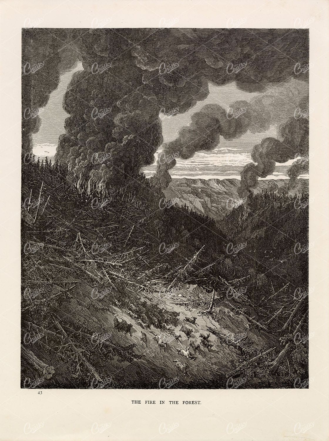
GUSTAVE DORE – The Fire in the Forest – Antique Artwork 1891
You’re looking at a beautifully detailed, lithograph print by Gustave Doré. A French artist, printmaker, illustrator, comics artist, caricaturist, and sculptor who worked primarily with wood-engraving. This particular engraving was sourced from the 1891 ‘Bible Gallery’ book that compiled a collection of Doré’s biblical themed artwork.
- License Info
- Resolution: 8044 x 10773 300dpi
- Year of Print: 1891
- Artist: Gustave Dore
From this collection

Toile De Jouy Chinoiserie PNG Illustration with Ornamental Carriage, Decorative Motifs, and Family Scene
The image is 1 of 59 from the following collection: 'Discover Toile De Jouy’s gorgeous style within this meticulously edited collection of 59 isolated PNG illustrations. Inside, you'll discover a wonderfully detailed set of vintage illustrations with a subtle texture applied, making the illustration look like it has been printed with dark blue ink! It’s super effective and looks fantastic on light backgrounds.
- Image Type(s): PNG
From this collection

Contemplative Young Man Beside Garden Wall with Decorative Urn
A Charming Mix of Vintage Illustrations – Pastoral Scenes, Mythical Figures & More This image is part of a collection packed with beautifully restored vintage toile de jouy style illustrations. Think peaceful countryside scenes, graceful mythological figures, farm animals, and a good dose of that old-timey charm. Whether you’re into junk journaling, crafting, branding, or just love adding a touch of vintage to your creative projects, there’s loads to play with here. You’ll find everything from shepherd boys and garden goddesses to hot air balloons, dancing villagers, and elegant birds - all cleaned up and ready to use. Perfect for print, digital, or anything in between, this set brings a slice of history into your modern designs with plenty of character and detail.
- Image Type(s): PNG
From this collection

Antique Map of Texas, Western Part with Galveston Bay
A vintage 19th century map depicting the western part of Texas along with a detailed inset of Galveston Bay, Houston, and surrounding areas. The map highlights the state’s development, including railroads, towns, and natural features.
- Resolution: 7270 x 5100
- Image Type(s): JPG
From this collection

Detailed 19th Century Map of Texas, Eastern Part
A detailed map from the 19th century illustrating the eastern part of Texas, USA. The map features various towns, railroads, and natural landmarks, providing a glimpse into the state’s historical geography and development.
- Resolution: 7269 x 5100
- Image Type(s): JPG
From this collection


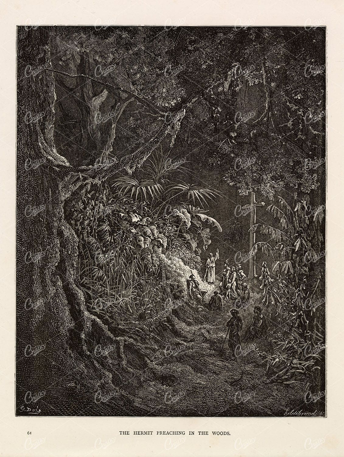
CHRISTIAN Artwork – The Hermit Preaching in the Woods – Antique Print
You’re looking at a beautifully detailed, lithograph print by Gustave Doré. A French artist, printmaker, illustrator, comics artist, caricaturist, and sculptor who worked primarily with wood-engraving. This particular engraving was sourced from the 1891 ‘Bible Gallery’ book that compiled a collection of Doré’s biblical themed artwork.
- License Info
- Resolution: 7732 x 10252 300dpi
- Year of Print: 1891
- Artist: Gustave Dore
From this collection

Antique Map of Eastern India, Burma, Siam, and French Indo-China
This antique map showcases Eastern India, Burma (now Myanmar), Siam (now Thailand), and French Indo-China (Vietnam, Laos, Cambodia), with a focus on the geopolitical boundaries and major cities of the early 20th century. The map provides a detailed view of the region's topographical features, including rivers, mountain ranges, and coastlines, reflecting the historical context of Southeast Asia during this period.
- Resolution: 7143 x 5100
- Image Type(s): JPG
- Antique
- antique map
- Asia
- Atlas
- Burma
- cartography
- cities
- coastlines
- colonial
- country
- cultural heritage
- early 20th century
- Eastern India
- exploration
- French Indo-China
- Geography
- geopolitical boundaries
- historical geography
- historical map
- History
- Landscape
- Map
- mountain ranges
- old map
- representation
- Rivers
- Siam
- Southeast Asia
- topography
- World
From this collection


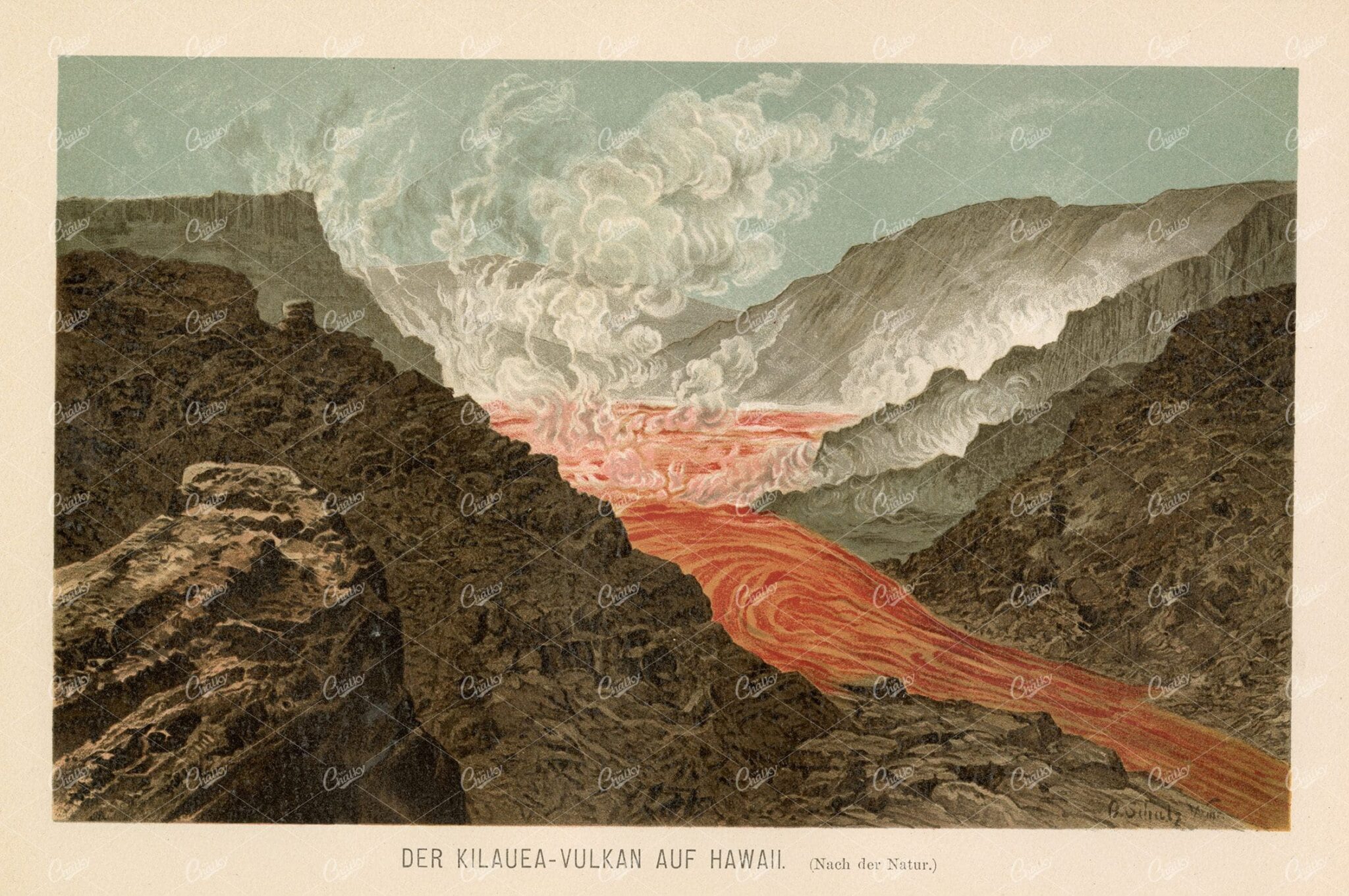
ANTIQUE Print 1877 – Kilauea Volcano in Hawaii
- License Info
- Resolution: 8072px x 5364px
- Year of Print: 1877
Related Images

Antique Map of Northern Ohio with Detailed City and County Lines
A historic map from the late 19th century detailing Northern Ohio, including major cities, counties, and transportation routes. This antique map highlights the region's development and infrastructure.
- Resolution: 7247 x 5100
- Image Type(s): JPG
From this collection

Vintage Map of Minnesota Featuring Lakes and Urban Areas
A vintage map of Minnesota highlighting its numerous lakes, urban areas, and transportation routes, showcasing the state's geographical diversity from the early 20th century.
- Resolution: 7166 x 5100
- Image Type(s): JPG
From this collection

Antique Map of Mexico Showing Topography and Major Cities
An antique map of Mexico displaying the topography, major cities, and transportation routes, with a focus on the geographical diversity and historical boundaries from the early 20th century.
- Resolution: 7163 x 5100
- Image Type(s): JPG
From this collection

Support the Library
Our supporters and members help us continue collecting and restoring these wonderful pieces of art for the modern creator
Unlock Everything and Become a Member!
While a lot of the library is available for free, some is kept behind closed dusty doors only to be accessed by our lovely members.