

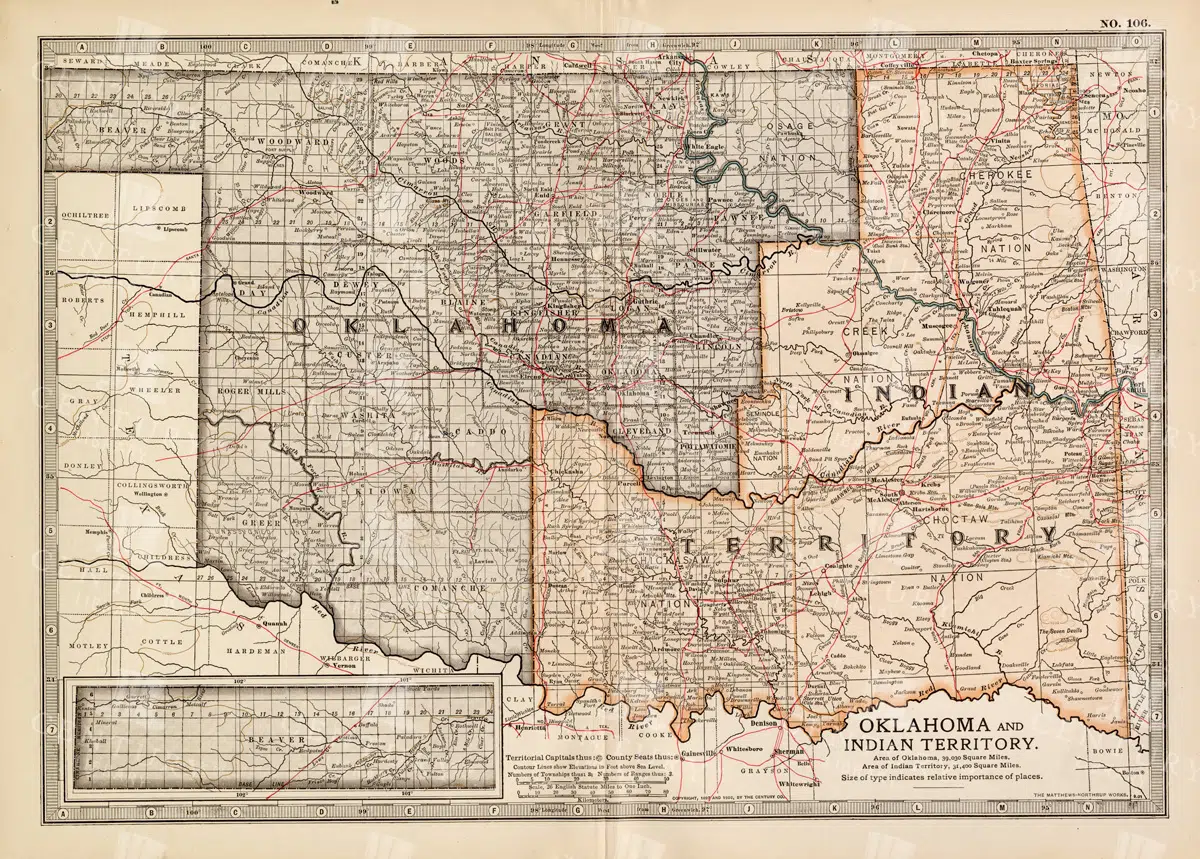
Antique Map of Oklahoma and Indian Territory from the 19th Century
This antique map from the 19th century illustrates Oklahoma and Indian Territory, showcasing the regions before statehood. It details the counties, settlements, and major transportation routes of the time.
- Resolution: 7249 x 5100
- Image Type(s): JPG
From this collection

Historic Map of New Jersey
A detailed antique map of New Jersey, highlighting its counties, cities, and significant landmarks, reflecting the state's geography and development during the late 19th century.
- Resolution: 7239 x 5100
- Image Type(s): JPG
From this collection

Vintage Map of Minnesota Featuring Lakes and Urban Areas
A vintage map of Minnesota highlighting its numerous lakes, urban areas, and transportation routes, showcasing the state's geographical diversity from the early 20th century.
- Resolution: 7166 x 5100
- Image Type(s): JPG
From this collection
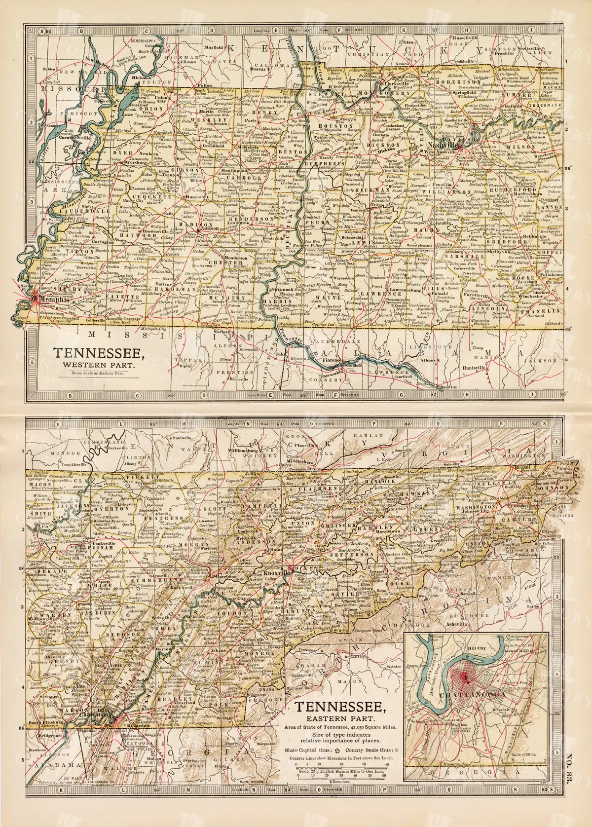
Antique Map of Tennessee, USA – Eastern and Western Parts
An antique map from the 19th century depicting both the eastern and western parts of Tennessee, USA. The map shows various towns, railways, and natural features, providing a comprehensive view of the state’s geography and development during the period.
- Resolution: 7268 x 5100
- Image Type(s): JPG
From this collection
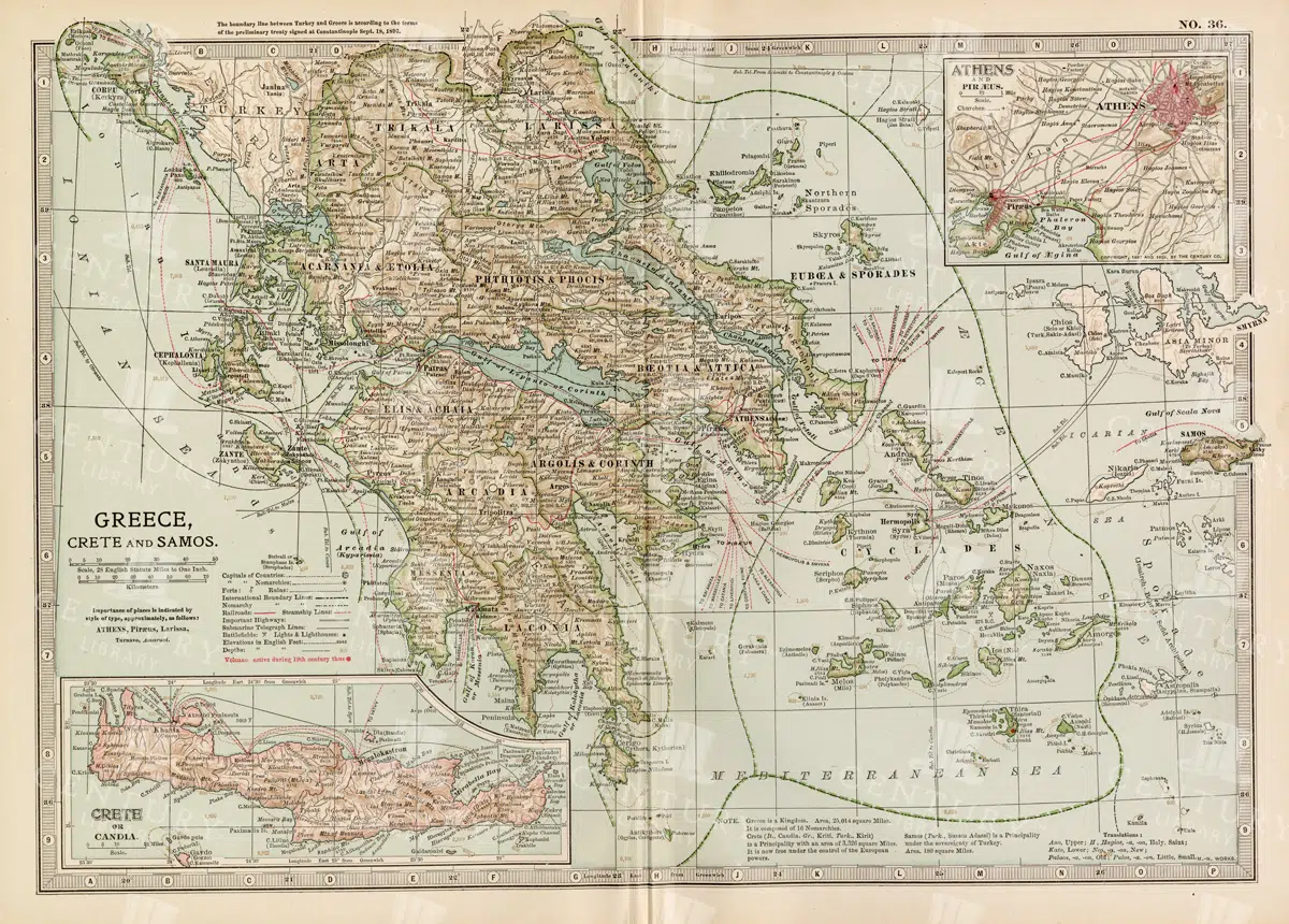
Antique Map of Greece Highlighting Crete and Samos with Detailed Topography
This antique map of Greece highlights the regions of Crete and Samos, showing detailed topographical features such as mountains, rivers, and coastlines. The map provides a historical overview of the geopolitical boundaries, major cities, and maritime routes in the Aegean Sea during the late 19th century. It offers a valuable perspective on the landscape and political divisions of Greece and its islands at the time.
- Resolution: 7140 x 5100
- Image Type(s): JPG
From this collection


Springtime Landscape with Trees and Lake Detailed Illustration
A detailed illustration of a springtime landscape featuring trees and a lake, capturing the serene beauty of nature with intricate line art details
- Resolution: 5135px x 7465px
- Image Type(s): PNG
Related Images

Detailed 19th Century Map of Ontario with Inset of Toronto and Vicinity
A richly detailed map of Ontario from the late 19th century, featuring county divisions, cities, and a prominent inset of Toronto and its surrounding areas, highlighting important transportation routes.
- Resolution: 7250 x 5100
- Image Type(s): JPG
From this collection

Antique Map of New Brunswick, Nova Scotia, and Prince Edward Island
A historic map from the late 19th century illustrating the Canadian provinces of New Brunswick, Nova Scotia, and Prince Edward Island, featuring key cities, towns, and geographical landmarks.
- Resolution: 7238 x 5100
- Image Type(s): JPG
- 19th-century
- Antique
- Atlantic
- Atlas
- Borders
- Canada
- cartography
- cities
- classic
- coastline
- colonial
- country
- Geography
- Globe
- heritage
- History
- illustration
- Landscape
- Map
- maritime
- new brunswick
- novascotia
- Ocean
- princeed ward island
- provinces
- regions
- representation
- Rivers
- Road
- settlements
- territory
- topography
- tourism
- towns
- Travel
- vintage
- World
From this collection

Historical Map of Manitoba, British Columbia, and the Northwest Territories
A detailed historical map depicting the regions of Manitoba, British Columbia, and the Northwest Territories, showcasing topographical features, settlements, and boundaries in the early 20th century.
- Resolution: 7160 x 5100
- Image Type(s): JPG
- topographical
- northwest
- columbia
- manitoba
- settlements
- early
- 20th
- demographics
- century
- provincial
- division
- resources
- settlement
- climate
- infrastructure
- regions
- boundaries
- colonial
- territories
- exploration
- cartography
- transportation
- coastline
- historical
- natural
- vintage
- representation
- Antique
- History
- River
- Geography
- Atlas
- British
- World
- Landscape
- Canada
- Globe
- Map
- Travel
- Borders
From this collection


Historic Map of North Carolina
A detailed antique map of North Carolina, highlighting its counties, cities, and key geographical features, showcasing the state's landscape during the late 19th century.
- Resolution: 7243 x 5100
- Image Type(s): JPG
From this collection
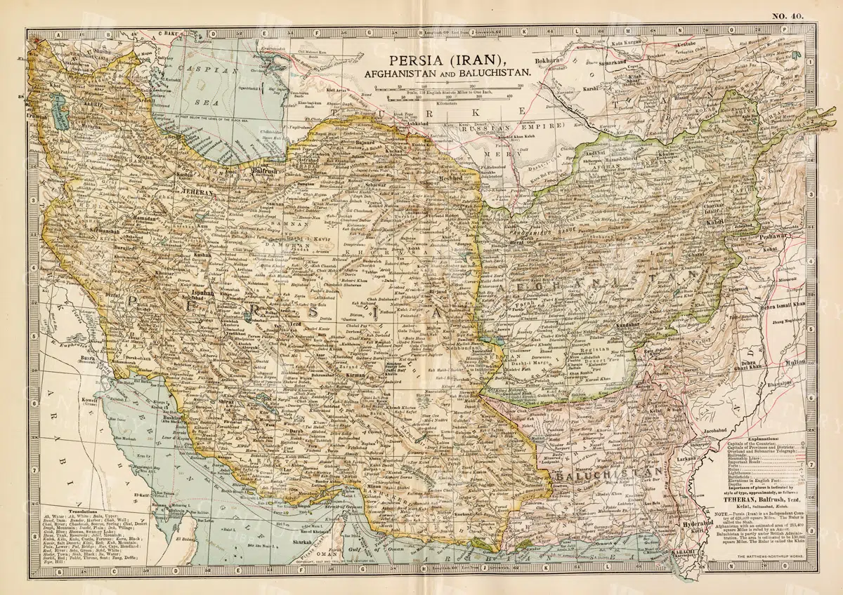
Antique Map of Persia, Afghanistan, and Baluchistan with Geopolitical Borders
This antique map of Persia (modern-day Iran), Afghanistan, and Baluchistan highlights the geopolitical borders and key cities of the early 20th century. The map details the region's topographical features, including mountain ranges, rivers, and deserts, offering a comprehensive view of the landscape. It provides a historical perspective on the political and geographical divisions in this part of the Middle East and South Asia during the period.
- Resolution: 7148 x 5100
- Image Type(s): JPG
- Afghanistan
- Afghanistan history
- Antique
- antique map
- Atlas
- Baluchistan
- cartography
- cities
- colonial
- country
- deserts
- early 20th century
- exploration
- Geography
- geopolitical borders
- historical geography
- historical map
- History
- Iran
- Landscape
- Map
- Middle East
- mountain ranges
- old map
- Persia
- Persia history
- representation
- Rivers
- South Asia
- topography
- World
From this collection


VINTAGE Colour Print of the Tyndall Glacier, Greenland – 1877
- License Info
- Resolution: 7676px x 5529px
- Year of Print: 1877
Related Images

Antique Map of Western New York
A detailed historic map showcasing the western part of New York, highlighting counties, cities, and geographical features, including insets of major urban areas like Buffalo and Rochester.
- Resolution: 7241 x 5100
- Image Type(s): JPG
From this collection

Vintage Map of Northern New York
An antique map focusing on the northern and eastern parts of New York, showing the state's counties, cities, and significant natural features, typical of late 19th-century cartography.
- Resolution: 7240 x 5100
- Image Type(s): JPG
From this collection

Historical Map of Northern Michigan and Surrounding Great Lakes
A historical map of Northern Michigan, including surrounding areas of the Great Lakes, highlighting major towns, transportation routes, and natural features from the early 20th century.
- Resolution: 7164 x 5100
- Image Type(s): JPG
From this collection

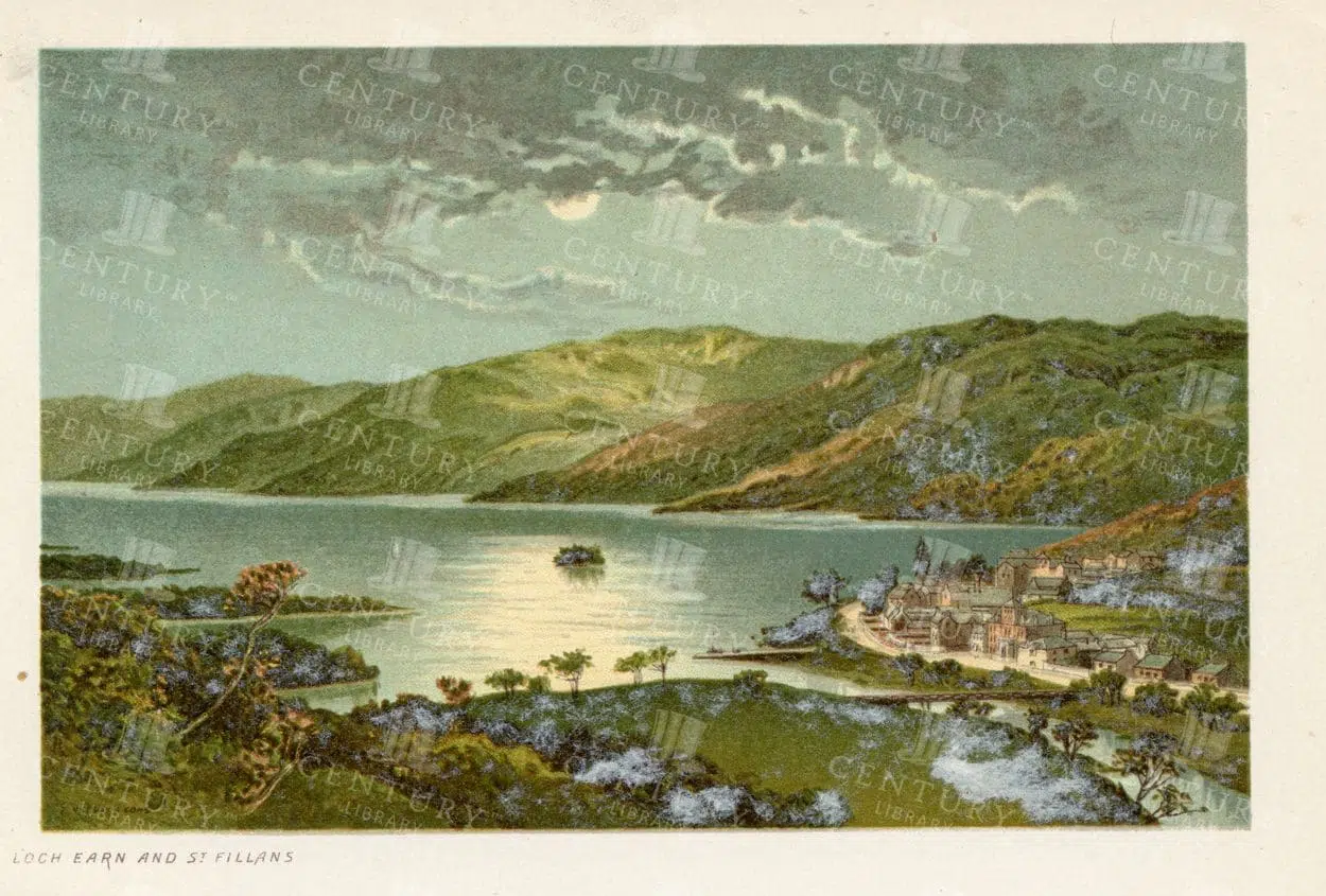

STUNNING Vintage Scottish Illustration – Luss Straits -Loch Lomond
- Resolution: 4706px x 3211px
- Year of Print: 1895
- Artist: T. Nelson and Sons
Related Images


Antique 19th Century Map of Oregon Featuring Detailed Topographical Features
A detailed antique map from the 19th century showcasing the state of Oregon, including its mountains, rivers, and settlements. This map highlights the state's topography and early infrastructure development.
- Resolution: 7251 x 5100
- Image Type(s): JPG
From this collection


19th Century Map of Switzerland, Liechtenstein, and Parts of Austria-Hungary
A detailed antique map from the 19th century showcasing Switzerland, Liechtenstein, and parts of Austria-Hungary. The map highlights the mountainous terrain, lakes, and major cities, reflecting the historical borders and settlements of the region.
- Resolution: 7267 x 5100
- Image Type(s): JPG
From this collection
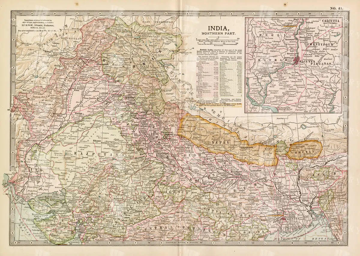
Historical Map of Northern India and Nepal Featuring Mountainous Terrain
Historical Map of Northern India and Nepal Featuring Mountainous Terrain
- Resolution: 7144 x 5100
- Image Type(s): JPG
- early 20th century
- Nepal
- Northern India
- Himalayas
- mountainous terrain
- South Asian history
- South Asia
- topography
- cities
- historical geography
- antique map
- historical map
- colonial
- exploration
- old map
- cartography
- political boundaries
- transportation
- historical
- old
- representation
- Antique
- History
- Geography
- Atlas
- World
- Landscape
- Globe
- Rivers
- Map
- Navigation
From this collection

Antique Map of the Chinese Empire Highlighting Major Regions and Cities
This antique map of the Chinese Empire highlights the major regions and cities, offering a detailed view of the empire's geographical and political structure. The map also includes insets of significant areas like Hong Kong and Peking, providing historical context.
- Resolution: 7119 x 5100
- Image Type(s): JPG
From this collection

Antique 19th Century Map of Southern Ohio Featuring Major Cities and Rivers
A detailed 19th-century map showcasing Southern Ohio, highlighting cities like Cincinnati and Cleveland, along with rivers and other key geographical features. Ideal for historical and geographical studies.
- Resolution: 7248 x 5100
- Image Type(s): JPG
From this collection

Vintage Map of Montana
An antique map showcasing the state of Montana, highlighting counties, cities, and geographical features in fine detail, typical of late 19th to early 20th century cartography.
- Resolution: 7235 x 5100
- Image Type(s): JPG
From this collection

Vintage Map of Northern Illinois Featuring Chicago and Surrounding Areas
This vintage map of Northern Illinois features Chicago and its surrounding areas, highlighting major transportation routes, rivers, and urban centers. The map provides a detailed overview of the region's geography during the early 20th century, showcasing the development and expansion of Chicago as a key American city. It offers a historical perspective on the infrastructure and urban planning of the time.
- Resolution: 7142 x 5100
- Image Type(s): JPG
From this collection

Historical Map of Idaho and Wyoming Including Yellowstone National Park
This historical map covers the states of Idaho and Wyoming, with a special focus on Yellowstone National Park. The map details the topographical features, including mountains, rivers, and forests, as well as the transportation routes and political boundaries of the early 20th century. It provides a valuable snapshot of the American West during this period, highlighting the natural beauty and geographical diversity of the region.
- Resolution: 7141 x 5100
- Image Type(s): JPG
- early 20th century
- Yellowstone National Park
- Idaho
- Western states
- national parks
- forests
- topography
- historical geography
- antique map
- historical map
- exploration
- old map
- cartography
- American West
- political boundaries
- transportation
- conservation
- historical
- vintage
- old
- representation
- Antique
- History
- Wyoming
- Geography
- Landscape
- United States
- Rivers
- Mountains
- Map
From this collection

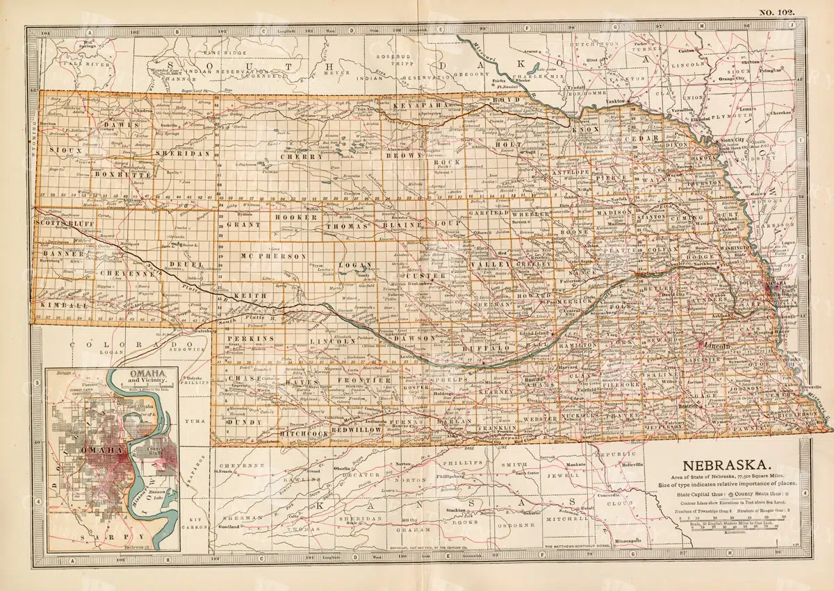
Historic Map of Nebraska
A detailed historic map of Nebraska, illustrating counties, towns, and important routes, reflecting the geography and infrastructure of the state during the late 19th to early 20th century.
- Resolution: 7236 x 5100
- Image Type(s): JPG
From this collection


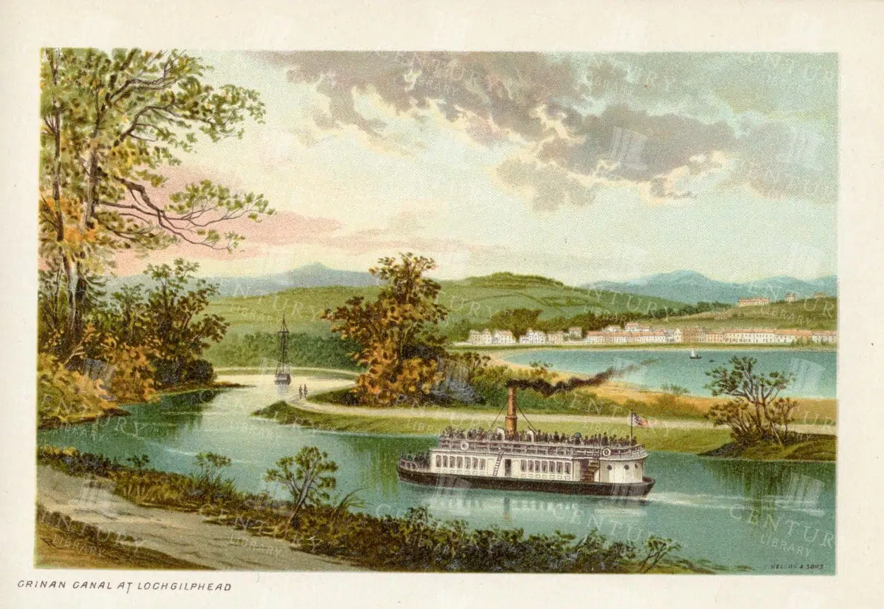
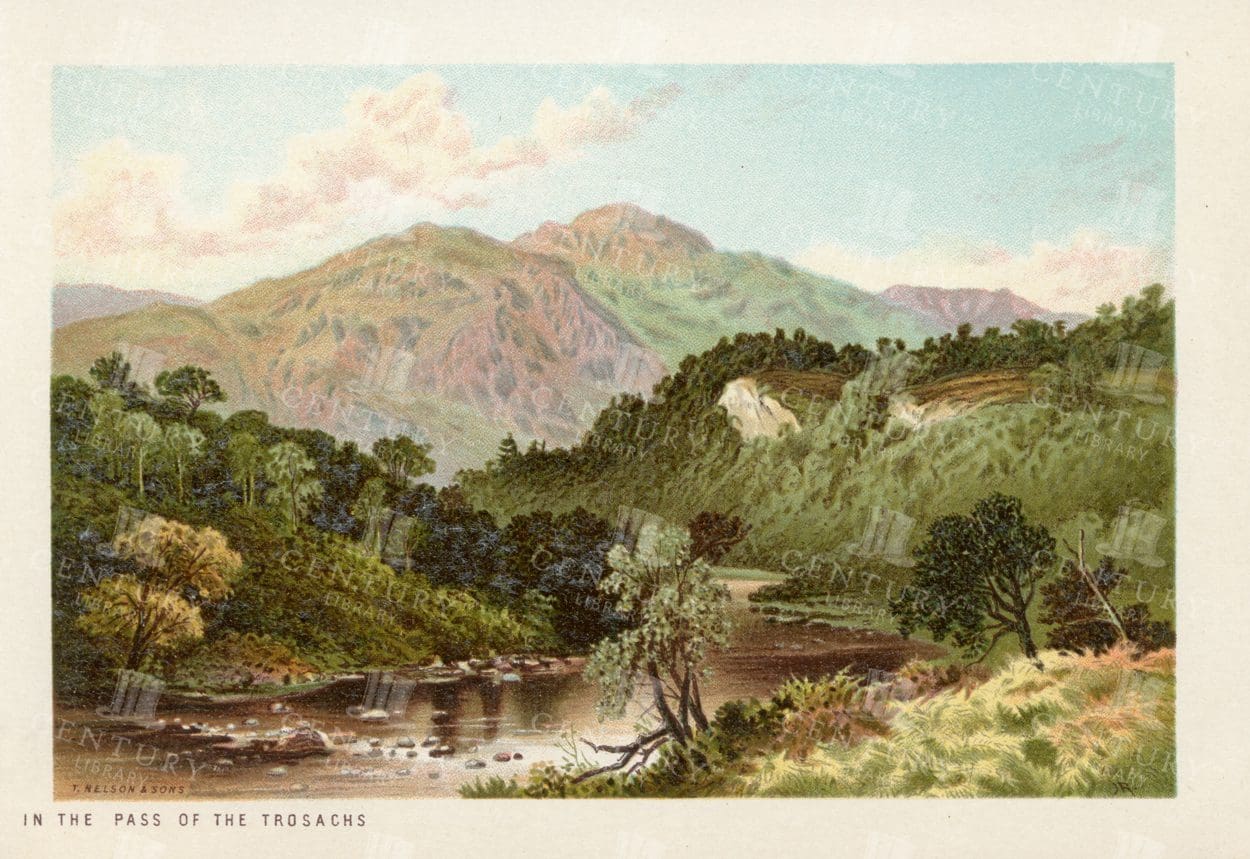
CRINAN CANAL at Lochgilphead – Vintage Scottish Illustration – 1895
- Resolution: 4747px x 3198px
- Year of Print: 1895
- Artist: T. Nelson and Sons
Related Images


Antique Map of North Dakota
A historic map of North Dakota from the late 19th century, detailing the state's counties, cities, and major geographical landmarks, reflecting its development and settlement patterns.
- Resolution: 7244 x 5100
- Image Type(s): JPG
From this collection


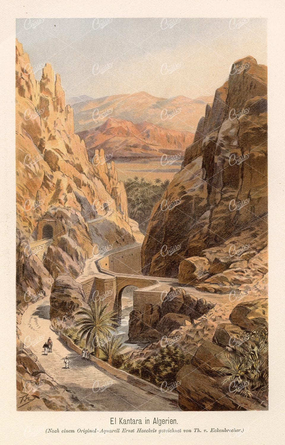
LOCH GOILHEAD – Vintage Scottish Landscape Chromo Illustration
- Resolution: 4749px x 3197px
- Year of Print: 1895
- Artist: T. Nelson and Sons
Related Images

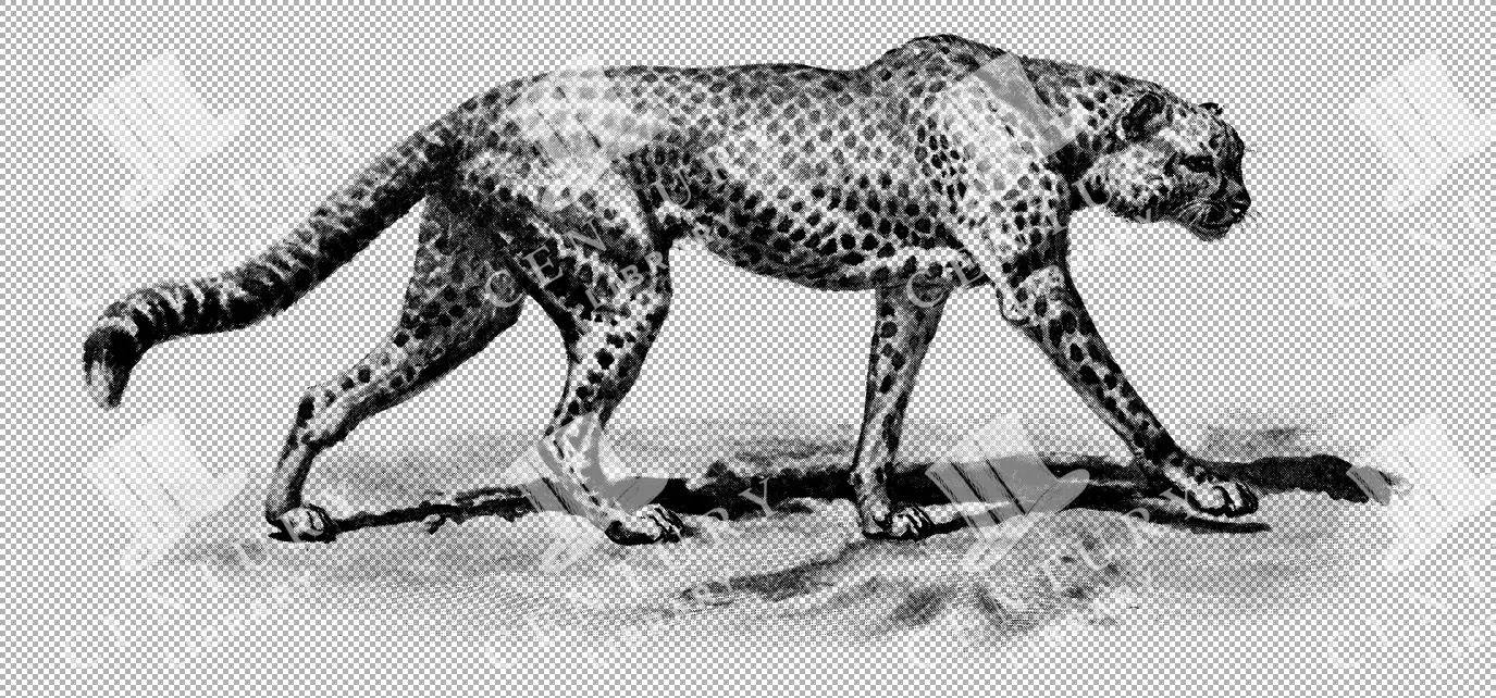
Illustration of a Cheetah
A vintage illustration of a cheetah prowling in a savanna landscape, emphasizing its sleek body and distinctive spots. The artwork captures the agility and speed of this apex predator in a classic black and white style.
- Resolution: 4888px x 2283px
- Image Type(s): PNG
Related Images

Support the Library
Our supporters and members help us continue collecting and restoring these wonderful pieces of art for the modern creator
Unlock Everything and Become a Member!
While a lot of the library is available for free, some is kept behind closed dusty doors only to be accessed by our lovely members.