
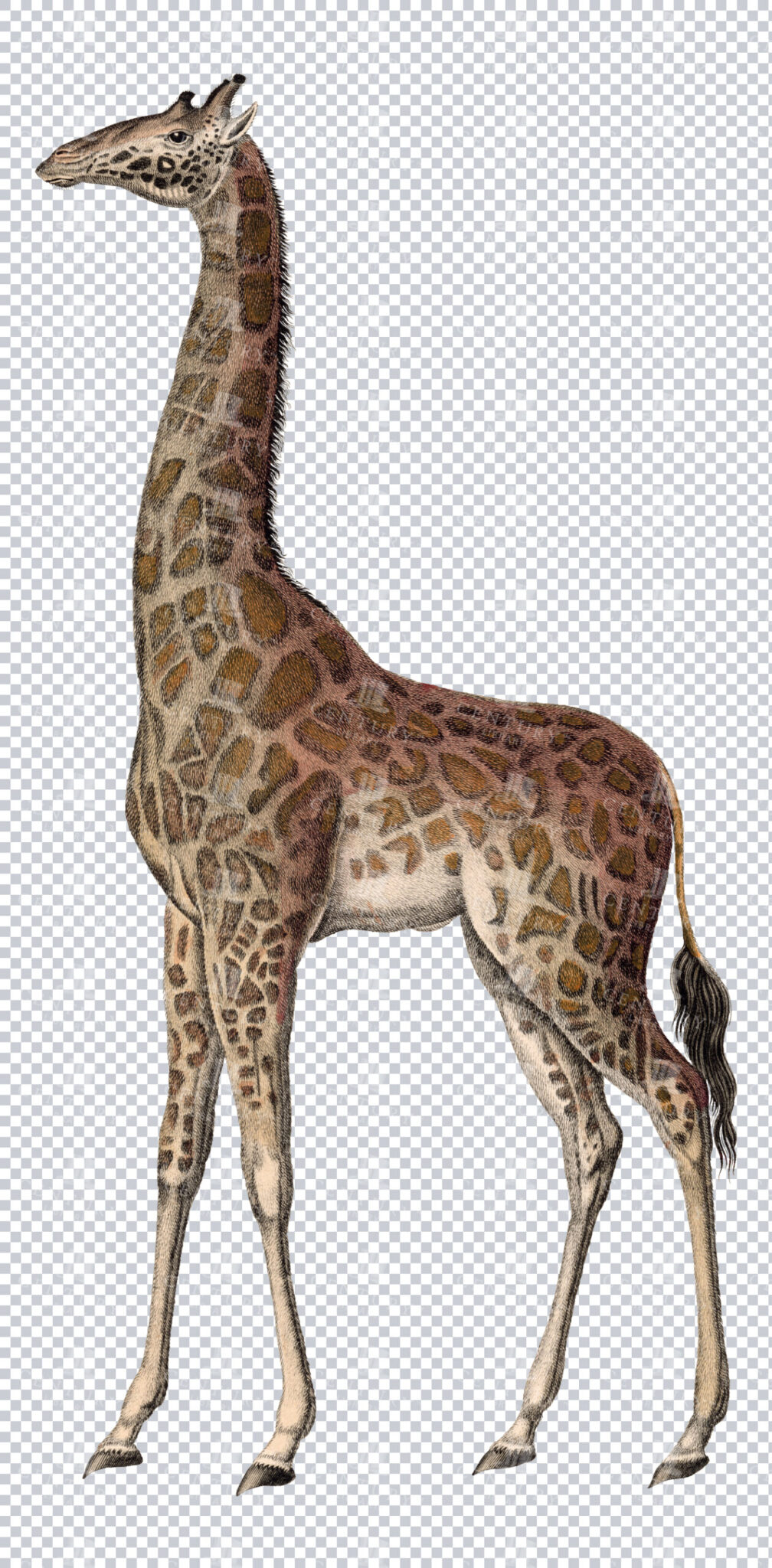
Vintage Illustration of Giraffe on Transparent Background
Classic vintage illustration of a giraffe on a transparent background. Perfect for educational materials or design projects.
- Resolution: 4316 × 8758
- Image Type(s): PNG
From this collection

Antique Map of the United States
Detailed antique map of the United States showing states, territories, railroads, and cities, with inset of Alaska. Includes topographical features, rivers, and mountain ranges.
- Resolution: 7275 x 5100
- Image Type(s): JPG
- state lines
- united states map
- nostalgic
- america map
- cartographer
- reference
- archival
- USA
- topographical
- mountain ranges
- railroads
- cities
- antique map
- historical map
- territories
- exploration
- old map
- cartography
- vintage map
- American history
- transportation
- states
- historic
- education
- 19th-century
- collectible
- historical
- detailed
- heritage
- illustration
- vintage
- Atlantic Ocean
- Antique
- History
- Alaska
- Pacific Ocean
- Geography
- United States
- America
- Rivers
- Map
- Borders
From this collection

Vintage Engraving of Armadillo on Transparent Background
Vintage illustration of an armadillo, highlighting its textured armored shell on a transparent background. Suitable for educational resources, design projects, or zoological studies.
- Resolution: 4835 × 2567
- Image Type(s): PNG
- 19th-century
- Animal
- Antique
- Armadillo
- armored
- Art
- artistic
- Background
- biology
- Black and white
- collectible
- Design
- detailed
- Drawing
- education
- Engraving
- Etching
- exotic
- fauna
- historical
- History
- illustration
- isolated
- Mammal
- monochrome
- natural
- Nature
- old-fashioned
- retro
- scientific
- Shell
- South America
- Texture
- traditional
- transparent
- unique
- vintage
- Wildlife
- Zoology
From this collection

Vintage Engraving of Kangaroo on Transparent Background
Vintage illustration of a kangaroo, highlighting its posture and muscular legs on a transparent background. Perfect for educational content, wildlife designs, or Australian-themed projects.
- Resolution: 5268 × 4164
- Image Type(s): PNG
- 19th-century
- Animal
- Antique
- Art
- artistic
- Australia
- Background
- biology
- Black and white
- collectible
- Design
- detailed
- Dog
- Drawing
- education
- Engraving
- Etching
- exotic
- fauna
- historical
- History
- hopping
- illustration
- isolated
- Kangaroo
- Mammal
- Marsupial
- monochrome
- natural
- Nature
- old-fashioned
- retro
- scientific
- Texture
- traditional
- transparent
- unique
- vintage
- Wildlife
- Zoology
From this collection

Vintage Illustration of Bactrian Camel on Transparent Background
Detailed vintage illustration of a Bactrian camel, presented on a transparent background. Suitable for educational or design projects.
- Resolution: 5161 × 4128
- Image Type(s): PNG
From this collection

Vintage Engraving of Buffalo on Transparent Background
A detailed vintage engraving of a buffalo, isolated on a transparent background. Ideal for educational content or creative projects.
- Resolution: 6225 × 3523
- Image Type(s): PNG
From this collection

Vintage Engraving of Reindeer on Transparent Background
A vintage engraving of a reindeer, beautifully detailed and isolated on a transparent background. Ideal for educational or creative projects.
- Resolution: 4669 × 3972
- Image Type(s): PNG
From this collection

Vintage Engraving of Koala with Baby on Transparent Background
vintage illustration of a koala with its baby on its back, showcasing intricate fur details on a transparent background. Perfect for educational materials, wildlife designs, or artistic projects.
- Resolution: 3428 × 3093
- Image Type(s): PNG
- 19th-century
- Animal
- Antique
- Art
- artistic
- Baby
- Background
- biology
- Black and white
- Cat
- collectible
- cute
- Design
- detailed
- domestic
- Drawing
- education
- Engraving
- Etching
- exotic
- Family
- fauna
- feline
- fur
- historical
- History
- illustration
- isolated
- Kitten
- kitty
- koala baby
- Madagascar
- Mammal
- monochrome
- Mother
- natural
- Nature
- nurturing
- old-fashioned
- parent
- Pet
- retro
- scientific
- Texture
- traditional
- transparent
- unique
- vintage
- Whiskers
- Wildlife
- Zoology
From this collection

Antique Map of the West Indies
Historical antique map of the West Indies, showcasing islands like Cuba, Jamaica, and Puerto Rico, with detailed nautical routes, ports, and topography. Includes inset of Bermuda. 19th century cartography.
- Resolution: 7279 x 5100
- Image Type(s): JPG
- nostalgic
- cartographer
- cuba
- puerto rico
- nautical routes
- ports
- bermuda
- islands map
- sea routes
- bermuda map
- west indies map
- island history
- archival
- Caribbean islands
- Caribbean
- detailed map
- maritime
- topography
- historical map
- exploration
- old map
- cartography
- transportation
- 19th-century
- collectible
- historical
- heritage
- classic
- Islands
- country
- vintage
- representation
- Atlantic Ocean
- Antique
- History
- Jamaica
- West Indies
- Geography
- Atlas
- World
- Map
- Nautical
From this collection

Vintage Engraving of Solenodon on Transparent Background
Intricate vintage illustration of a solenodon, showcasing its unique long snout and fur details on a transparent background. Perfect for educational resources, nature designs, or zoological studies.
- Resolution: 4158 × 2218
- Image Type(s): PNG
- 19th-century
- Animal
- Antique
- Art
- artistic
- Background
- biology
- Black and white
- collectible
- Design
- detailed
- Drawing
- education
- Engraving
- Etching
- fauna
- historical
- History
- illustration
- isolated
- long snout
- Mammal
- monochrome
- natural
- Nature
- nocturnal
- old-fashioned
- Otter
- Porcupine
- retro
- Rodent
- scientific
- solenodon
- Texture
- traditional
- transparent
- unique
- vintage
- Wild
- Wildlife
- Zoology
From this collection

Vintage Engraving of Marsupial with Young on Transparent Background
Vintage illustration of a marsupial with its young on its back, showcasing intricate fur and tail details on a transparent background. Ideal for educational resources, wildlife designs, or artistic projects.
- Resolution: 3247 × 2082
- Image Type(s): PNG
- 19th-century
- Animal
- Antique
- Art
- artistic
- Background
- biology
- Black and white
- Cat
- collectible
- Design
- detailed
- Dog
- domestic animal
- Drawing
- education
- Engraving
- Etching
- exotic
- Family
- fauna
- feline
- historical
- History
- illustration
- isolated
- Mammal
- Marsupial
- monochrome
- natural
- Nature
- nurturing
- old-fashioned
- parent
- Pet
- retro
- scientific
- Texture
- traditional
- transparent
- unique
- vintage
- Wildlife
- young
- Zoology
From this collection

Vintage Engraving of Slow Loris on Transparent Background
Vintage illustration of a slow loris, featuring its distinct large eyes and detailed fur on a transparent background. Perfect for educational content, design projects, or zoological studies.
- Resolution: 2734 × 3087
- Image Type(s): PNG
- 19th-century
- Animal
- Antique
- Art
- artistic
- Background
- biology
- Black and white
- collectible
- Design
- detailed
- Drawing
- education
- endangered
- Engraving
- Etching
- exotic
- fauna
- fur
- historical
- History
- illustration
- isolated
- Mammal
- mongoose
- monochrome
- natural
- Nature
- nocturnal
- old-fashioned
- Primate
- retro
- scientific
- slow loris
- Southeast Asia
- Texture
- traditional
- transparent
- unique
- vintage
- Wildlife
- Zoology
From this collection

Vintage Engraving of Giant Anteater on Transparent Background
Detailed vintage illustration of a giant anteater, featuring intricate line work and shading on a transparent background. Ideal for educational materials, wildlife projects, or design elements.
- Resolution: 4609 × 2311
- Image Type(s): PNG
- 19th-century
- Animal
- Anteater
- Antique
- Art
- artistic
- Background
- biology
- Black and white
- collectible
- Design
- detailed
- Drawing
- education
- endangered
- Engraving
- Etching
- exotic
- fauna
- Giant
- historical
- History
- illustration
- isolated
- Mammal
- monochrome
- natural
- Nature
- old-fashioned
- retro
- scientific
- South America
- species
- Texture
- traditional
- transparent
- vintage
- Wildlife
- Zoology
From this collection

Vintage Illustration of Scimitar-Horned Oryx on Transparent Background
Detailed vintage illustration of a scimitar-horned oryx, presented on a transparent background. Perfect for educational and design purposes.
- Resolution: 4755 × 4569
- Image Type(s): PNG
From this collection
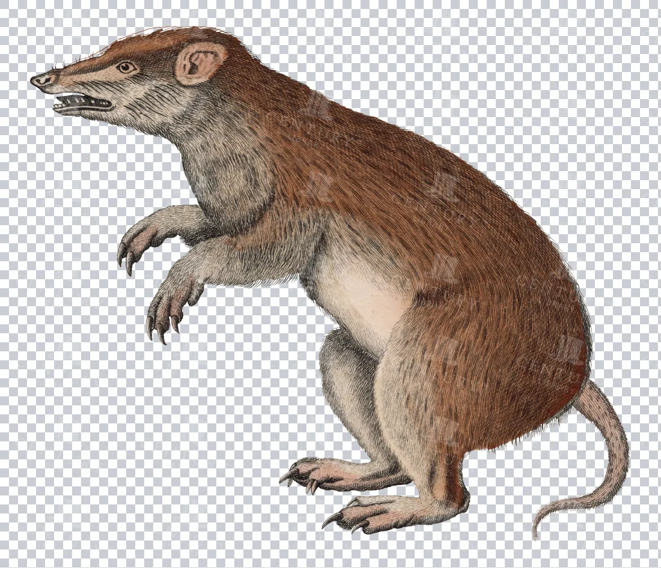
Vintage Illustration of Malagasy Rodent on Transparent Background
Detailed vintage illustration of a Malagasy rodent, presented on a transparent background. Ideal for educational materials or design projects.
- Resolution: 3261 × 2801
- Image Type(s): PNG
- 19th-century
- Animal
- Antique
- Art
- Background
- biology
- collectible
- cute
- detailed
- domestic
- Drawing
- Ear
- education
- Engraving
- Etching
- fauna
- fur
- historical
- History
- illustration
- isolated
- Madagascar
- Malagasy rodent
- Mammal
- Mouse
- natural
- Nature
- old-fashioned
- Pet
- Rat
- retro
- Rodent
- scientific
- tail
- traditional
- transparent
- unique
- vintage
- Wildlife
- Zoology
From this collection

Vintage Engraving of Wombat on Transparent Background
A detailed vintage engraving of a wombat, isolated on a transparent background. Great for educational and design purposes.
- Resolution: 4055 × 1821
- Image Type(s): PNG
From this collection
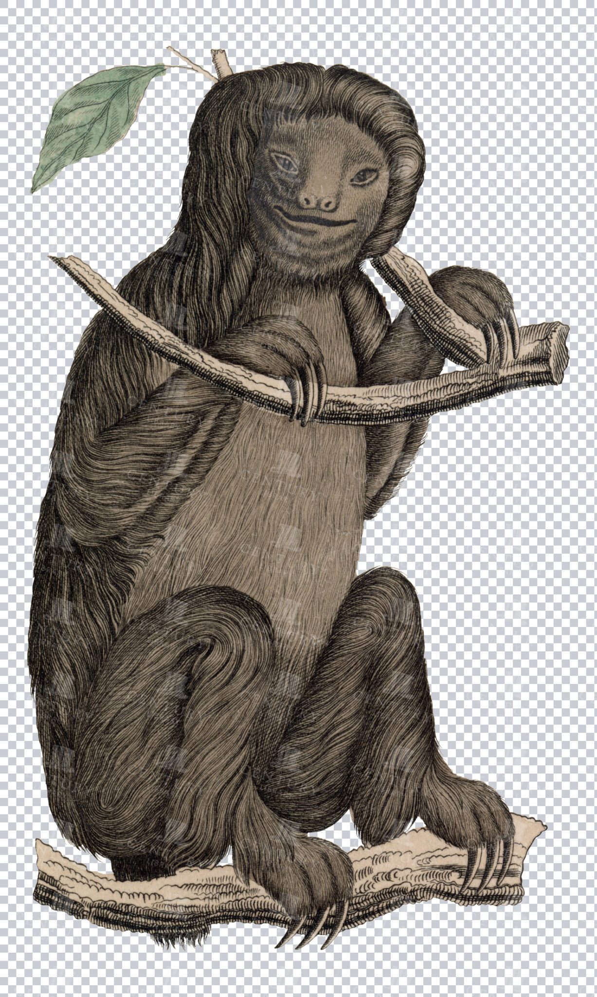
Vintage Engraving of Sloth on Transparent Background
Intricate vintage illustration of a sloth hanging from a branch, showcasing detailed fur and texture on a transparent background. Ideal for educational resources, nature designs, or artistic projects.
- Resolution: 2634 × 4394
- Image Type(s): PNG
- 19th-century
- Animal
- Antique
- Art
- artistic
- Background
- biology
- Black and white
- Branch
- bust
- Carving
- collectible
- Design
- detailed
- Drawing
- education
- Engraving
- Etching
- fauna
- Hanging
- historical
- History
- illustration
- isolated
- Mammal
- monochrome
- natural
- Nature
- old-fashioned
- plastic art
- retro
- scientific
- Sculpture
- Sloth
- slow
- Statue
- Texture
- traditional
- transparent
- Tropical
- unique
- vintage
- Wildlife
- Zoology
From this collection

Antique Map of Virginia
Historical antique map of Virginia, showing counties, towns, railroads, rivers, and geographical details. Includes insets of the western part of Virginia and the Norfolk vicinity. 19th century cartography.
- Resolution: 7277 x 5100
- Image Type(s): JPG
- 19th-century
- American history
- Antique
- archival
- Atlantic Ocean
- Atlas
- cartographer
- cartography
- classic
- collectible
- counties
- detailed map
- education
- exploration
- geographical details
- Geography
- heritage
- historic
- historical
- historical map
- historical regions
- History
- Map
- norfolk
- nostalgic
- old
- old map
- railroads
- reference
- representation
- Rivers
- state boundaries
- towns
- transportation
- USA
- vintage
- Virginia
- virginia counties
- virginia map
- western virginia
From this collection

Antique Map of Vermont and New Hampshire
Detailed antique map showing the states of Vermont and New Hampshire with towns, railroads, rivers, and geographical features. Historical cartography showcasing 19th century state boundaries and infrastructures.
- Resolution: 7276 x 5100
- Image Type(s): JPG
- 19th-century
- American history
- Antique
- archival
- Atlantic Ocean
- Atlas
- Borders
- cartographer
- cartography
- classic
- collectible
- detailed map
- education
- exploration
- geographical features
- Geography
- heritage
- historic
- historical
- historical map
- History
- infrastructures
- Map
- New England
- New Hampshire
- new hampshire map
- nostalgic
- old map
- railroads
- reference
- representation
- Rivers
- state boundaries
- state lines
- states
- towns
- transportation
- USA
- Vermont
- vermont map
- vintage
- vintage map
From this collection

Vintage Engraving of Musk Deer on Transparent Background
Detailed vintage engraving of a musk deer with characteristic fangs, isolated on a transparent background. Great for educational use or design purposes.
- Resolution: 2900 × 2373
- Image Type(s): PNG
From this collection

Vintage Illustration of Hyrax on Transparent Background
Detailed vintage illustration of a hyrax, presented on a transparent background. Ideal for educational use or design projects.
- Resolution: 4473 × 1913
- Image Type(s): PNG
From this collection

Vintage Engraving of Tenrec on Transparent Background
Detailed vintage illustration of a tenrec, showing its unique bristly fur and elongated snout on a transparent background. Ideal for educational resources, design projects, or zoological studies.
- Resolution: 4817 × 2308
- Image Type(s): PNG
- 19th-century
- Animal
- Antique
- Art
- artistic
- Background
- biology
- Black and white
- collectible
- Design
- detailed
- Drawing
- education
- Engraving
- Etching
- exotic
- fauna
- historical
- History
- illustration
- isolated
- Madagascar
- Mammal
- monochrome
- natural
- Nature
- old-fashioned
- retro
- rodent-like
- scientific
- spiny
- tenrec
- Texture
- traditional
- transparent
- unique
- vintage
- Wildlife
- wool
- Zoology
From this collection

Vintage Engraving of Pangolin on Transparent Background
Detailed vintage engraving of a pangolin, presented on a transparent background. Ideal for educational content or creative projects.
- Resolution: 5461 × 2823
- Image Type(s): PNG
From this collection

Vintage Engraving of Platypus on Transparent Background
Detailed vintage illustration of a platypus, showcasing intricate features and texture on a transparent background. Perfect for educational content, design, or wildlife projects.
- Resolution: 4723 × 2500
- Image Type(s): PNG
- 19th-century
- Animal
- Antique
- aquatic
- Art
- artistic
- Australia
- Background
- biology
- Black and white
- collectible
- Design
- detailed
- Drawing
- duck-billed
- education
- Engraving
- Etching
- exotic
- fauna
- historical
- History
- illustration
- isolated
- Mammal
- monochrome
- natural
- Nature
- old-fashioned
- Platypus
- retro
- scabbard
- scientific
- sheath
- Texture
- traditional
- transparent
- unique
- vintage
- Wildlife
- Zoology
From this collection
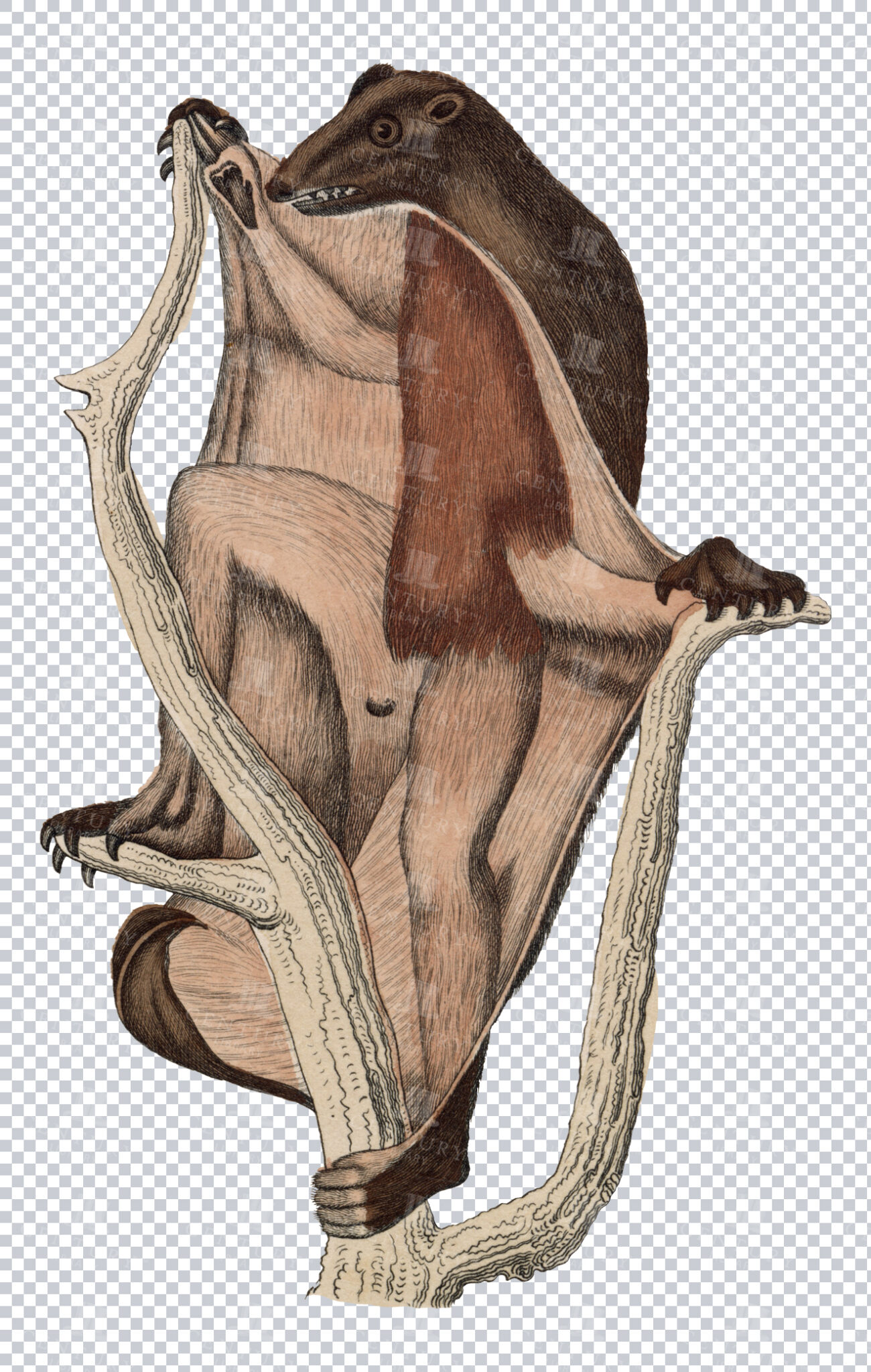
Vintage Engraving of Flying Lemur on Transparent Background
Detailed vintage illustration of a flying lemur, showing its gliding membrane on a transparent background. Ideal for educational resources, design projects, or zoological studies.
- Resolution: 2908 × 4578
- Image Type(s): PNG
- 19th-century
- Animal
- Antique
- Art
- artistic
- Background
- biology
- Black and white
- collectible
- Design
- detailed
- Drawing
- education
- Engraving
- Etching
- exotic
- fauna
- Flying
- gliding
- Harp
- historical
- History
- illustration
- isolated
- Lemur
- Mammal
- membrane
- monochrome
- natural
- Nature
- old-fashioned
- retro
- scientific
- Texture
- traditional
- transparent
- unique
- vintage
- Wildlife
- Zoology
From this collection

Antique Map of West Virginia
Detailed antique map of West Virginia, showing counties, towns, railroads, and geographical features. Historical 19th century cartography with insets of surrounding areas. An educational and collectible piece.
- Resolution: 7280 x 5100
- Image Type(s): JPG
- nostalgic
- cartographer
- state boundaries
- historical regions
- west virginia map
- west virginia counties
- surrounding areas
- heritage map
- vintage west virginia
- state map
- reference
- archival
- geographical features
- USA
- railroads
- detailed map
- topography
- historical map
- exploration
- old map
- cartography
- American history
- transportation
- counties
- towns
- education
- 19th-century
- collectible
- historical
- heritage
- classic
- vintage
- old
- representation
- Antique
- History
- West Virginia
- Geography
- Atlas
- World
- Globe
- Map
From this collection

Antique Map of Wisconsin
Historical antique map of Wisconsin, showing counties, towns, railroads, rivers, and other geographical features. A 19th century map that illustrates the development and infrastructure of the state.
- Resolution: 7281 x 5100
- Image Type(s): JPG
- nostalgic
- cartographer
- state boundaries
- historical regions
- heritage map
- wisconsin map
- wisconsin counties
- vintage wisconsin
- historical development
- state map
- reference
- geographical features
- USA
- infrastructure
- railroads
- detailed map
- topography
- historical map
- exploration
- old map
- cartography
- American history
- transportation
- counties
- towns
- education
- 19th-century
- collectible
- historical
- heritage
- classic
- vintage
- representation
- Antique
- History
- Wisconsin
- Geography
- Atlas
- World
- Rivers
- Map
From this collection

Antique Map of Washington State
Antique map of Washington State, featuring towns, counties, railroads, and geographical features such as rivers and mountains. 19th century cartography highlighting the development and infrastructure of the state.
- Resolution: 7278 x 5100
- Image Type(s): JPG
- nostalgic
- cartographer
- state boundaries
- washington state
- state development
- historical washington
- pacific northwest
- washington map
- northwest history
- washington geography
- reference
- archival
- geographical features
- USA
- infrastructure
- railroads
- detailed map
- historical map
- exploration
- old map
- cartography
- American history
- transportation
- counties
- towns
- education
- 19th-century
- collectible
- historical
- heritage
- classic
- vintage
- representation
- Antique
- History
- Washington
- Geography
- Atlas
- World
- Rivers
- Mountains
- Map
From this collection

Support the Library
Our supporters and members help us continue collecting and restoring these wonderful pieces of art for the modern creator
Unlock Everything and Become a Member!
While a lot of the library is available for free, some is kept behind closed dusty doors only to be accessed by our lovely members.