

Antique Map of Eastern India, Burma, Siam, and French Indo-China
This antique map showcases Eastern India, Burma (now Myanmar), Siam (now Thailand), and French Indo-China (Vietnam, Laos, Cambodia), with a focus on the geopolitical boundaries and major cities of the early 20th century. The map provides a detailed view of the region's topographical features, including rivers, mountain ranges, and coastlines, reflecting the historical context of Southeast Asia during this period.
- Resolution: 7143 x 5100
- Image Type(s): JPG
- Antique
- antique map
- Asia
- Atlas
- Burma
- cartography
- cities
- coastlines
- colonial
- country
- cultural heritage
- early 20th century
- Eastern India
- exploration
- French Indo-China
- Geography
- geopolitical boundaries
- historical geography
- historical map
- History
- Landscape
- Map
- mountain ranges
- old map
- representation
- Rivers
- Siam
- Southeast Asia
- topography
- World
From this collection
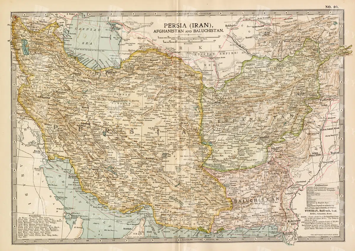
Antique Map of Persia, Afghanistan, and Baluchistan with Geopolitical Borders
This antique map of Persia (modern-day Iran), Afghanistan, and Baluchistan highlights the geopolitical borders and key cities of the early 20th century. The map details the region's topographical features, including mountain ranges, rivers, and deserts, offering a comprehensive view of the landscape. It provides a historical perspective on the political and geographical divisions in this part of the Middle East and South Asia during the period.
- Resolution: 7148 x 5100
- Image Type(s): JPG
- Afghanistan
- Afghanistan history
- Antique
- antique map
- Atlas
- Baluchistan
- cartography
- cities
- colonial
- country
- deserts
- early 20th century
- exploration
- Geography
- geopolitical borders
- historical geography
- historical map
- History
- Iran
- Landscape
- Map
- Middle East
- mountain ranges
- old map
- Persia
- Persia history
- representation
- Rivers
- South Asia
- topography
- World
From this collection
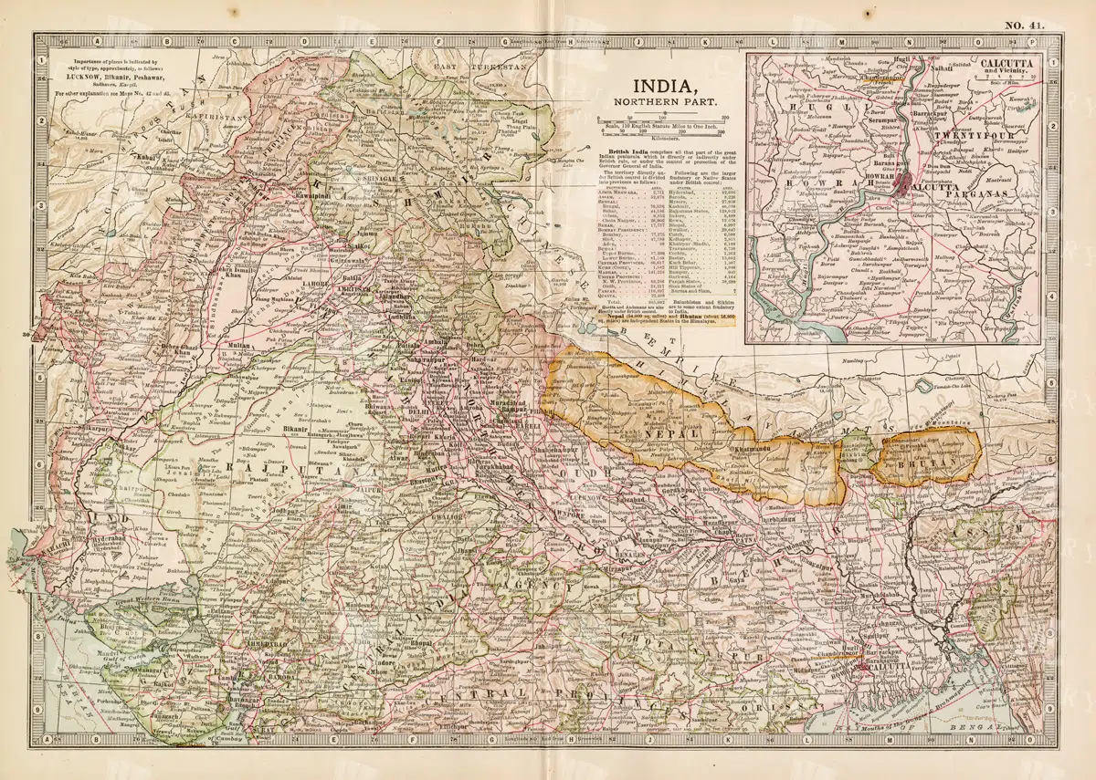
Historical Map of Northern India and Nepal Featuring Mountainous Terrain
Historical Map of Northern India and Nepal Featuring Mountainous Terrain
- Resolution: 7144 x 5100
- Image Type(s): JPG
- Antique
- antique map
- Atlas
- cartography
- cities
- colonial
- early 20th century
- exploration
- Geography
- Globe
- Himalayas
- historical
- historical geography
- historical map
- History
- Landscape
- Map
- mountainous terrain
- Navigation
- Nepal
- Northern India
- old
- old map
- political boundaries
- representation
- Rivers
- South Asia
- South Asian history
- topography
- transportation
- World
From this collection

Vintage Map of Northern Illinois Featuring Chicago and Surrounding Areas
This vintage map of Northern Illinois features Chicago and its surrounding areas, highlighting major transportation routes, rivers, and urban centers. The map provides a detailed overview of the region's geography during the early 20th century, showcasing the development and expansion of Chicago as a key American city. It offers a historical perspective on the infrastructure and urban planning of the time.
- Resolution: 7142 x 5100
- Image Type(s): JPG
From this collection

Historical Map of Idaho and Wyoming Including Yellowstone National Park
This historical map covers the states of Idaho and Wyoming, with a special focus on Yellowstone National Park. The map details the topographical features, including mountains, rivers, and forests, as well as the transportation routes and political boundaries of the early 20th century. It provides a valuable snapshot of the American West during this period, highlighting the natural beauty and geographical diversity of the region.
- Resolution: 7141 x 5100
- Image Type(s): JPG
- American West
- Antique
- antique map
- cartography
- conservation
- early 20th century
- exploration
- forests
- Geography
- historical
- historical geography
- historical map
- History
- Idaho
- Landscape
- Map
- Mountains
- national parks
- old
- old map
- political boundaries
- representation
- Rivers
- topography
- transportation
- United States
- vintage
- Western states
- Wyoming
- Yellowstone National Park
From this collection

Antique Map of Southern India and the Straits Settlements with Ceylon
This antique map depicts Southern India and the Straits Settlements, including the island of Ceylon (now Sri Lanka). The map highlights key cities, transportation networks, and topographical features such as rivers and mountain ranges. It provides a historical perspective on the colonial boundaries and geopolitical landscape of the region during the early 20th century, reflecting the connection between Southern India and Southeast Asia.
- Resolution: 7145 x 5100
- Image Type(s): JPG
- Antique
- antique map
- Atlas
- British Empire
- cartography
- Ceylon
- cities
- colonial boundaries
- country
- early 20th century
- exploration
- Geography
- Globe
- historical geography
- historical map
- History
- Indian Ocean
- Landscape
- Map
- mountain ranges
- old map
- representation
- Rivers
- South Asia
- Southeast Asia
- Southern India
- Sri Lanka
- Straits Settlements
- transportation
- Travel
- World
From this collection

Vintage Map of Indiana Highlighting Transportation Networks and County Borders
This vintage map of Indiana highlights the state's transportation networks, including roads and railroads, along with its county borders. The map provides a detailed view of Indiana's geography during the early 20th century, focusing on the development of infrastructure and urban areas. It offers a historical overview of the state's growth and the connections between its cities and rural areas.
- Resolution: 7146 x 5100
- Image Type(s): JPG
From this collection

Detailed Antique Map of Iowa with County Boundaries and Transportation Routes
This detailed antique map of Iowa showcases the state's county boundaries, major cities, and transportation routes, including roads and railroads. The map provides a comprehensive view of Iowa's geography during the early 20th century, highlighting the state's agricultural landscape and infrastructure development. It serves as a valuable resource for understanding Iowa's historical growth and its place in the broader Midwest.
- Resolution: 7147 x 5100
- Image Type(s): JPG
From this collection

Support the Library
Our supporters and members help us continue collecting and restoring these wonderful pieces of art for the modern creator
Unlock Everything and Become a Member!
While a lot of the library is available for free, some is kept behind closed dusty doors only to be accessed by our lovely members.