

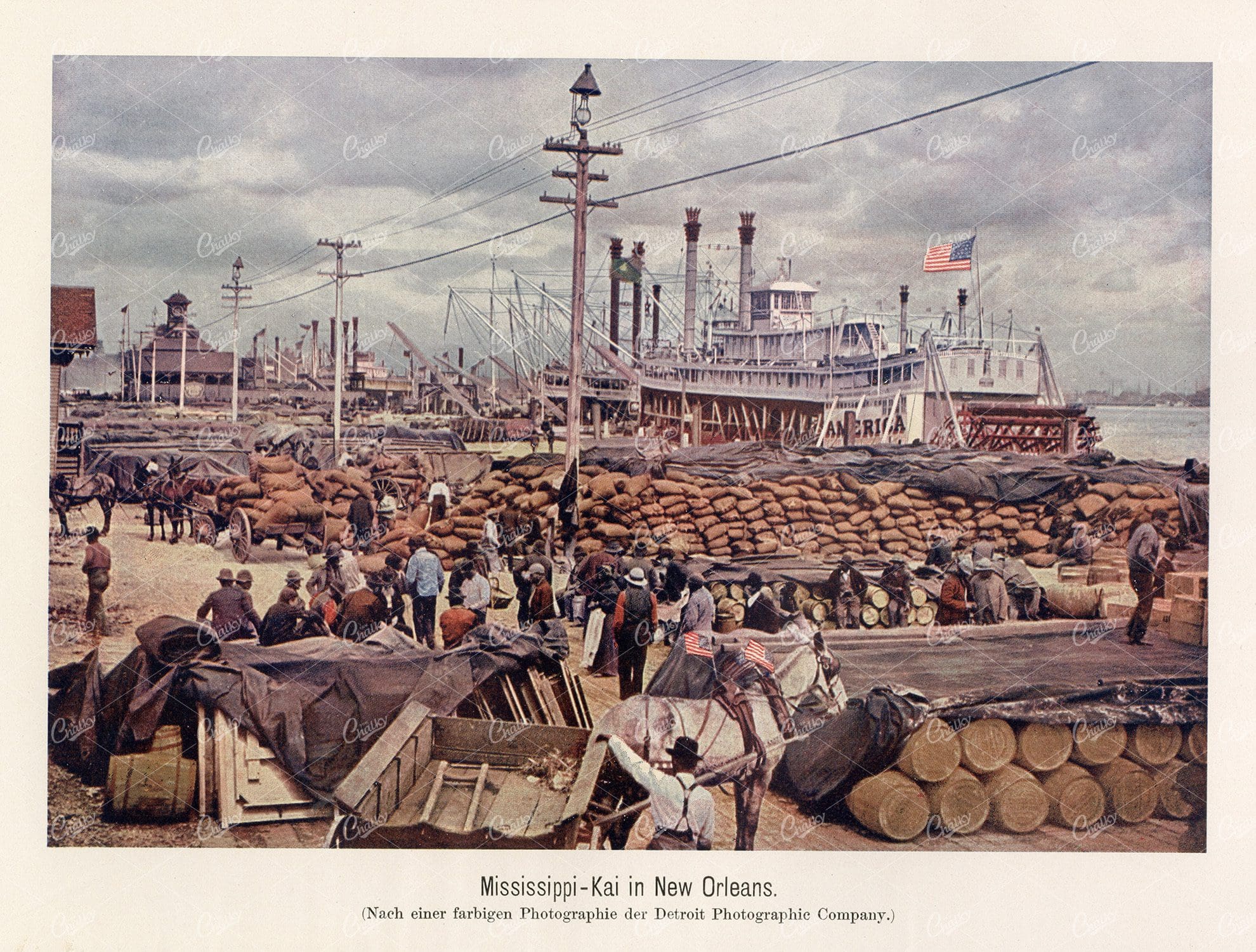
MISSISSIPPI QUAY in New Orleans – Vintage German Print 1877
- License Info
- Resolution: 7292px x 5525px
- Year of Print: 1877
Related Images

Antique Map of Southern India and the Straits Settlements with Ceylon
This antique map depicts Southern India and the Straits Settlements, including the island of Ceylon (now Sri Lanka). The map highlights key cities, transportation networks, and topographical features such as rivers and mountain ranges. It provides a historical perspective on the colonial boundaries and geopolitical landscape of the region during the early 20th century, reflecting the connection between Southern India and Southeast Asia.
- Resolution: 7145 x 5100
- Image Type(s): JPG
- early 20th century
- mountain ranges
- British Empire
- colonial boundaries
- Sri Lanka
- Ceylon
- Straits Settlements
- Southern India
- South Asia
- cities
- historical geography
- antique map
- historical map
- exploration
- old map
- cartography
- transportation
- Southeast Asia
- country
- representation
- Indian Ocean
- Antique
- History
- Geography
- Atlas
- World
- Landscape
- Globe
- Rivers
- Map
- Travel
From this collection

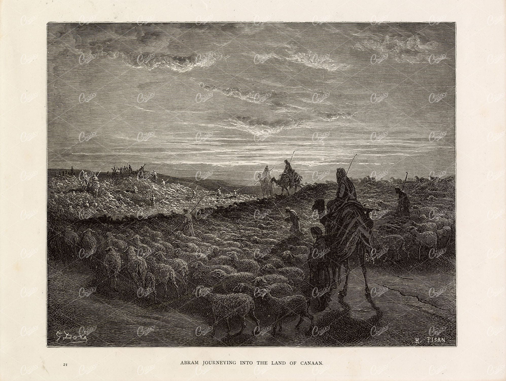
ABRAM Journeying into the Land of Canaan – Shepherd – Gustave Dore 1891
You’re looking at a beautifully detailed, lithograph print by Gustave Doré. A French artist, printmaker, illustrator, comics artist, caricaturist, and sculptor who worked primarily with wood-engraving. This particular engraving was sourced from the 1891 ‘Bible Gallery’ book that compiled a collection of Doré’s biblical themed artwork.
- License Info
- Resolution: 10794 x 8117 300dpi
- Year of Print: 1891
- Artist: Gustave Dore
From this collection

Vintage Map of Indiana Highlighting Transportation Networks and County Borders
This vintage map of Indiana highlights the state's transportation networks, including roads and railroads, along with its county borders. The map provides a detailed view of Indiana's geography during the early 20th century, focusing on the development of infrastructure and urban areas. It offers a historical overview of the state's growth and the connections between its cities and rural areas.
- Resolution: 7146 x 5100
- Image Type(s): JPG
From this collection

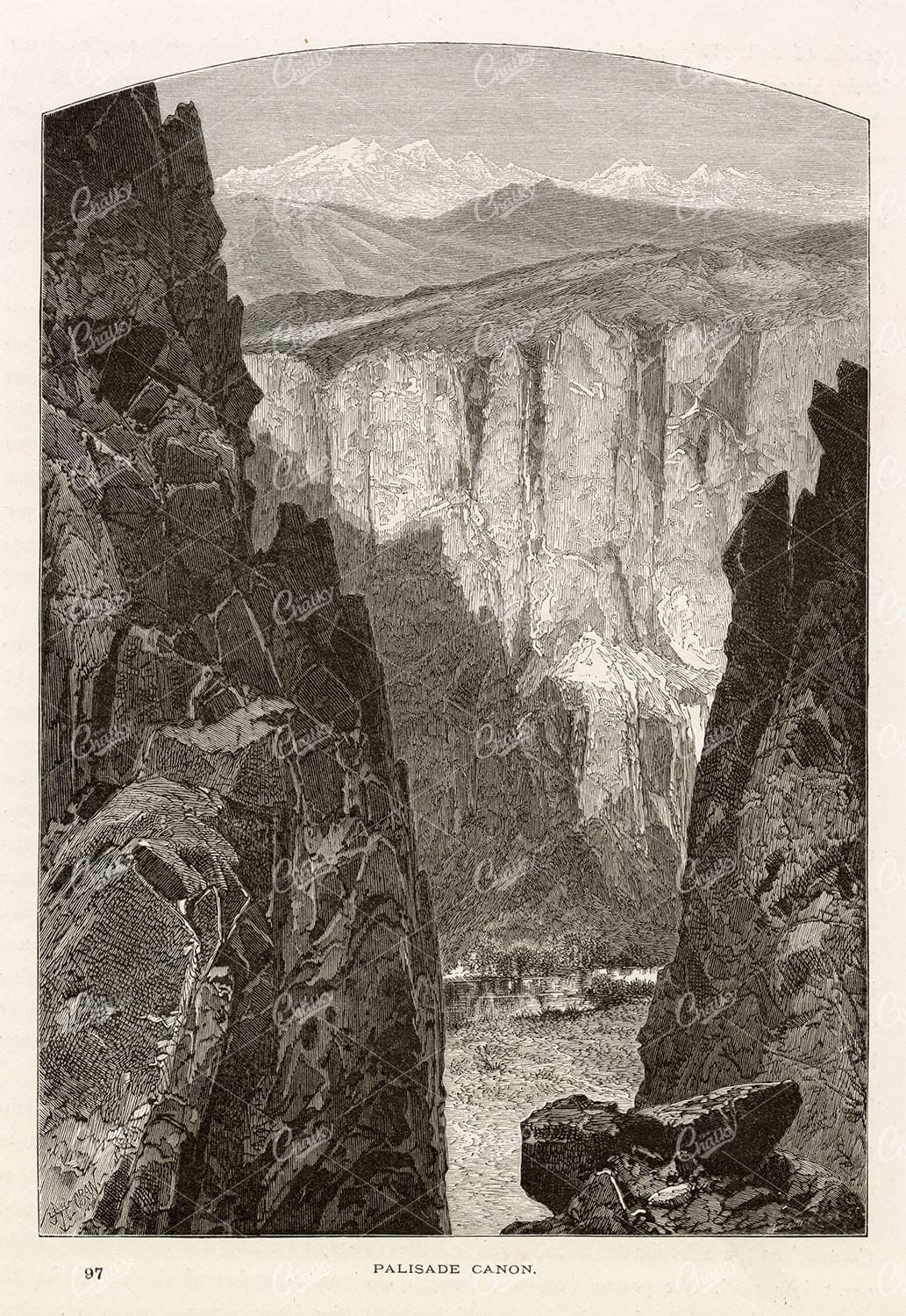
NEVADA – Palisafe Canyon – Antique America Landscape Mountains – 1874
You're looking at a beautifully detailed engraved illustration from the 'Picturesque America' series. Published by D. Appleton and Company of New York in 1872 and 1874 and edited by the romantic poet and journalist William Cullen Bryant. The "Picturesque America; or, The Land We Live In. A Delineation by Pen and Pencil of the Mountains, Rivers, Lakes, Forests, Water-falls, Shores, Cañons, Valleys, Cities, and Other Picturesque Features of Our Country. With Illustrations on Steel and Wood, by Eminent American Artists" series was published and delivered as a subscription; semi-monthly parts were sent out to subscribers. Once complete, the subscription would be bound into volumes. The stately, bound two volume set was proudly displayed in parlors of subscriber homes as a show of status. Engravers included Robert Hinshelwood (1812-1885), Edward Paxman Brandard (1819-1898), Samuel Valentine Hunt (1803-1893), William Wellstood (1819-1900), William Chapin (1802-1888), Henry Bryan Hall (1808-1884).
- License Info
- Resolution: 6000 x 8800
- Year of Print: 1874
- Artist: D. Appleton
From this collection

Detailed Antique Map of Iowa with County Boundaries and Transportation Routes
This detailed antique map of Iowa showcases the state's county boundaries, major cities, and transportation routes, including roads and railroads. The map provides a comprehensive view of Iowa's geography during the early 20th century, highlighting the state's agricultural landscape and infrastructure development. It serves as a valuable resource for understanding Iowa's historical growth and its place in the broader Midwest.
- Resolution: 7147 x 5100
- Image Type(s): JPG
From this collection
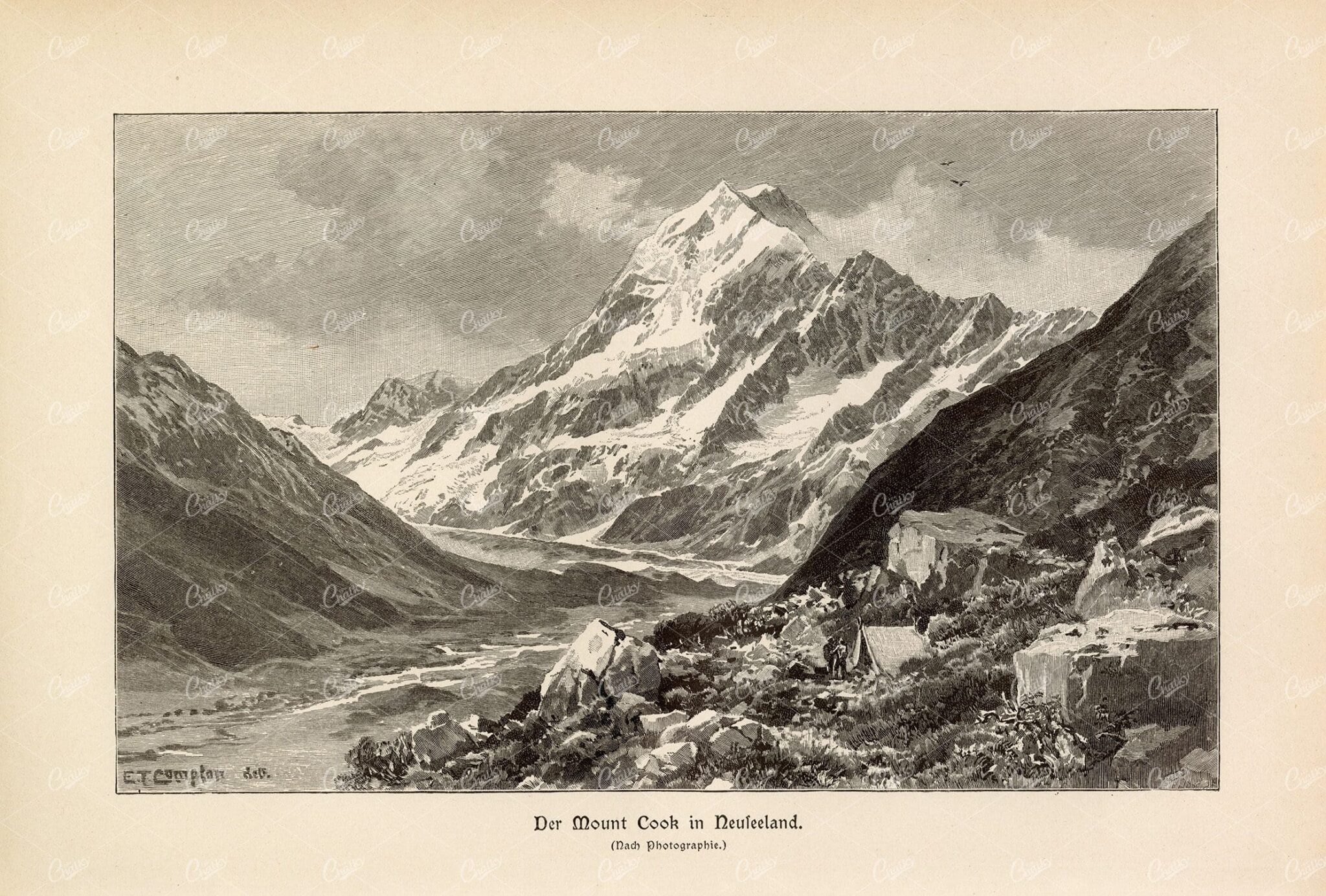
MOUNT COOK – New Zealand’s Alpine Wonder – Vintage German Print
- License Info
- Resolution: 8847px x 5981px
- Year of Print: 1877
Related Images

Vintage Map of Missouri, Northern Part with Cities and Roads
A vintage map showing the northern part of Missouri, including cities, roads, and county lines, reflecting the region's infrastructure and geography from the early 20th century.
- Resolution: 7168 x 5100
- Image Type(s): JPG
From this collection

Antique Map of Mississippi with River and County Details
An antique map of Mississippi focusing on its river systems, county divisions, and major transportation routes, reflecting the state's historical geography from the early 20th century.
- Resolution: 7167 x 5100
- Image Type(s): JPG
From this collection
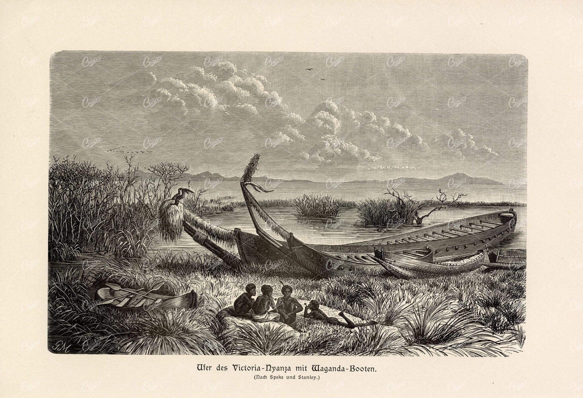
ANTIQUE 1877 Print – Bank of the Victoria River with Waganda Boats
- License Info
- Resolution: 8738px x 5955px
- Year of Print: 1877
Related Images


SINKING Run (Above Tyrone) – 1874 American Lightning Print
You're looking at a beautifully detailed engraved illustration from the 'Picturesque America' series. Published by D. Appleton and Company of New York in 1872 and 1874 and edited by the romantic poet and journalist William Cullen Bryant. The "Picturesque America; or, The Land We Live In. A Delineation by Pen and Pencil of the Mountains, Rivers, Lakes, Forests, Water-falls, Shores, Cañons, Valleys, Cities, and Other Picturesque Features of Our Country. With Illustrations on Steel and Wood, by Eminent American Artists" series was published and delivered as a subscription; semi-monthly parts were sent out to subscribers. Once complete, the subscription would be bound into volumes. The stately, bound two volume set was proudly displayed in parlors of subscriber homes as a show of status. Engravers included Robert Hinshelwood (1812-1885), Edward Paxman Brandard (1819-1898), Samuel Valentine Hunt (1803-1893), William Wellstood (1819-1900), William Chapin (1802-1888), Henry Bryan Hall (1808-1884).
- License Info
- Resolution: 8408 x 11149 300dpi
- Year of Print: 1874
- Artist: D. Appleton
From this collection

MOUNT VESUVIUS – View Across the Bay of Naples – Antique Print
- License Info
- Resolution: 7984px x 5493px
- Year of Print: 1877
Related Images
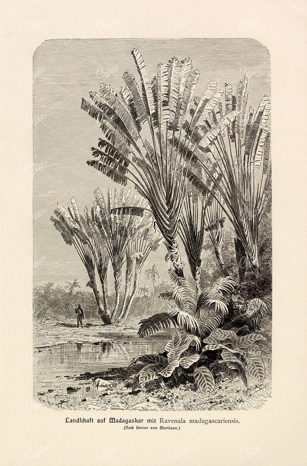
VINTAGE German Print – Ravenala Madagascariensis in Madagascar
- License Info
- Resolution: 5859px x 8882px
- Year of Print: 1877
Related Images

ANTIQUE Colour Print 1877 – The Bay Of Cameroon
- License Info
- Resolution: 7288px x 5526px
- Year of Print: 1877
Related Images

EGYPT Alexandria City Aerial View 1880 Antique Print
An original Antique Plate scan from the National Encyclopaedia: A Dictionary of Universal Knowledge. Published by William Mackenzie in 1880. Click on the Artist's name to see the full collection from this series!
- License Info
- Resolution: 8600 x 5500 300dpi
- Year of Print: 1880
- Artist: William Mackenzie
From this collection

ANTIQUE Print – Panoramic View of the Rhine Valley near Bingen
- License Info
- Resolution: 7596px x 5484px
- Year of Print: 1877
Related Images


ANTIQUE Colour Print of Tintern Abbey – 1882 Frederick Ross
- License Info
- Resolution: 12555px x 9107px
- Year of Print: 1882
Related Images
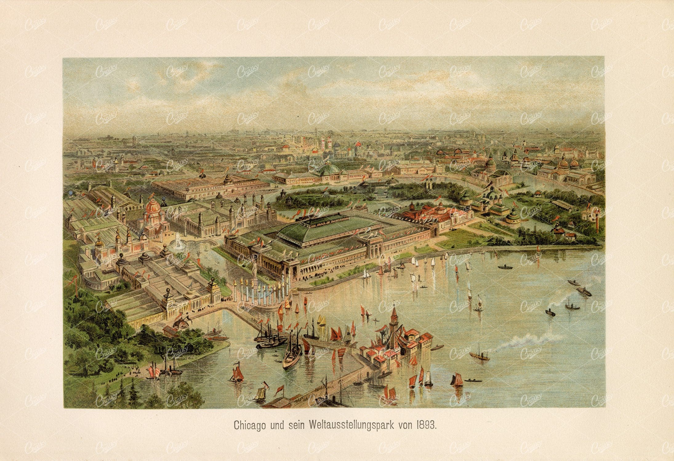
ANTIQUE German Print – World Exhibition Park in Chicago 1800’s
- License Info
- Resolution: 8794px x 6023px
- Year of Print: 1800's
Related Images
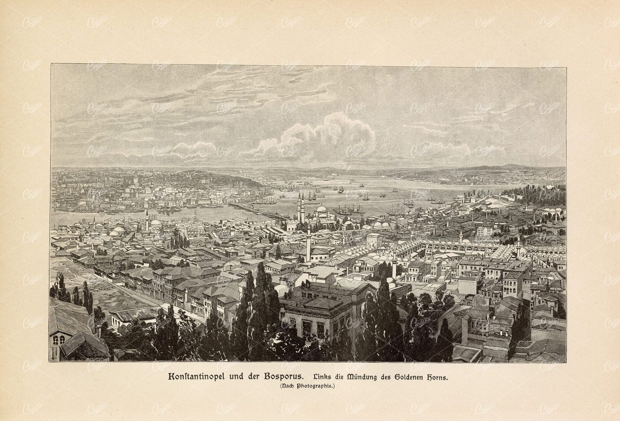
VINTAGE Print 1877 – Constantinople and the Bosphorus
- License Info
- Resolution: 8779px x 5970px
- Year of Print: 1877
Related Images

Antique Map of Southern Missouri with Transportation Networks
An antique map of Southern Missouri detailing transportation networks, including railroads and highways, alongside topographical features from the early 20th century.
- Resolution: 7169 x 5100
- Image Type(s): JPG
From this collection

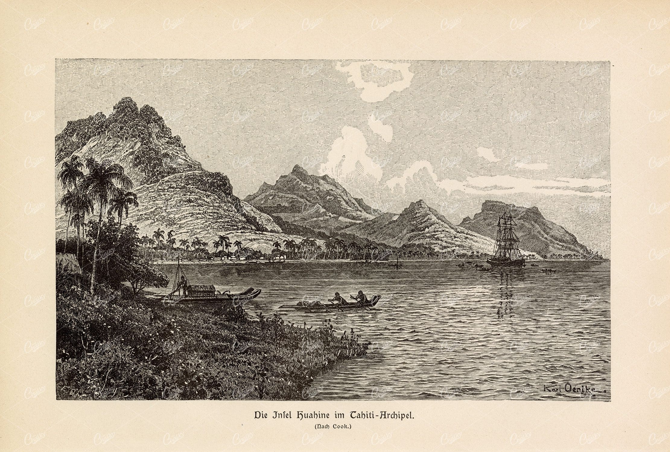
ANTIQUE Print 1877 – Island in the Tahiti Archipelago
- License Info
- Resolution: 8809px x 5949px
- Year of Print: 1877
Related Images


Support the Library
Our supporters and members help us continue collecting and restoring these wonderful pieces of art for the modern creator
Unlock Everything and Become a Member!
While a lot of the library is available for free, some is kept behind closed dusty doors only to be accessed by our lovely members.