

Vintage Map of Minnesota Featuring Lakes and Urban Areas
A vintage map of Minnesota highlighting its numerous lakes, urban areas, and transportation routes, showcasing the state's geographical diversity from the early 20th century.
- Resolution: 7166 x 5100
- Image Type(s): JPG
From this collection

Antique Map of Northern Ohio with Detailed City and County Lines
A historic map from the late 19th century detailing Northern Ohio, including major cities, counties, and transportation routes. This antique map highlights the region's development and infrastructure.
- Resolution: 7247 x 5100
- Image Type(s): JPG
From this collection

Antique Map of Southern Michigan and Urban Development
An antique map of Southern Michigan detailing urban development, major cities, and transportation networks, including Detroit, from the early 20th century.
- Resolution: 7165 x 5100
- Image Type(s): JPG
From this collection

Historical Map of Northern Michigan and Surrounding Great Lakes
A historical map of Northern Michigan, including surrounding areas of the Great Lakes, highlighting major towns, transportation routes, and natural features from the early 20th century.
- Resolution: 7164 x 5100
- Image Type(s): JPG
From this collection

Vintage Map of Northern Illinois Featuring Chicago and Surrounding Areas
This vintage map of Northern Illinois features Chicago and its surrounding areas, highlighting major transportation routes, rivers, and urban centers. The map provides a detailed overview of the region's geography during the early 20th century, showcasing the development and expansion of Chicago as a key American city. It offers a historical perspective on the infrastructure and urban planning of the time.
- Resolution: 7142 x 5100
- Image Type(s): JPG
From this collection

Detailed 19th Century Map of Illinois, USA
A richly detailed 19th century map of Illinois, focusing on the southern part of the state, including the area around Chicago and St. Louis. The map is intricately detailed with towns, railways, and geographical features, showcasing the state’s development during the period.
- Resolution: 7265 x 5100
- Image Type(s): JPG
- 19th-century
- America
- Antique
- antique map
- archives
- Atlas
- Borders
- cartography
- Chicago
- counties
- country
- development
- Engineering
- exploration
- Geography
- heritage
- historic
- historical
- History
- Illinois
- landmarks
- Map
- Midwest
- old map
- railways
- reference
- representation
- retro
- Rivers
- Rural
- settlements
- southern Illinois
- St. Louis
- territorial
- topographic
- topography
- towns
- transportation
- urban
- USA
- vintage
- World
From this collection

Antique 19th Century Map of Southern Ohio Featuring Major Cities and Rivers
A detailed 19th-century map showcasing Southern Ohio, highlighting cities like Cincinnati and Cleveland, along with rivers and other key geographical features. Ideal for historical and geographical studies.
- Resolution: 7248 x 5100
- Image Type(s): JPG
From this collection
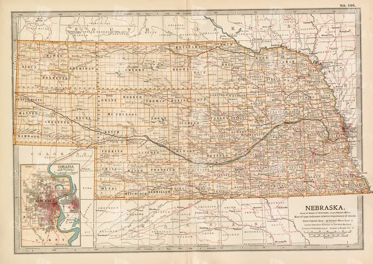
Historic Map of Nebraska
A detailed historic map of Nebraska, illustrating counties, towns, and important routes, reflecting the geography and infrastructure of the state during the late 19th to early 20th century.
- Resolution: 7236 x 5100
- Image Type(s): JPG
From this collection

Vintage Map of Indiana Highlighting Transportation Networks and County Borders
This vintage map of Indiana highlights the state's transportation networks, including roads and railroads, along with its county borders. The map provides a detailed view of Indiana's geography during the early 20th century, focusing on the development of infrastructure and urban areas. It offers a historical overview of the state's growth and the connections between its cities and rural areas.
- Resolution: 7146 x 5100
- Image Type(s): JPG
From this collection

Detailed Antique Map of Iowa with County Boundaries and Transportation Routes
This detailed antique map of Iowa showcases the state's county boundaries, major cities, and transportation routes, including roads and railroads. The map provides a comprehensive view of Iowa's geography during the early 20th century, highlighting the state's agricultural landscape and infrastructure development. It serves as a valuable resource for understanding Iowa's historical growth and its place in the broader Midwest.
- Resolution: 7147 x 5100
- Image Type(s): JPG
From this collection

Vintage Map of Missouri, Northern Part with Cities and Roads
A vintage map showing the northern part of Missouri, including cities, roads, and county lines, reflecting the region's infrastructure and geography from the early 20th century.
- Resolution: 7168 x 5100
- Image Type(s): JPG
From this collection

Antique Map of Southern Missouri with Transportation Networks
An antique map of Southern Missouri detailing transportation networks, including railroads and highways, alongside topographical features from the early 20th century.
- Resolution: 7169 x 5100
- Image Type(s): JPG
From this collection

Support the Library
Our supporters and members help us continue collecting and restoring these wonderful pieces of art for the modern creator
Unlock Everything and Become a Member!
While a lot of the library is available for free, some is kept behind closed dusty doors only to be accessed by our lovely members.