

Decorative and Detailed Antique Frame / Border – Perfect for Invitations and Packaging No.31
- License Info
- Resolution: 5002px x 7218px
From this collection

Detailed Decorative Certificate Border in Green with Text Space and Ornate Seals
A detailed decorative border in green, designed for certificates with text space and multiple ornate seals, perfect for diplomas or awards.
- Image Type(s): PNG
From this collection

Aged with Beautiful Petina – Antique Handwritten Book Scan No.13
- License Info
- Resolution: 9649px x 7934px
From this collection

Aged with Beautiful Petina – Antique Handwritten Book Scan No.2
- License Info
- Resolution: 4545px x 3838px
From this collection

Vintage Gold and Blue Frame / Border with Decorative Design Elements
- License Info
- Resolution: 2843px x 4826px
From this collection

Detailed Line Art Illustration of an Old Locomotive
A detailed vintage line art illustration of an old locomotive, showcasing the intricate design and mechanical components of historic trains.
- Image Type(s): PNG
Related Images

Green Intricate Square Frame with Ornate Border Patterns for Decorative Use
A detailed square frame with an intricate green border design, featuring complex patterns and ornamental details, ideal for certificates or decorative projects.
- Image Type(s): PNG
From this collection
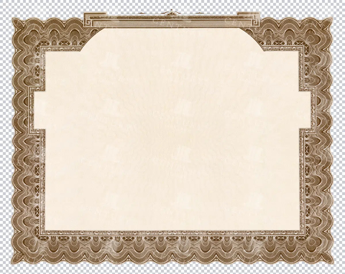
Brown Certificate Border with Blank Center
A brown certificate border featuring wavy patterns and a blank center, suitable for awards, diplomas, and official documents.
- Image Type(s): PNG
- Antique
- arabesque
- Art
- artistic
- Award
- blank
- Border
- Brown
- center
- certificate
- classic
- decor
- Decoration
- Decorative
- delicate
- Design
- diploma
- document
- elegant
- embellished
- Engraving
- fine
- formal
- Frame
- Graphic
- heritage
- illustration
- illustrative
- lined
- official
- officialborder
- old
- old-fashioned
- Ornate
- Outline
- Pattern
- Patterned
- Photograph
- representation
- retro
- stylish
- symmetrical
- traditional
- vintage
- wavy
From this collection

Antique Map of West Virginia
Detailed antique map of West Virginia, showing counties, towns, railroads, and geographical features. Historical 19th century cartography with insets of surrounding areas. An educational and collectible piece.
- Resolution: 7280 x 5100
- Image Type(s): JPG
- nostalgic
- cartographer
- state boundaries
- historical regions
- west virginia map
- west virginia counties
- surrounding areas
- heritage map
- vintage west virginia
- state map
- reference
- archival
- geographical features
- USA
- railroads
- detailed map
- topography
- historical map
- exploration
- old map
- cartography
- American history
- transportation
- counties
- towns
- education
- 19th-century
- collectible
- historical
- heritage
- classic
- vintage
- old
- representation
- Antique
- History
- West Virginia
- Geography
- Atlas
- World
- Globe
- Map
From this collection

Antique Map of Western England and Wales Including Detailed Regional Boundaries
An antique map of Western England and Wales, showcasing detailed regional boundaries and cities like Liverpool and Manchester. The map highlights important geographical features, transportation routes, and historical landmarks in the area.
- Resolution: 7126 x 5100
- Image Type(s): JPG
From this collection

Detailed Vintage Map of Central America Including Guatemala and Nicaragua
A detailed vintage map of Central America, featuring countries like Guatemala and Nicaragua. The map highlights important geographical features, cities, and transportation routes, providing a historical perspective on the region.
- Resolution: 7116 x 5100
- Image Type(s): JPG
From this collection

Aged with Beautiful Petina – Antique Handwritten Book Scan No.3
- License Info
- Resolution: 9257px x 7861px
From this collection

High Quality Scan of Front of Anitque Music Sheet Booklet with Worn Label
- License Info
- Resolution: 6900px x 10000px
From this collection

Decorative and Detailed Antique Frame / Border – Perfect for Invitations and Packaging No.4
- License Info
- Resolution: 3982px x 5362px
From this collection

Antique Map of Northern England Including Northumberland, Durham, and Isle of Man
An antique map of Northern England, showcasing regions like Northumberland and Durham, as well as the Isle of Man inset. The map provides detailed insights into the region's historical geography, including towns, transportation routes, and coastal features.
- Resolution: 7124 x 5100
- Image Type(s): JPG
From this collection

Inside Rear Book Cover Scan – Tan Card Stock Texture
- License Info
- Resolution: 3500px x 4951px
From this collection

Decorative and Detailed Antique Frame / Border – Perfect for Invitations and Packaging No.18
- License Info
- Resolution: 7223px x 9189px
From this collection

Decorative and Detailed Antique Frame / Border – Perfect for Invitations and Packaging No.17
- License Info
- Resolution: 6623px x 8997px
From this collection

Decorative and Detailed Antique Frame / Border – Perfect for Invitations and Packaging No.16
- License Info
- Resolution: 6623px x 9065px
From this collection

Decorative and Detailed Antique Frame / Border – Perfect for Invitations and Packaging No.7
- License Info
- Resolution: 4553px x 6781px
From this collection
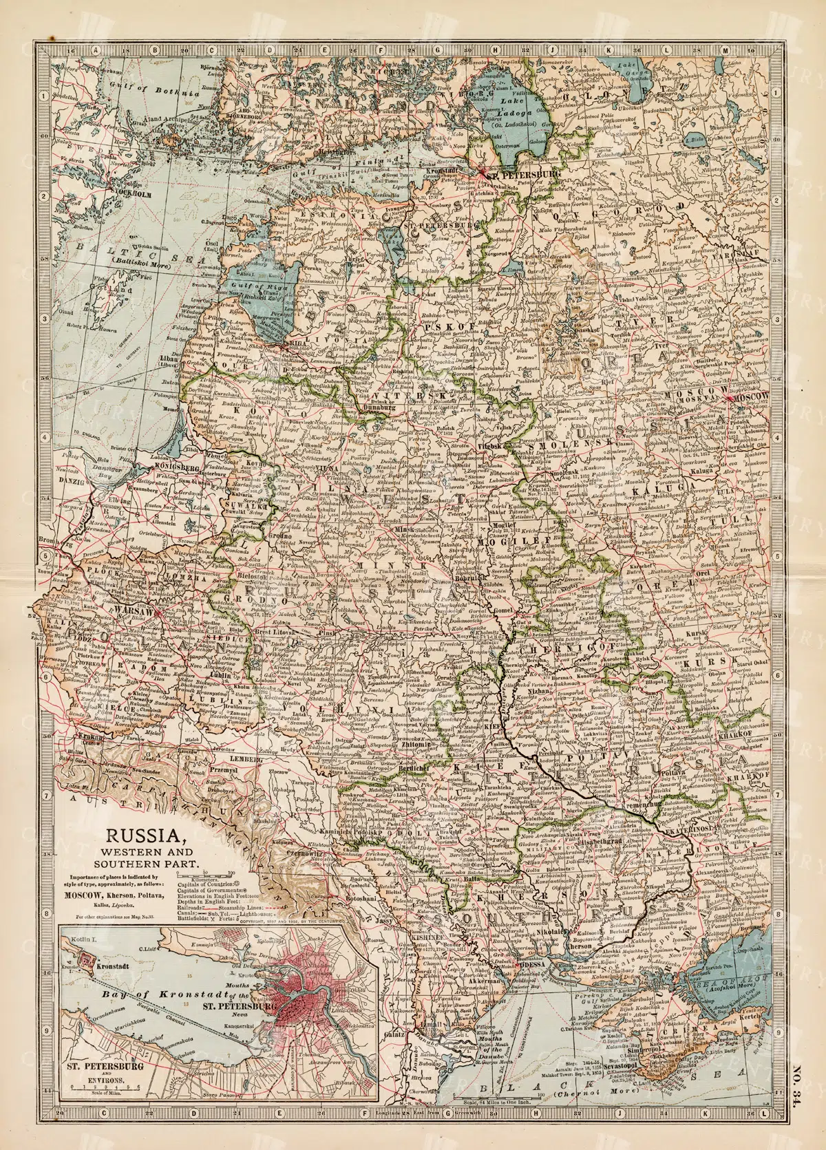
19th Century Map of Russia’s Western and Southern Parts with St. Petersburg
A detailed 19th century map highlighting the western and southern parts of Russia, including the prominent city of St. Petersburg. This vintage map showcases the political and geographical landscape of the era, featuring intricate details of cities, rivers, and borders.
- Resolution: 7257 x 5100
- Image Type(s): JPG
- 1800s
- 19th-century
- Antique
- antique cartography
- antique map
- antique paper
- archival
- Atlas
- Baltic Sea
- cartographic history
- cartography
- cities
- Eastern Europe
- european history
- geographical features
- Geography
- heritage
- historical artifact
- historical document
- historical geography
- historical information
- historical map
- historical records
- history lovers
- Map
- map of Russia
- old
- old Europe
- old map
- political divisions
- representation
- Rivers
- Russia
- Russian Empire
- southern Russia
- St. Petersburg
- St. Petersburg history
- topography
- vintage
- vintage map
- western Russia
From this collection

ANTIQUE Decorative Arts – Rare 19th Century Print – Wood Carvings
- License Info
- Resolution: 10977px x 15480px
- Year of Print: 1866
- Artist: Michel Lienard
From this collection

Blank Antique Folded and Worn Receipt Book Open Page
- License Info
- Resolution: 9746px x 7987px
From this collection

High Quality Paper Texture Scan of Antique Page
- License Info
- Resolution: 4466px x 4957px
From this collection

Decorative and Detailed Antique Frame / Border – Perfect for Invitations and Packaging No.19
- License Info
- Resolution: 7232px x 9238px
From this collection

Decorative and Detailed Antique Frame / Border – Perfect for Invitations and Packaging No.6
- License Info
- Resolution: 8738px x 6812px
From this collection

Decorative and Detailed Antique Frame / Border – Perfect for Invitations and Packaging No.36
- License Info
- Resolution: 4308px x 6246px
From this collection

Decorative and Detailed Antique Frame / Border – Perfect for Invitations and Packaging No.26
- License Info
- Resolution: 6937px x 8869px
From this collection

Decorative and Detailed Antique Frame / Border – Perfect for Invitations and Packaging No.22
- License Info
- Resolution: 6192px x 8929px
From this collection

Decorative and Detailed Antique Frame / Border – Perfect for Invitations and Packaging No.5
- License Info
- Resolution: 9261px x 7318px
From this collection

Antique Map of Western Pennsylvania from the 19th Century with Pittsburgh Inset
This antique map highlights Western Pennsylvania from the 19th century, featuring cities, counties, and transportation routes. Includes an inset of Pittsburgh and its vicinity, showcasing urban growth.
- Resolution: 7252 x 5100
- Image Type(s): JPG
From this collection

Vintage Map of the Southwestern Part of the German Empire with Regional Details
This vintage map of the southwestern part of the German Empire details the region’s cities, roads, and geographical features. The map provides a historical overview of the area, including key locations like Munich and Stuttgart. The vintage style and precise detailing make it an essential resource for those interested in the history and geography of this region. The map also includes insets of specific cities, offering additional insight into the urban development of the time.
- Resolution: 7139 x 5100
- Image Type(s): JPG
- historical german map
- detailed german map
- old germany map
- german vintage
- german towns
- german regions
- historical germany map
- german cities
- vintage germany
- german geography
- southwestern
- munich
- southwestern german map
- southwestern germany
- stuttgart map
- munich map
- stuttgart
- german empire map
- german cartography
- german history
- german empire
- detailed map
- vintage cartography
- antique geography
- historical geography
- antique map
- historical map
- old map
- towns
- historical
- Roads
- vintage
- old
- representation
- Antique
- Geography
- Atlas
- World
- Map
From this collection

Antique Map of Central and Eastern England Including Nottingham and Cambridge
An antique map of Central and Eastern England, featuring detailed views of cities like Nottingham and Cambridge. The map highlights important transportation networks, geographical features, and regional boundaries, offering historical context for the area.
- Resolution: 7128 x 5100
- Image Type(s): JPG
From this collection

Vintage Map of Eastern China with Detailed Regions and Cities like Beijing and Shanghai
A vintage map of Eastern China, detailing major cities such as Beijing and Shanghai. The map provides insights into the region's geography, transportation networks, and historical context, offering a comprehensive view of Eastern China's layout.
- Resolution: 7118 x 5100
- Image Type(s): JPG
From this collection

Detailed Vintage Map of Southeast Australia Including Victoria, New South Wales, and South Australia
A detailed vintage map showing the southeast part of Australia, including Victoria, New South Wales, and parts of South Australia and Queensland. The map highlights major cities, railways, and geographical features, offering a historical perspective on the region's layout during the period.
- Resolution: 7110 x 5100
- Image Type(s): JPG
From this collection

Decorative and Detailed Antique Frame / Border – Perfect for Invitations and Packaging No.9
- License Info
- Resolution: 5453px x 7533px
From this collection

Vintage Map of Northern New York
An antique map focusing on the northern and eastern parts of New York, showing the state's counties, cities, and significant natural features, typical of late 19th-century cartography.
- Resolution: 7240 x 5100
- Image Type(s): JPG
From this collection

Vintage Map of Northern California Including San Francisco and Yosemite Valley
A vintage map depicting the northern part of California, highlighting major cities like San Francisco and natural landmarks such as Yosemite Valley. The map provides detailed insights into the region's geographical features, transportation routes, and historical importance.
- Resolution: 7113 x 5100
- Image Type(s): JPG
From this collection

Empire of Austria-Hungary Historical Map with Detailed Regional Boundaries and Railways
This historical map of the Austria-Hungary Empire showcases detailed regional boundaries, cities, and extensive railway networks. The map includes significant areas like Budapest and Vienna, providing a comprehensive view of the empire's geographical and political landscape during the period.
- Resolution: 7112 x 5100
- Image Type(s): JPG
From this collection

Antique Historical Map of Western Austria-Hungary Featuring Vienna and Prague
An antique map of the western part of Austria-Hungary, highlighting major cities like Vienna and Prague. The map provides intricate details of regional boundaries, railway networks, and topographical features, reflecting the historical political landscape of the region.
- Resolution: 7111 x 5100
- Image Type(s): JPG
From this collection

RARE 19th Century Decorative Art print – Vegetable Subject Friezes
- License Info
- Resolution: 10977px x 15480px
- Year of Print: 1866
- Artist: Michel Lienard
From this collection


Eccentric Blue and Red Border Design – Perfect for Print Design
- License Info
- Resolution: 3281px x 3699px
From this collection

Antique 19th Century Map of Oregon Featuring Detailed Topographical Features
A detailed antique map from the 19th century showcasing the state of Oregon, including its mountains, rivers, and settlements. This map highlights the state's topography and early infrastructure development.
- Resolution: 7251 x 5100
- Image Type(s): JPG
From this collection

Antique Tan Paper Texture Scan No.1
- License Info
- Resolution: 5745px x 5745px
From this collection

Aged with Beautiful Petina – Antique Handwritten Book Scan No.9
- License Info
- Resolution: 9496px x 7778px
From this collection

Vintage Scan of Grunge and Dirty Cream Envelope Texture No.2
- License Info
- Resolution: 3295px x 6901px
From this collection
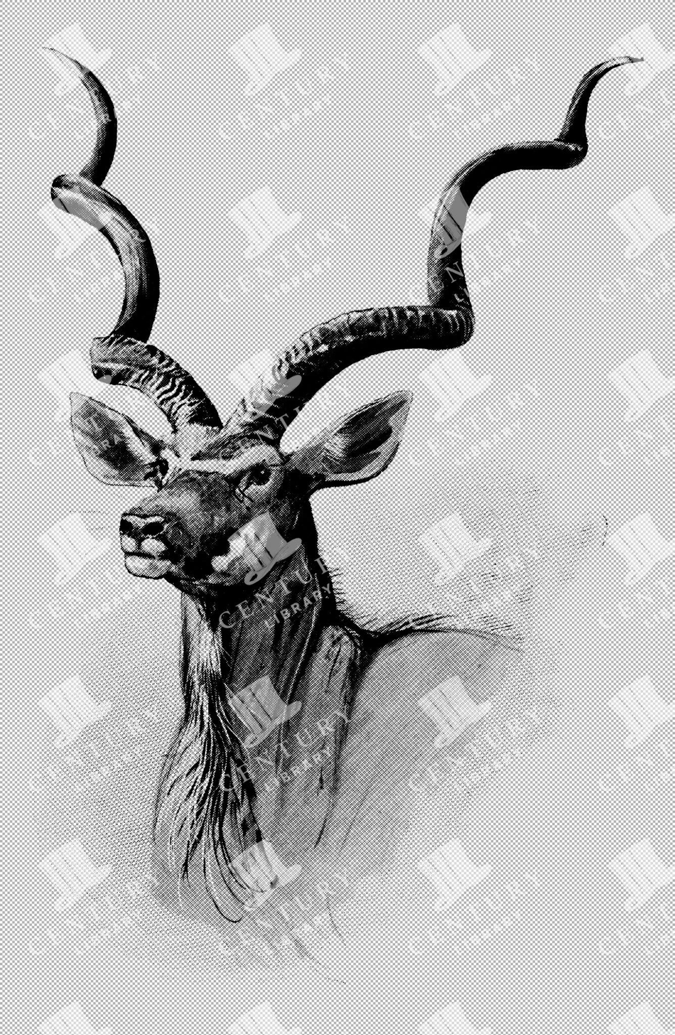
Detailed Vintage Illustration of Koodoo Antelope Bust with Long Curled Antlers as Transparent PNG
A detailed vintage illustration of a Koodoo antelope bust, featuring long curled antlers. This transparent PNG artwork emphasizes the antelope's unique features, making it suitable for design and nature-related projects.
- Resolution: 2377px x 3644px
- Image Type(s): PNG
Related Images

Detailed Vintage Illustration of Italian Land Crab in Natural Pose as Isolated Transparent PNG Artwork
A detailed vintage illustration of an Italian land crab in a natural pose. This transparent PNG artwork captures the intricate details of the crab's form and texture, ideal for digital and nature-themed projects.
- Resolution: 4192px x 2617px
- Image Type(s): PNG
Related Images

19th Century Map of Switzerland, Liechtenstein, and Parts of Austria-Hungary
A detailed antique map from the 19th century showcasing Switzerland, Liechtenstein, and parts of Austria-Hungary. The map highlights the mountainous terrain, lakes, and major cities, reflecting the historical borders and settlements of the region.
- Resolution: 7267 x 5100
- Image Type(s): JPG
From this collection

Support the Library
Our supporters and members help us continue collecting and restoring these wonderful pieces of art for the modern creator
Unlock Everything and Become a Member!
While a lot of the library is available for free, some is kept behind closed dusty doors only to be accessed by our lovely members.