
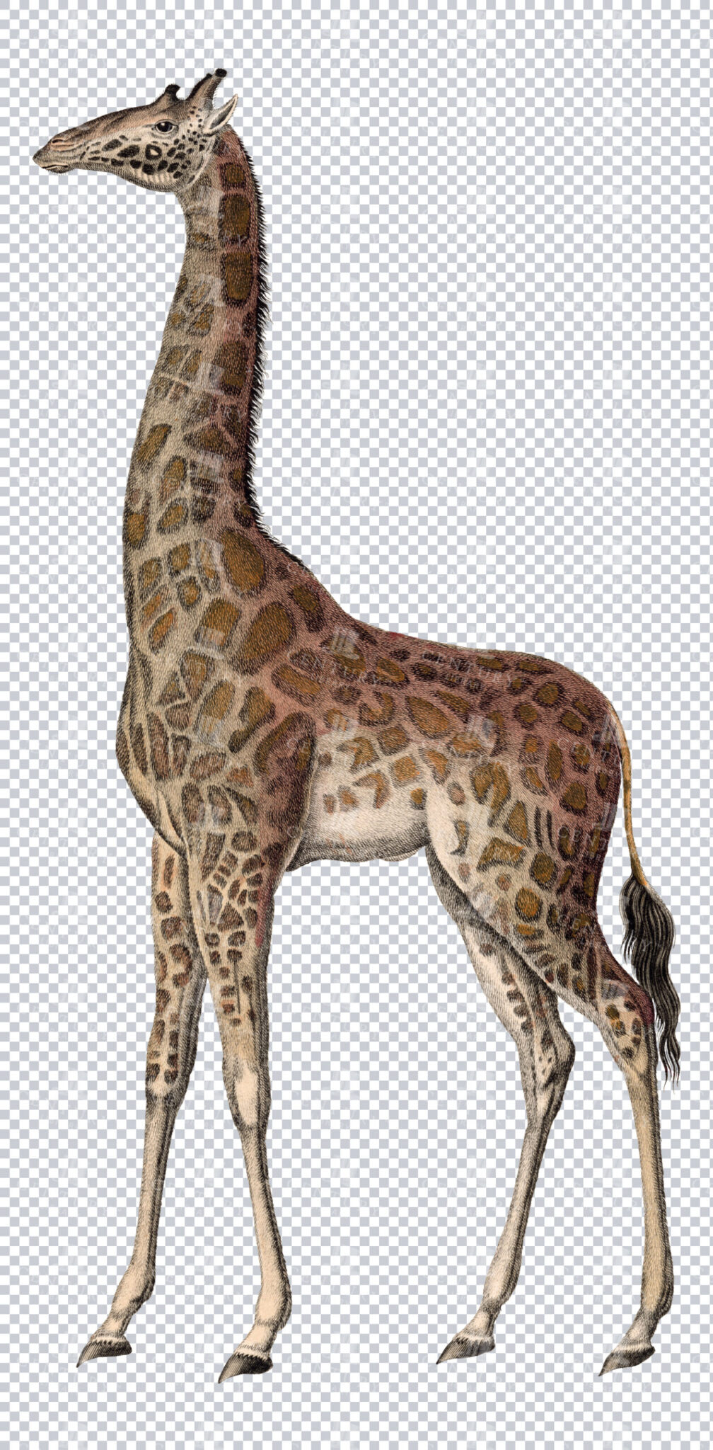
Vintage Illustration of Giraffe on Transparent Background
Classic vintage illustration of a giraffe on a transparent background. Perfect for educational materials or design projects.
- Resolution: 4316 × 8758
- Image Type(s): PNG
From this collection
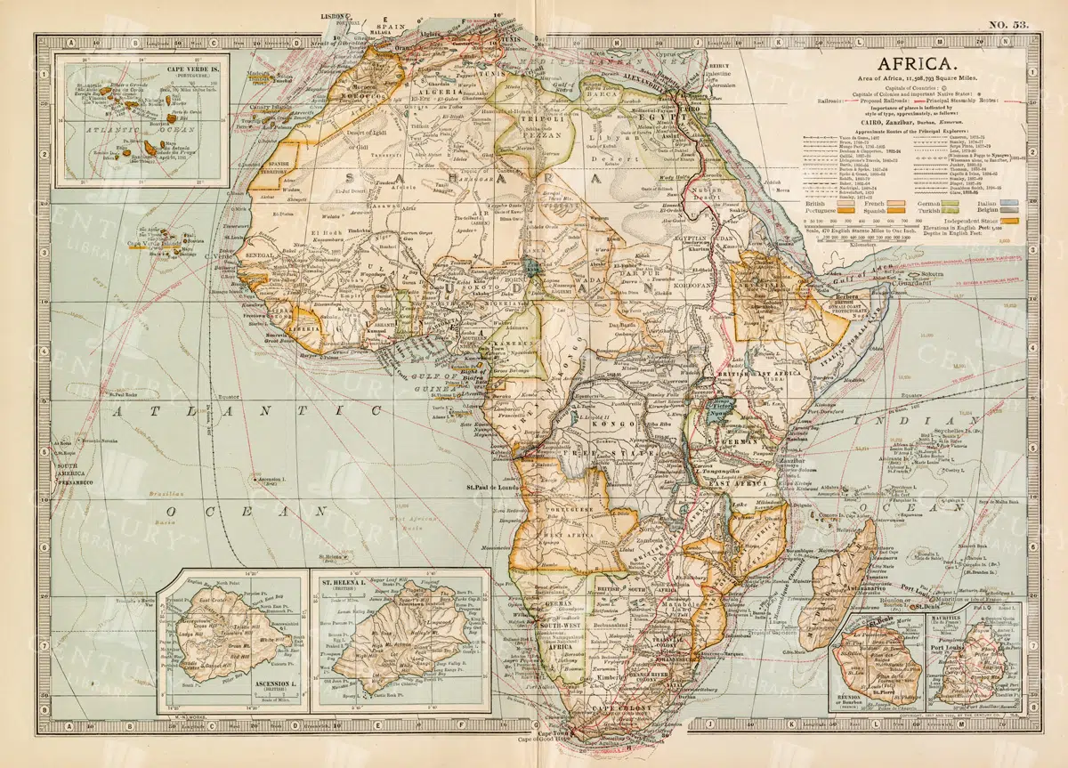
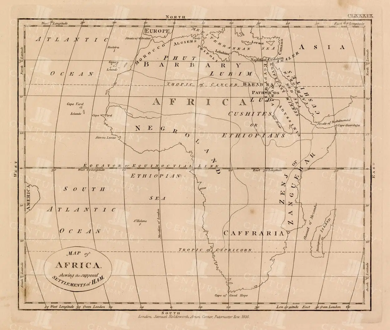
Antique 1800s Map of Africa Showing Entire Continent and Colonial Territories – Vintage Historical Cartography
This comprehensive antique map from the 1800s showcases the entire continent of Africa, highlighting colonial territories and geographical features. The map is a valuable historical document, offering insights into Africa's political and natural landscape during the colonial era. A beautifully detailed piece of vintage cartography.
- Resolution: 7104 x 5100
- Image Type(s): JPG
- 1800s
- Africa
- Africa colonial
- Africa history
- Africa map
- Antique
- antique map
- Atlas
- boundaries
- cartography
- colonial era
- colonial territories
- country
- detailed
- entire continent
- exploration
- Geography
- historical
- historical map
- History
- illustration
- Map
- natural features
- old map
- political map
- preserved
- representation
- retro
- topography
- vintage
- vintage map
- World
From this collection
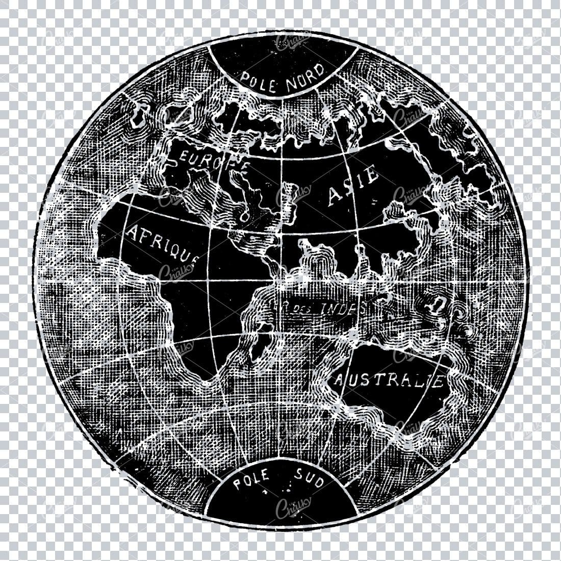
Small Vintage Illustration of the World / Globe Map
- License Info
- Resolution: 1805px x 1780px
Related Images


Antique 1800s Map of North-West Africa Highlighting Morocco, Algeria, and Western Sahara – Vintage Historical Map
This antique map from the 1800s highlights North-West Africa, including Morocco, Algeria, and the Western Sahara. It captures the colonial and geographical landscape of the time, showing intricate details of the region’s political boundaries and natural features. A beautifully preserved piece of history in vintage cartography.
- Resolution: 7102 x 5100
- Image Type(s): JPG
- 1800s
- Africa
- Africa colonial
- Africa map
- Algeria
- Antique
- antique map
- Atlas
- cartography
- colonial
- colonial era
- country
- detailed
- exploration
- Geography
- Globe
- historical
- historical map
- History
- Map
- Morocco
- natural features
- Navigation
- North-West Africa
- old
- old map
- political boundaries
- preserved
- representation
- retro
- topography
- Travel
- vintage
- vintage map
- Western Sahara
- World
From this collection

Vintage 1800s Map of Southern Africa Including South Africa, Namibia, and Surrounding Territories – Antique Map
A vintage map from the 1800s depicting Southern Africa, including South Africa, Namibia, and surrounding territories. This antique map highlights the region’s colonial borders, cities, and natural features, offering a detailed view of the area during the colonial period. Perfect for history and cartography enthusiasts.
- Resolution: 7103 x 5100
- Image Type(s): JPG
From this collection
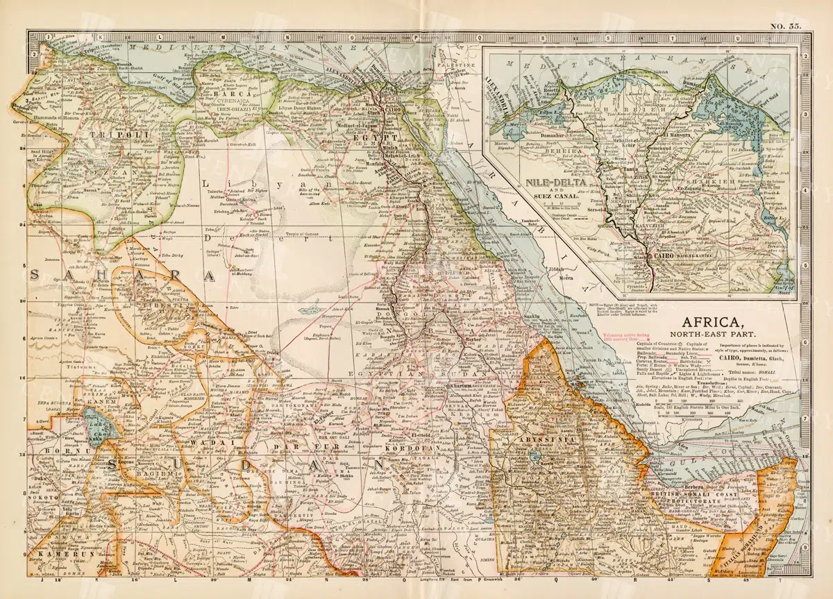
Vintage 1800s Map of North-East Africa Including Egypt, Sudan, and the Nile Delta – Antique Historical Map
This vintage map from the 1800s illustrates North-East Africa, including Egypt, Sudan, and the Nile Delta. The map is a beautiful representation of the region's historical geography, showing important cities, boundaries, and geographical features from the colonial era. A valuable piece for those interested in African history and cartography.
- Resolution: 7101 x 5100
- Image Type(s): JPG
- 1800s
- Africa
- Africa colonial
- Africa map
- Antique
- antique map
- Atlas
- boundaries
- cartography
- cities
- colonial era
- detailed
- Egypt
- exploration
- Geography
- historical
- historical geography
- historical map
- illustration
- Map
- Nile Delta
- North-East Africa
- old map
- preserved
- representation
- retro
- Rivers
- Sudan
- topography
- Travel
- vintage
- vintage map
- World
From this collection
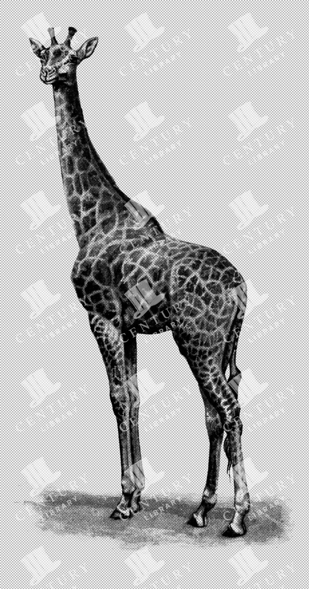
Giraffe Illustration on Transparent Background
Tall illustration of a giraffe standing, showcasing its long neck and distinctive coat patterns, isolated on a transparent background.
- Resolution: 2349px x 4481px
- Image Type(s): PNG
- Africa
- African
- Animal
- Art
- Black and white
- Coat Patterns
- Decorative
- detailed
- distinctive
- Drawing
- elegant
- endangered
- Giraffe
- herbivore
- illustration
- isolated
- Isolated Image
- Long Neck
- Mammal
- Natural History
- Nature
- Neck
- Ornate
- PNG
- safari
- savanna
- sketch
- species
- Species Identification
- Tall
- transparent background
- Wild
- Wildlife
- Wildlife Art
- Wildlife Illustration
- Zoology
Related Images
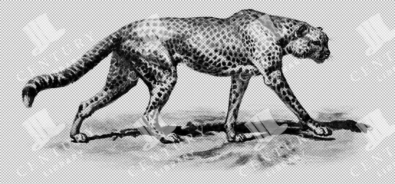
Illustration of a Cheetah
A vintage illustration of a cheetah prowling in a savanna landscape, emphasizing its sleek body and distinctive spots. The artwork captures the agility and speed of this apex predator in a classic black and white style.
- Resolution: 4888px x 2283px
- Image Type(s): PNG
Related Images
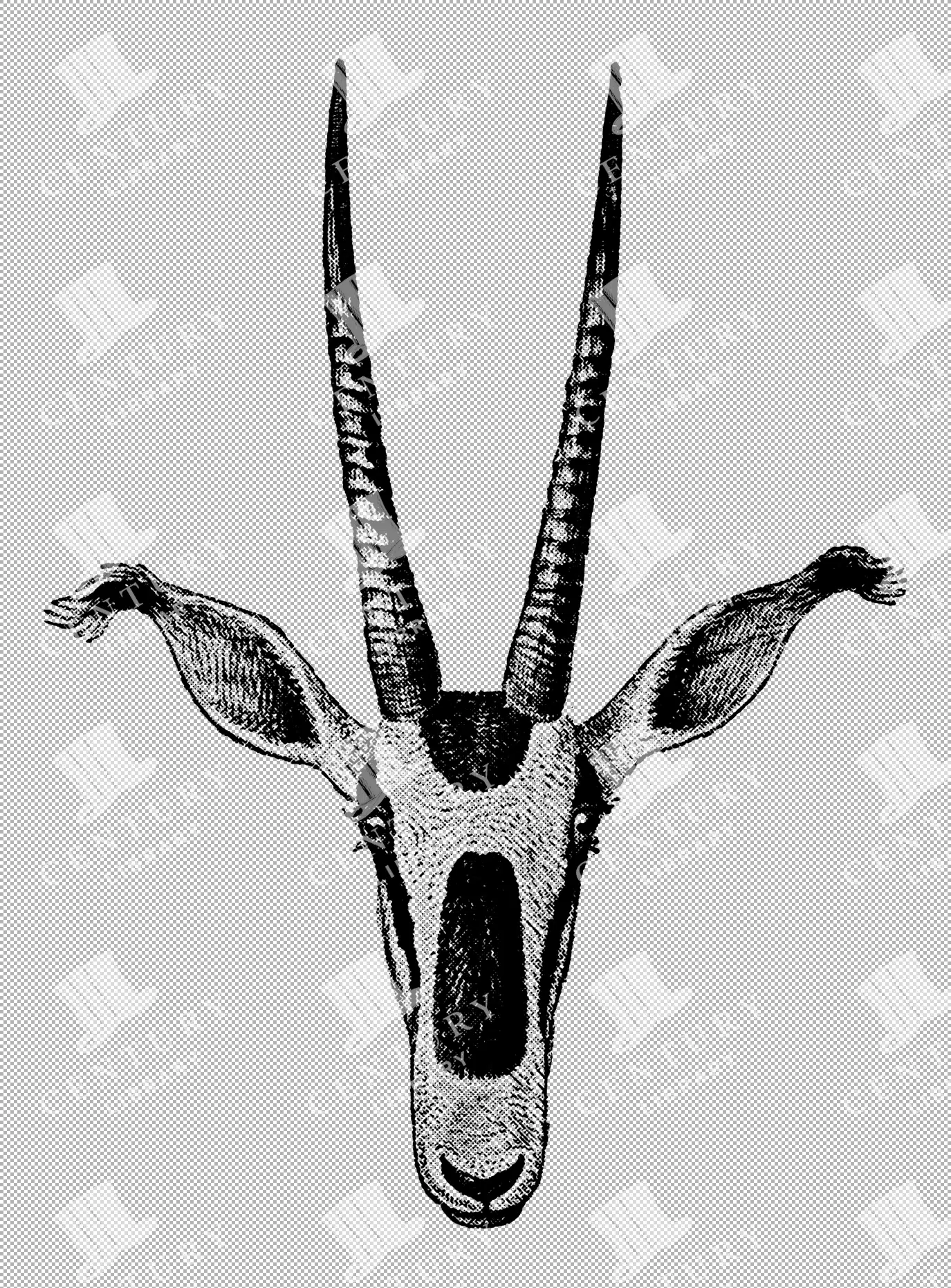
Fringe-Eared Oryx Illustration on Transparent Background
Illustration of a fringe-eared oryx head, featuring long straight horns and distinct facial markings, isolated on a transparent background.
- Resolution: 1959px x 2653px
- Image Type(s): PNG
- adornment
- Africa
- African
- Animal
- Antelope
- Antelopes
- Art
- Black and white
- Bovidae
- Decoration
- Decorative
- detailed
- distinctive
- Drawing
- elegant
- endangered
- Facial Markings
- Fringe-Eared
- Grazers
- Grazing
- Head
- Horns
- illustration
- isolated
- Isolated Image
- Long Horns
- Mammal
- Natural History
- Nature
- Ornate
- Oryx
- pendant
- PNG
- savanna
- sketch
- species
- Species Identification
- symmetry
- transparent background
- Wildlife
- Wildlife Art
- Wildlife Illustration
- Zoology
Related Images

Family of Hippopotamus in Water – Isolated PNG
A detailed illustration of a family of hippopotamuses, including adults and calves, lounging in water. This transparent PNG showcases the hippos in a natural setting, emphasizing their social behavior and habitat.
- Resolution: 4672px x 5936px
- Image Type(s): PNG
Related Images
VINTAGE Map of Africa – 1836 Original Antique Print
- License Info
- Resolution: 8690px x 7365px
- Year of Print: 1836
- Artist: Charles Taylor
Related Images

VINTAGE Map of Africa – 1836 Original Antique Print – Fold Out
- License Info
- Resolution: 11144px x 9172px
- Year of Print: 1836
- Artist: Charles Taylor
Related Images

MAPS – Antique Map of AFRICA from RARE Abraham REES Encyclopaedia 1800s
You're looking at an Original pre-1820's Antique Engraving from a rare copy of Abraham Rees' "The Cyclopaedia; or, UNIVERSAL DICTIONARY OF ARTS, SCIENCES, and LITERATURE" (Published 1820 by Longman, Hurst, Rees, Orme)
- License Info
- Resolution: 9350 x 7400 300dpi
- Year of Print: 1800s
- Artist: Abraham Rees
From this collection

VINTAGE Map of Africa. 1880 William Mackenzie.
An original Antique Plate scan from the National Encyclopaedia: A Dictionary of Universal Knowledge. Published by William Mackenzie in 1880. Click on the Artist's name to see the full collection from this series!
- License Info
- Resolution: 7594 x 10009 300dpi
- Year of Print: 1880
- Artist: William Mackenzie
From this collection

Antique 1800s Map of Central Africa Featuring Colonial Territories and Natural Features – Vintage Historical Map
This detailed antique map from the 1800s depicts Central Africa, highlighting various colonial territories, natural features, and historical locations. It showcases the intricate geography of the region during the colonial period, offering a glimpse into the past through this vintage, beautifully preserved map.
- Resolution: 7100 x 5100
- Image Type(s): JPG
- 1800s
- Africa
- Africa colonial
- Africa map
- Antique
- antique illustration
- Atlas
- Borders
- cartography
- Central Africa
- colonial
- colonialism
- detailed
- exploration
- Geography
- historical
- historical map
- History
- illustration
- Map
- Mountains
- natural features
- old map
- past
- preserved
- regions
- representation
- retro
- Rivers
- territories
- topography
- vintage
- vintage map
- World
From this collection

GEOGRAPHY – Map of Africa – Antique 1851 Print by Johann Heck
You’re looking at a well preserved original plate from Johann Georg Heck's “Iconographic Encyclopedia of Sciences, Literature and Art” published in 1851 by Rudolphe Garrigue in New York. We were extremely fortunate to acquire the full collection of illustrative prints from the series, which after many months of looking, proved to be very difficult!
- License Info
- Resolution: 9354 x 7782 300dpi
- Year of Print: 1851
- Artist: Johann Georg Heck
From this collection

ANTIQUE Map of Africa – 1851 Original Johann Heck Iconography Print
You’re looking at a well preserved original plate from Johann Georg Heck's “Iconographic Encyclopedia of Sciences, Literature and Art” published in 1851 by Rudolphe Garrigue in New York. We were extremely fortunate to acquire the full collection of illustrative prints from the series, which after many months of looking, proved to be very difficult!
- License Info
- Resolution: 9463 x 7936 300dpi
- Year of Print: 1851
- Artist: Johann Georg Heck
From this collection

VINTAGE German Encyclopedia Print Showing African People – 1882
- License Info
- Resolution: 10619px x 8714px
- Year of Print: 1882
Related Images

Support the Library
Our supporters and members help us continue collecting and restoring these wonderful pieces of art for the modern creator
Unlock Everything and Become a Member!
While a lot of the library is available for free, some is kept behind closed dusty doors only to be accessed by our lovely members.