
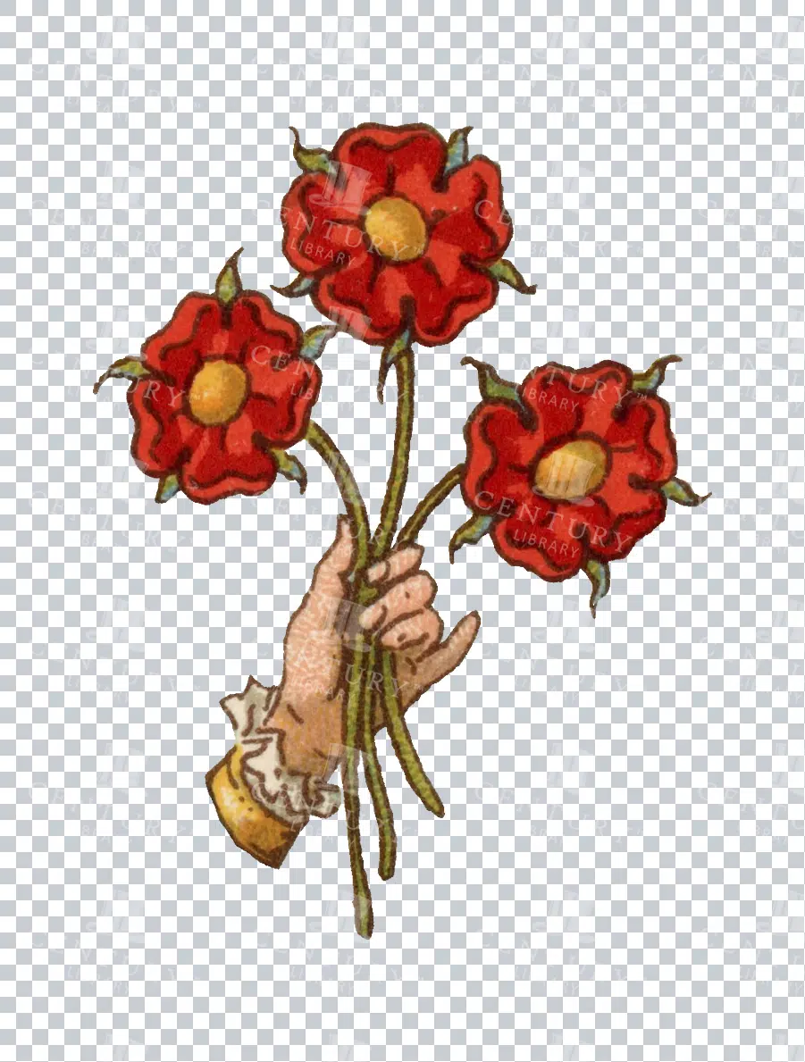
Heraldic Hand Holding Red Roses Vintage Illustration
A vintage heraldic image featuring a hand holding a bouquet of three red roses. This isolated PNG image captures the elegance and symbolism often associated with medieval and noble iconography. The hand is delicately drawn, with detailed features that emphasize the historic artistry. Ideal for use in designs that require a touch of tradition and heritage.
- Resolution: 693 x 915
- Image Type(s): PNG
From this collection

19th Century World Map – Chief Countries and Their Colonies
An antique world map from the 19th century showcasing chief countries and their colonies during the period. The map uses Mercator's projection and highlights the global political landscape, including colonial possessions.
- Resolution: 7272 x 5100
- Image Type(s): JPG
From this collection
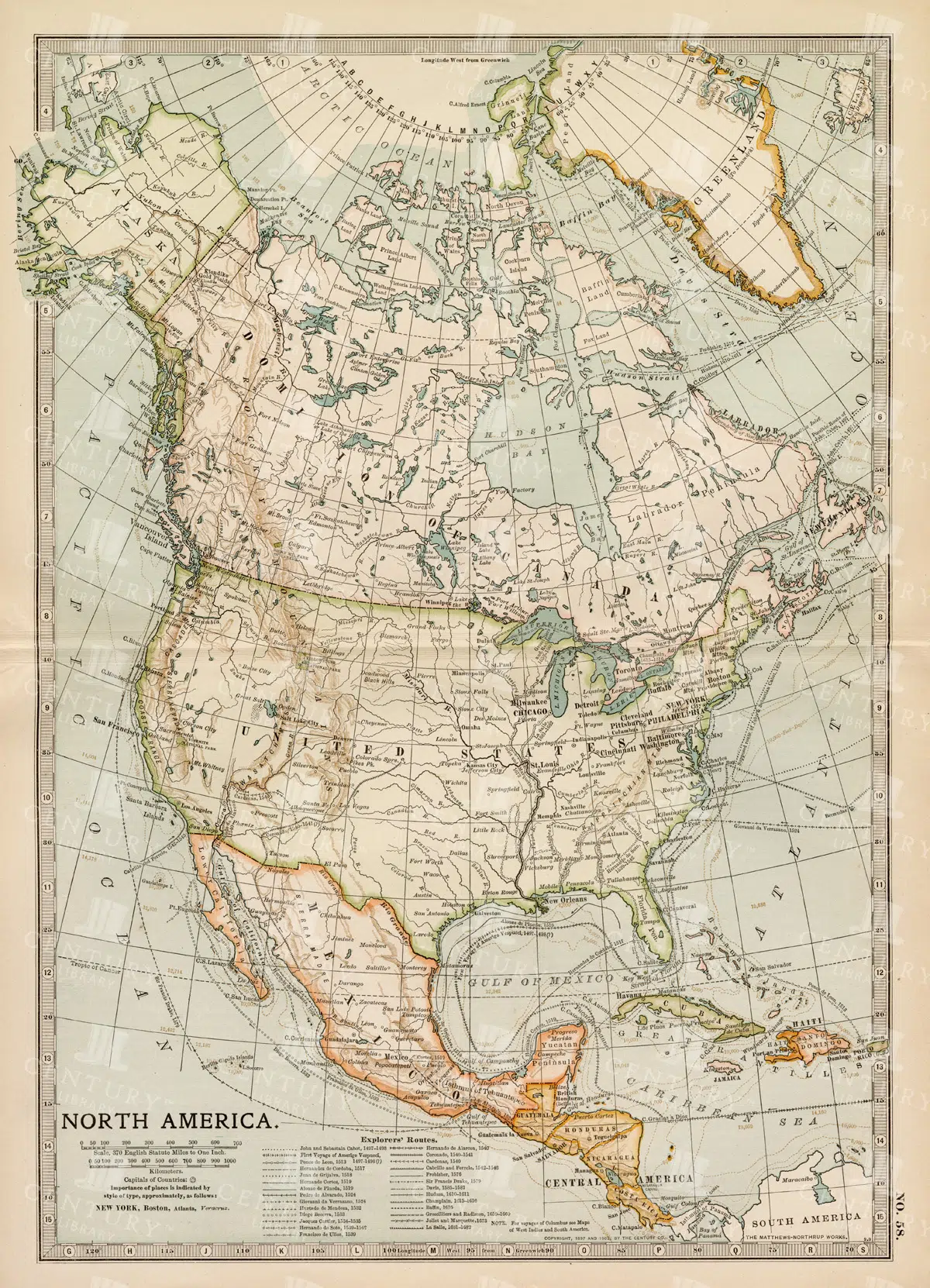
Vintage Map of North America
A historic map of North America, offering a comprehensive view of the continent's geography, including the United States, Canada, and Mexico, from the late 19th century.
- Resolution: 7242 x 5100
- Image Type(s): JPG
From this collection

Distressed Vintage Paper Texture
- Resolution: 7319px x 10296px
- Image Type(s): JPG
- burning
- text
- letterhead
- burnt
- correspondence
- torn
- layers
- brittle
- poster
- dirty
- spotted
- document
- weathered
- letter
- sheet
- pages
- cardboard
- backgrounds
- age
- stain
- messy
- decay
- obsolete
- parchment
- stained
- canvas
- aging
- leather
- rough
- aged
- stucco
- blank
- vintage
- empty
- retro
- old
- grunge
- Scrolls
- Vintage Texture
- Paper Texture
- Antique
- Paper
- Book
- Note
- Ancient
- Wallpaper
- History
- Texture
- Background
From this collection
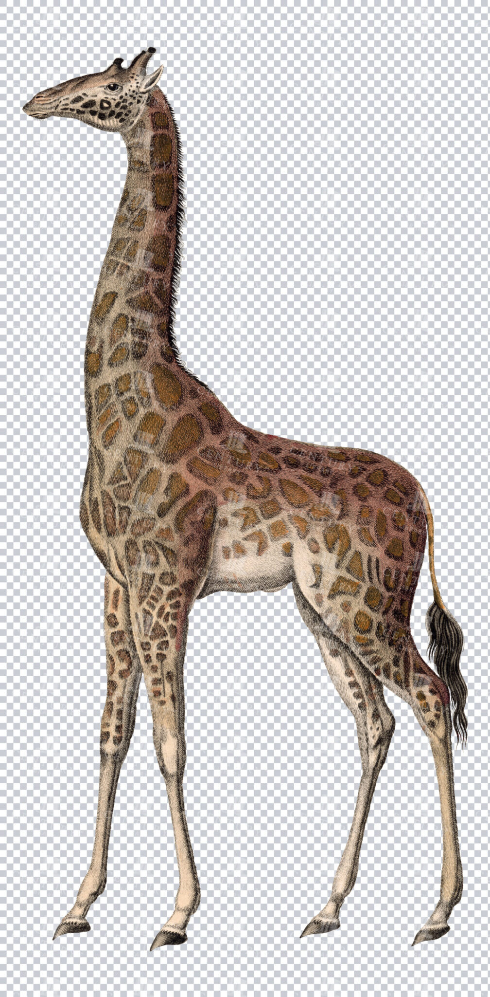
Vintage Illustration of Giraffe on Transparent Background
Classic vintage illustration of a giraffe on a transparent background. Perfect for educational materials or design projects.
- Resolution: 4316 × 8758
- Image Type(s): PNG
From this collection

Grunge Vintage Paper Texture with Petina
- Resolution: 5021px x 7026px
- Image Type(s): JPG
- burning
- text
- letterhead
- burnt
- correspondence
- torn
- layers
- brittle
- poster
- dirty
- spotted
- document
- weathered
- letter
- sheet
- pages
- cardboard
- backgrounds
- age
- stain
- messy
- decay
- obsolete
- parchment
- stained
- canvas
- aging
- leather
- rough
- aged
- stucco
- blank
- vintage
- empty
- retro
- old
- grunge
- Scrolls
- Vintage Texture
- Paper Texture
- Antique
- Paper
- Book
- Note
- Ancient
- Wallpaper
- History
- Texture
- Background
From this collection

1897 Map of Italy: Comprehensive View Including Rome and Venice
A detailed 1897 map of Italy, encompassing the entire peninsula including key cities like Rome and Venice. This map highlights the topographical features, transportation networks, and regional boundaries of Italy during the late 19th century. It offers a broad view of Italy's geography and historical development, making it a significant resource for historical studies.
- Resolution: 7153 x 5100
- Image Type(s): JPG
From this collection

Antique Map of the United States
Detailed antique map of the United States showing states, territories, railroads, and cities, with inset of Alaska. Includes topographical features, rivers, and mountain ranges.
- Resolution: 7275 x 5100
- Image Type(s): JPG
- state lines
- united states map
- nostalgic
- america map
- cartographer
- reference
- archival
- USA
- topographical
- mountain ranges
- railroads
- cities
- antique map
- historical map
- territories
- exploration
- old map
- cartography
- vintage map
- American history
- transportation
- states
- historic
- education
- 19th-century
- collectible
- historical
- detailed
- heritage
- illustration
- vintage
- Atlantic Ocean
- Antique
- History
- Alaska
- Pacific Ocean
- Geography
- United States
- America
- Rivers
- Map
- Borders
From this collection

Grunge Vintage Paper Texture with Petina
- Resolution: 7319px x 10320px
- Image Type(s): JPG
- age
- aged
- aging
- Ancient
- Antique
- Background
- backgrounds
- blank
- Book
- brittle
- burning
- burnt
- canvas
- cardboard
- correspondence
- decay
- dirty
- document
- empty
- grunge
- History
- layers
- leather
- letter
- letterhead
- messy
- Note
- obsolete
- old
- pages
- Paper
- Paper Texture
- parchment
- poster
- retro
- rough
- Scrolls
- sheet
- spotted
- stain
- stained
- stucco
- text
- Texture
- torn
- vintage
- Vintage Texture
- Wallpaper
- weathered
From this collection

Vintage Illustration of Arabica Male Skull with Detailed Horns from the 1800s
This 1800s illustration shows a detailed skull of an Arabica male with prominent, spiral horns, exemplifying the anatomical features of this unique species.
- Resolution: 1770px x 2079px
- Image Type(s): PNG
From this collection
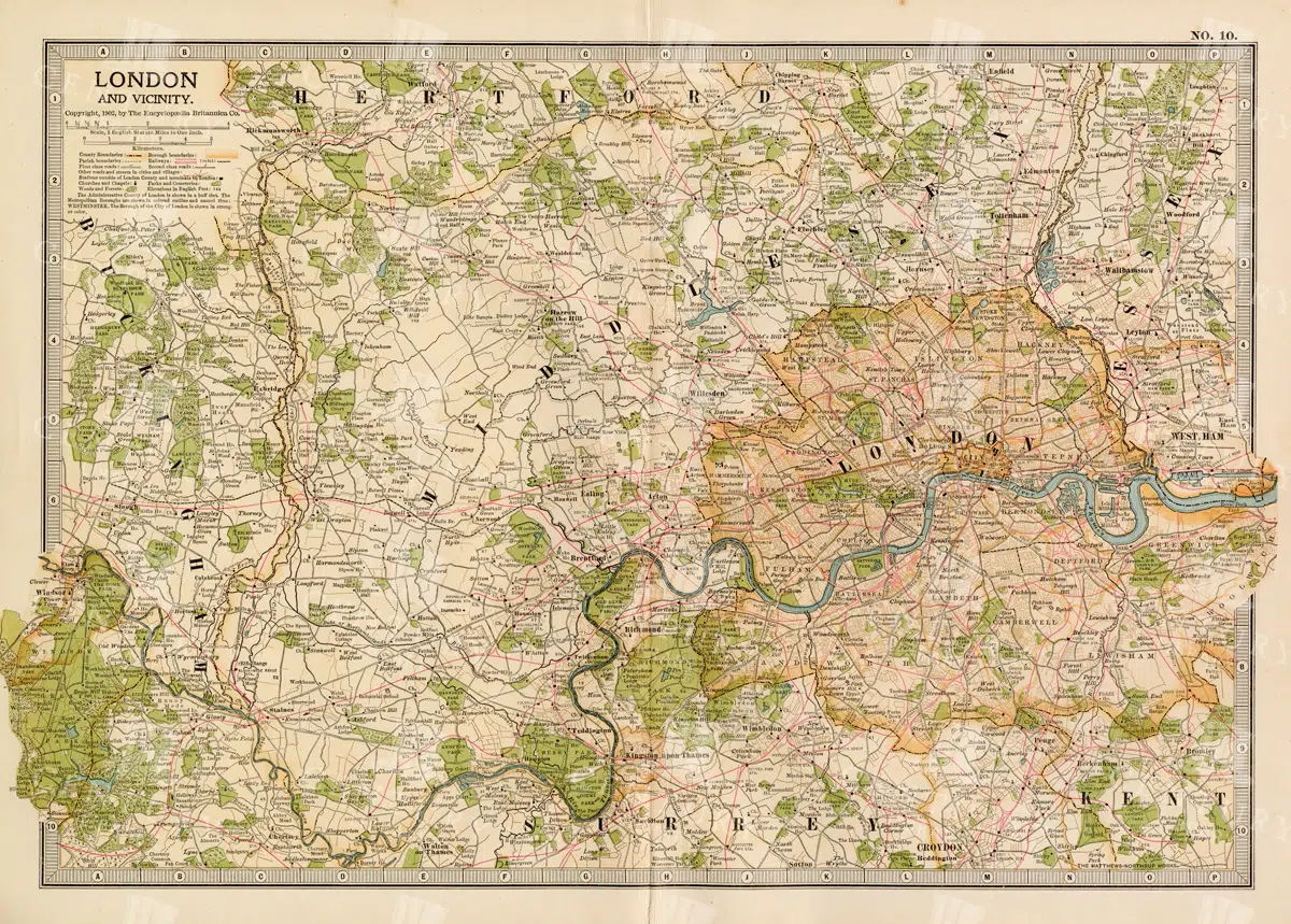
1897 Map of London and Surrounding Areas in the Late 19th Century
A detailed map from 1897 showcasing London and its surrounding areas, including key roads, railways, and landmarks. The map offers a comprehensive view of the city's layout and development during the late 19th century, providing valuable historical insights into London's urban expansion and infrastructure. The vintage aesthetic adds to its charm as a historical document.
- Resolution: 7158 x 5100
- Image Type(s): JPG
From this collection

Vintage Engraving of Armadillo on Transparent Background
Vintage illustration of an armadillo, highlighting its textured armored shell on a transparent background. Suitable for educational resources, design projects, or zoological studies.
- Resolution: 4835 × 2567
- Image Type(s): PNG
- 19th-century
- Animal
- Antique
- Armadillo
- armored
- Art
- artistic
- Background
- biology
- Black and white
- collectible
- Design
- detailed
- Drawing
- education
- Engraving
- Etching
- exotic
- fauna
- historical
- History
- illustration
- isolated
- Mammal
- monochrome
- natural
- Nature
- old-fashioned
- retro
- scientific
- Shell
- South America
- Texture
- traditional
- transparent
- unique
- vintage
- Wildlife
- Zoology
From this collection

Grunge Paper Texture with Faint Ornamental Frame and Baroque Scrollwork
- Image Type(s): JPG
- age
- aged
- aged paper background
- aging
- Ancient
- Antique
- Antique Border
- backgrounds
- baroque scrollwork
- blank
- Book
- brittle
- burning
- burnt
- canvas
- cardboard
- classical paper texture
- correspondence
- decay
- decorative cartouche
- decorative engraving
- dirty
- distressed paper
- document
- empty
- empty frame motif
- faint illustration overlay
- grunge texture
- Historical Ephemera
- History
- layers
- letter
- letterhead
- messy
- Note
- obsolete
- old
- ornamental frame
- pages
- Paper
- parchment
- poster
- retro
- rococo detail
- rough
- Scrolls
- sheet
- spotted
- stain
- stained
- stucco
- text
- torn
- vintage
- vintage document backdrop
- Wallpaper
- weathered
- worn parchment texture
From this collection

Vintage Map of Ireland Highlighting Political Boundaries and Topographical Features
This vintage map of Ireland highlights the country's political boundaries and key topographical features, including rivers, mountains, and major cities. The map provides a historical overview of Ireland during the late 19th century, offering insight into the geopolitical landscape and cultural heritage of the island. It includes detailed insets of Dublin and its surrounding areas, reflecting Ireland's rich history and complex political past.
- Resolution: 7149 x 5100
- Image Type(s): JPG
- Antique
- antique map
- Atlas
- cartography
- cities
- cultural heritage
- Dublin
- Europe
- exploration
- Geography
- geopolitical
- historical geography
- historical map
- History
- Ireland
- Ireland history
- Irish history
- Island
- Landscape
- late 19th century
- Map
- Mountains
- old map
- political boundaries
- representation
- Rivers
- topography
- United Kingdom
- vintage
- World
From this collection

Vintage Engraving of Kangaroo on Transparent Background
Vintage illustration of a kangaroo, highlighting its posture and muscular legs on a transparent background. Perfect for educational content, wildlife designs, or Australian-themed projects.
- Resolution: 5268 × 4164
- Image Type(s): PNG
- 19th-century
- Animal
- Antique
- Art
- artistic
- Australia
- Background
- biology
- Black and white
- collectible
- Design
- detailed
- Dog
- Drawing
- education
- Engraving
- Etching
- exotic
- fauna
- historical
- History
- hopping
- illustration
- isolated
- Kangaroo
- Mammal
- Marsupial
- monochrome
- natural
- Nature
- old-fashioned
- retro
- scientific
- Texture
- traditional
- transparent
- unique
- vintage
- Wildlife
- Zoology
From this collection

Vintage Cream Paper Downloadable Texture
- Resolution: 4804px x 7228px
- Image Type(s): JPG
- age
- aged
- aging
- Ancient
- Antique
- Background
- backgrounds
- blank
- Book
- brittle
- burning
- burnt
- canvas
- cardboard
- correspondence
- decay
- dirty
- document
- empty
- grunge
- History
- layers
- leather
- letter
- letterhead
- messy
- Note
- obsolete
- old
- pages
- Paper
- Paper Texture
- parchment
- poster
- retro
- rough
- Scrolls
- sheet
- spotted
- stain
- stained
- stucco
- text
- Texture
- torn
- vintage
- Vintage Texture
- Wallpaper
- weathered
From this collection

Vintage Illustration of Bactrian Camel on Transparent Background
Detailed vintage illustration of a Bactrian camel, presented on a transparent background. Suitable for educational or design projects.
- Resolution: 5161 × 4128
- Image Type(s): PNG
From this collection

Vintage Engraving of Buffalo on Transparent Background
A detailed vintage engraving of a buffalo, isolated on a transparent background. Ideal for educational content or creative projects.
- Resolution: 6225 × 3523
- Image Type(s): PNG
From this collection

Vintage Engraving of Reindeer on Transparent Background
A vintage engraving of a reindeer, beautifully detailed and isolated on a transparent background. Ideal for educational or creative projects.
- Resolution: 4669 × 3972
- Image Type(s): PNG
From this collection

Aged Wallpaper Texture with Floral Damask Pattern and Handwriting Overlay
- Image Type(s): JPG
- age
- aged
- aged wallpaper texture
- aging
- Ancient
- Antique
- antique paper design
- blank
- Book
- botanical wallpaper texture
- brittle
- burning
- burnt
- canvas
- cardboard
- collage paper texture
- correspondence
- decay
- dirty
- distressed floral overlay
- document
- empty
- floral damask pattern
- grunge
- grunge paper surface
- Historical Ephemera
- History
- junk journal background
- layers
- letter
- letterhead
- messy
- Note
- obsolete
- old
- old paper with distress marks
- ornate pattern repeat
- pages
- Paper
- parchment
- poster
- retro
- rough
- Scrolls
- seamless vintage pattern
- sheet
- spotted
- stain
- stained
- text
- Texture
- torn
- Victorian floral motif
- vintage
- vintage decorative background
- Wallpaper
- wallpaper with scratches
- weathered
From this collection

Vintage Heraldic Acorns and Oak Leaves Illustration
An isolated PNG image of two acorns and oak leaves, drawn in a vintage heraldic style. This design element is often associated with strength, endurance, and longevity in heraldic traditions. Perfect for projects that require natural or historical themes.
- Resolution: 930 x 930
- Image Type(s): PNG
Related Images

1897 Map of Japan and Korea Detailing Regional Divisions
An intricate 1897 map of Japan and Korea, illustrating regional divisions, cities, and transportation routes. The map provides a detailed view of the geography and political landscape of East Asia during the late 19th century, highlighting the interconnectedness of Japan and Korea. Its vintage cartography offers a glimpse into the historical context of the region.
- Resolution: 7155 x 5100
- Image Type(s): JPG
From this collection

Grunge Vintage Paper Texture with Petina
- Resolution: 6171px x 9652px
- Image Type(s): JPG
- age
- aged
- aging
- Ancient
- Antique
- Background
- backgrounds
- blank
- Book
- brittle
- burning
- burnt
- canvas
- cardboard
- correspondence
- decay
- dirty
- document
- empty
- grunge
- History
- layers
- leather
- letter
- letterhead
- messy
- Note
- obsolete
- old
- pages
- Paper
- Paper Texture
- parchment
- poster
- retro
- rough
- Scrolls
- sheet
- spotted
- stain
- stained
- text
- Texture
- torn
- vintage
- Vintage Texture
- Wallpaper
- weathered
From this collection

Detailed 19th Century Map of the Netherlands, Belgium, and Luxembourg
A detailed antique map from the 19th century featuring the Netherlands, Belgium, and Luxembourg. The map showcases the geographical and political landscape of the region, including major cities, rivers, and borders.
- Resolution: 7271 x 5100
- Image Type(s): JPG
From this collection

Vintage 1800s Map of Alaska Featuring Detailed Geography and Historical Boundaries – Antique Historical Map
An antique map from the 1800s featuring Alaska, highlighting its detailed geography and historical boundaries. This vintage map offers a glimpse into the early cartographic representation of Alaska, with intricate details of its natural features and political divisions. A perfect addition for those interested in Alaskan history and vintage maps.
- Resolution: 7105 x 5100
- Image Type(s): JPG
From this collection
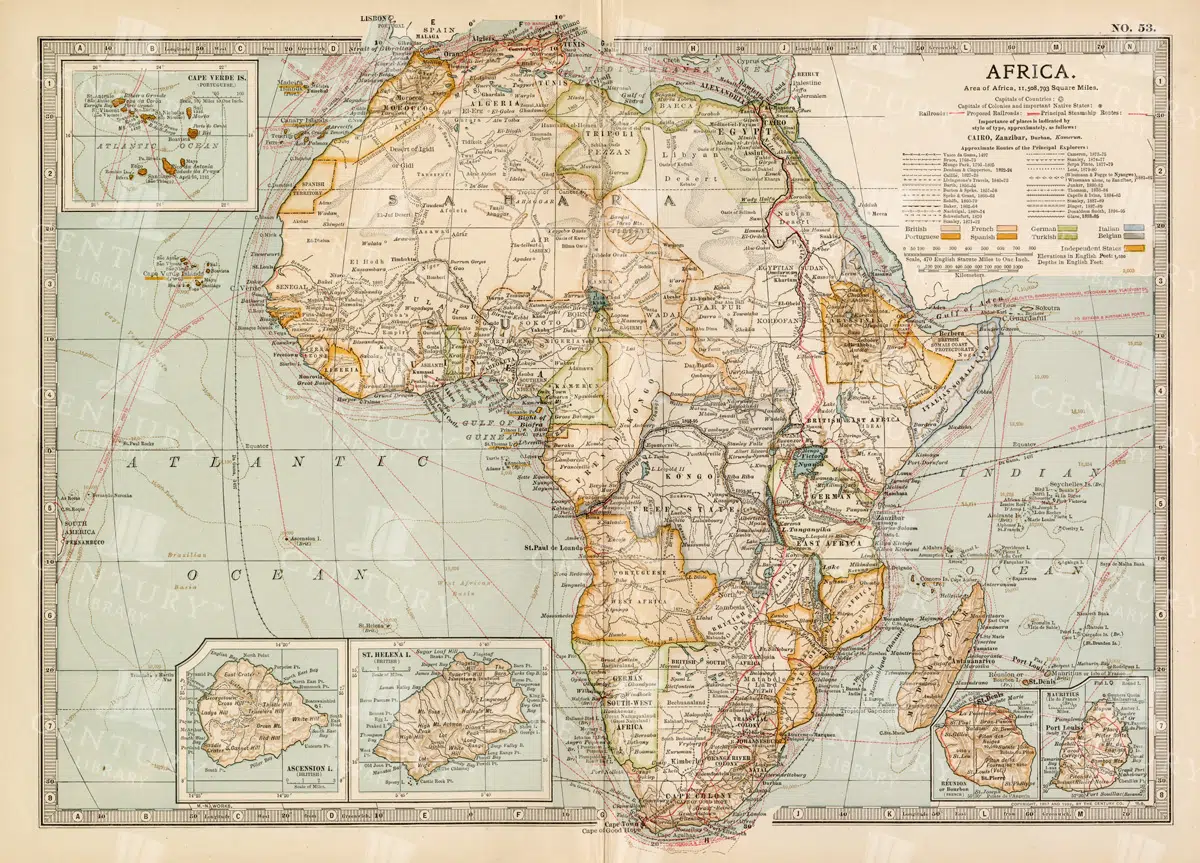
Antique 1800s Map of Africa Showing Entire Continent and Colonial Territories – Vintage Historical Cartography
This comprehensive antique map from the 1800s showcases the entire continent of Africa, highlighting colonial territories and geographical features. The map is a valuable historical document, offering insights into Africa's political and natural landscape during the colonial era. A beautifully detailed piece of vintage cartography.
- Resolution: 7104 x 5100
- Image Type(s): JPG
- 1800s
- Africa
- Africa colonial
- Africa history
- Africa map
- Antique
- antique map
- Atlas
- boundaries
- cartography
- colonial era
- colonial territories
- country
- detailed
- entire continent
- exploration
- Geography
- historical
- historical map
- History
- illustration
- Map
- natural features
- old map
- political map
- preserved
- representation
- retro
- topography
- vintage
- vintage map
- World
From this collection

Vintage Engraving of Koala with Baby on Transparent Background
vintage illustration of a koala with its baby on its back, showcasing intricate fur details on a transparent background. Perfect for educational materials, wildlife designs, or artistic projects.
- Resolution: 3428 × 3093
- Image Type(s): PNG
- 19th-century
- Animal
- Antique
- Art
- artistic
- Baby
- Background
- biology
- Black and white
- Cat
- collectible
- cute
- Design
- detailed
- domestic
- Drawing
- education
- Engraving
- Etching
- exotic
- Family
- fauna
- feline
- fur
- historical
- History
- illustration
- isolated
- Kitten
- kitty
- koala baby
- Madagascar
- Mammal
- monochrome
- Mother
- natural
- Nature
- nurturing
- old-fashioned
- parent
- Pet
- retro
- scientific
- Texture
- traditional
- transparent
- unique
- vintage
- Whiskers
- Wildlife
- Zoology
From this collection

Grunge Vintage Paper Texture with Petina
- Resolution: 6960px x 10069px
- Image Type(s): JPG
- age
- aged
- aging
- Ancient
- Antique
- Background
- backgrounds
- blank
- Book
- brittle
- burning
- burnt
- canvas
- cardboard
- correspondence
- decay
- dirty
- document
- empty
- grunge
- History
- layers
- leather
- letter
- letterhead
- messy
- Note
- obsolete
- old
- pages
- Paper
- Paper Texture
- parchment
- poster
- retro
- rough
- Scrolls
- sheet
- spotted
- stain
- stained
- stucco
- text
- Texture
- torn
- vintage
- Vintage Texture
- Wallpaper
- weathered
From this collection

Vintage Map of Southern England and Wales Highlighting Major Cities and Coastal Areas
This vintage map of Southern England and Wales highlights major cities, coastal areas, and important transportation routes. The map provides detailed insights into the region's historical geography and urban development during the period.
- Resolution: 7127 x 5100
- Image Type(s): JPG
From this collection

Claosaur Dinosaur Skeleton Illustration in Upright Stance
This illustration depicts the skeleton of a Claosaur, a dinosaur standing upright on its hind legs. The detailed anatomy includes the elongated tail, ribcage, and skull, showcasing the prehistoric structure in a museum-quality sketch style.
- Resolution: 4919px x 3829px
- Image Type(s): PNG
From this collection

Antique Map of the West Indies
Historical antique map of the West Indies, showcasing islands like Cuba, Jamaica, and Puerto Rico, with detailed nautical routes, ports, and topography. Includes inset of Bermuda. 19th century cartography.
- Resolution: 7279 x 5100
- Image Type(s): JPG
- nostalgic
- cartographer
- cuba
- puerto rico
- nautical routes
- ports
- bermuda
- islands map
- sea routes
- bermuda map
- west indies map
- island history
- archival
- Caribbean islands
- Caribbean
- detailed map
- maritime
- topography
- historical map
- exploration
- old map
- cartography
- transportation
- 19th-century
- collectible
- historical
- heritage
- classic
- Islands
- country
- vintage
- representation
- Atlantic Ocean
- Antique
- History
- Jamaica
- West Indies
- Geography
- Atlas
- World
- Map
- Nautical
From this collection

Vintage Engraving of Solenodon on Transparent Background
Intricate vintage illustration of a solenodon, showcasing its unique long snout and fur details on a transparent background. Perfect for educational resources, nature designs, or zoological studies.
- Resolution: 4158 × 2218
- Image Type(s): PNG
- scientific
- fauna
- education
- 19th-century
- monochrome
- collectible
- nocturnal
- long snout
- solenodon
- historical
- traditional
- detailed
- artistic
- natural
- isolated
- transparent
- unique
- old-fashioned
- biology
- illustration
- Zoology
- vintage
- retro
- Black and white
- Antique
- Engraving
- Etching
- Art
- Design
- History
- Rodent
- Otter
- Drawing
- Texture
- Mammal
- Wildlife
- Animal
- Wild
- Porcupine
- Background
- Nature
From this collection
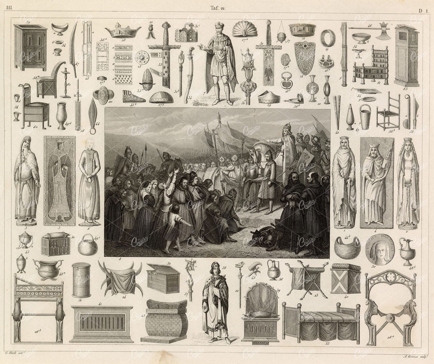
CHARLEMAGNE Times – History and Ethnology J.Heck Iconography 1851
You’re looking at a well preserved original plate from Johann Georg Heck's “Iconographic Encyclopedia of Sciences, Literature and Art” published in 1851 by Rudolphe Garrigue in New York. We were extremely fortunate to acquire the full collection of illustrative prints from the series, which after many months of looking, proved to be very difficult!
- License Info
- Resolution: 9477 x 7949 300dpi
- Year of Print: 1851
- Artist: Johann Georg Heck
From this collection

Heraldic Golden Harp with Winged Woman Vintage Art
A beautiful isolated PNG image of a golden harp with a winged woman, rendered in a vintage heraldic style. This image combines musical and mythological symbolism, perfect for use in designs that evoke themes of artistry, music, and mythology.
- Resolution: 760 x 1037
- Image Type(s): PNG
Related Images

Vintage Engraving of Marsupial with Young on Transparent Background
Vintage illustration of a marsupial with its young on its back, showcasing intricate fur and tail details on a transparent background. Ideal for educational resources, wildlife designs, or artistic projects.
- Resolution: 3247 × 2082
- Image Type(s): PNG
- 19th-century
- Animal
- Antique
- Art
- artistic
- Background
- biology
- Black and white
- Cat
- collectible
- Design
- detailed
- Dog
- domestic animal
- Drawing
- education
- Engraving
- Etching
- exotic
- Family
- fauna
- feline
- historical
- History
- illustration
- isolated
- Mammal
- Marsupial
- monochrome
- natural
- Nature
- nurturing
- old-fashioned
- parent
- Pet
- retro
- scientific
- Texture
- traditional
- transparent
- unique
- vintage
- Wildlife
- young
- Zoology
From this collection

Vintage Engraving of Slow Loris on Transparent Background
Vintage illustration of a slow loris, featuring its distinct large eyes and detailed fur on a transparent background. Perfect for educational content, design projects, or zoological studies.
- Resolution: 2734 × 3087
- Image Type(s): PNG
- 19th-century
- Animal
- Antique
- Art
- artistic
- Background
- biology
- Black and white
- collectible
- Design
- detailed
- Drawing
- education
- endangered
- Engraving
- Etching
- exotic
- fauna
- fur
- historical
- History
- illustration
- isolated
- Mammal
- mongoose
- monochrome
- natural
- Nature
- nocturnal
- old-fashioned
- Primate
- retro
- scientific
- slow loris
- Southeast Asia
- Texture
- traditional
- transparent
- unique
- vintage
- Wildlife
- Zoology
From this collection

Central Europe Travel Map Featuring Major Cities Like Paris, Berlin, and Vienna
This travel map of Central Europe highlights major cities such as Paris, Berlin, and Vienna, showcasing detailed routes and geographical features. The map provides a glimpse into the historical and political landscape of Central Europe during the time.
- Resolution: 7117 x 5100
- Image Type(s): JPG
From this collection

Detailed Historical Map of the East India Islands Including Malaysia and the Philippines
A detailed historical map of the East India Islands, including regions like Malaysia, the Philippines, and New Guinea. The map highlights important geographical features, cities, and maritime routes, offering a glimpse into the region's colonial history.
- Resolution: 7123 x 5100
- Image Type(s): JPG
From this collection
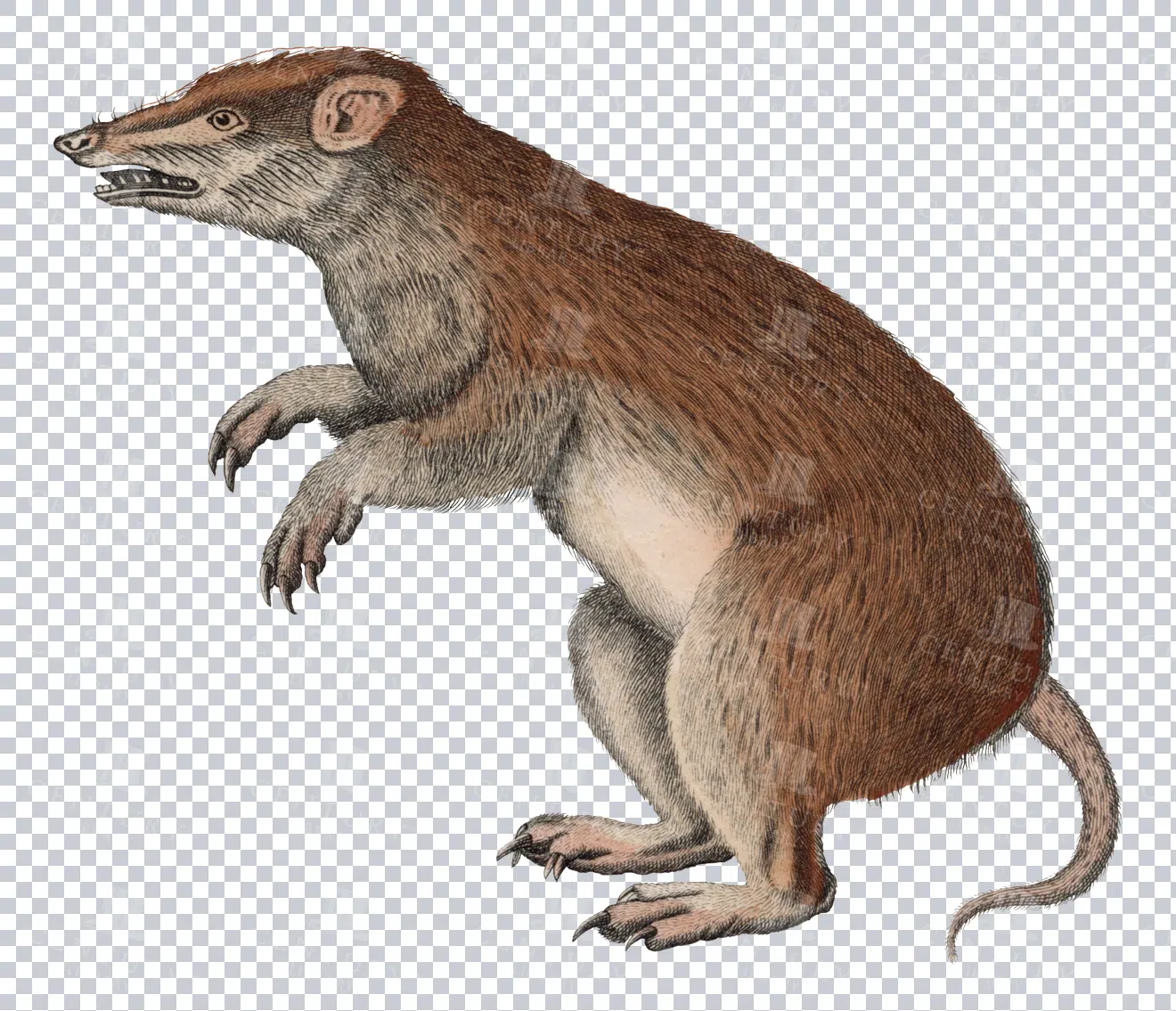
Vintage Illustration of Malagasy Rodent on Transparent Background
Detailed vintage illustration of a Malagasy rodent, presented on a transparent background. Ideal for educational materials or design projects.
- Resolution: 3261 × 2801
- Image Type(s): PNG
- 19th-century
- Animal
- Antique
- Art
- Background
- biology
- collectible
- cute
- detailed
- domestic
- Drawing
- Ear
- education
- Engraving
- Etching
- fauna
- fur
- historical
- History
- illustration
- isolated
- Madagascar
- Malagasy rodent
- Mammal
- Mouse
- natural
- Nature
- old-fashioned
- Pet
- Rat
- retro
- Rodent
- scientific
- tail
- traditional
- transparent
- unique
- vintage
- Wildlife
- Zoology
From this collection

Antique Map of Texas, Western Part with Galveston Bay
A vintage 19th century map depicting the western part of Texas along with a detailed inset of Galveston Bay, Houston, and surrounding areas. The map highlights the state’s development, including railroads, towns, and natural features.
- Resolution: 7270 x 5100
- Image Type(s): JPG
From this collection

Detailed 19th Century Map of Texas, Eastern Part
A detailed map from the 19th century illustrating the eastern part of Texas, USA. The map features various towns, railroads, and natural landmarks, providing a glimpse into the state’s historical geography and development.
- Resolution: 7269 x 5100
- Image Type(s): JPG
From this collection

Vintage Illustration of Scimitar-Horned Oryx on Transparent Background
Detailed vintage illustration of a scimitar-horned oryx, presented on a transparent background. Perfect for educational and design purposes.
- Resolution: 4755 × 4569
- Image Type(s): PNG
From this collection

Vintage Engraving of Wombat on Transparent Background
A detailed vintage engraving of a wombat, isolated on a transparent background. Great for educational and design purposes.
- Resolution: 4055 × 1821
- Image Type(s): PNG
From this collection

Vintage Engraving of Giant Anteater on Transparent Background
Detailed vintage illustration of a giant anteater, featuring intricate line work and shading on a transparent background. Ideal for educational materials, wildlife projects, or design elements.
- Resolution: 4609 × 2311
- Image Type(s): PNG
- 19th-century
- Animal
- Anteater
- Antique
- Art
- artistic
- Background
- biology
- Black and white
- collectible
- Design
- detailed
- Drawing
- education
- endangered
- Engraving
- Etching
- exotic
- fauna
- Giant
- historical
- History
- illustration
- isolated
- Mammal
- monochrome
- natural
- Nature
- old-fashioned
- retro
- scientific
- South America
- species
- Texture
- traditional
- transparent
- vintage
- Wildlife
- Zoology
From this collection

Vintage Illustration of Hyrax on Transparent Background
Detailed vintage illustration of a hyrax, presented on a transparent background. Ideal for educational use or design projects.
- Resolution: 4473 × 1913
- Image Type(s): PNG
From this collection
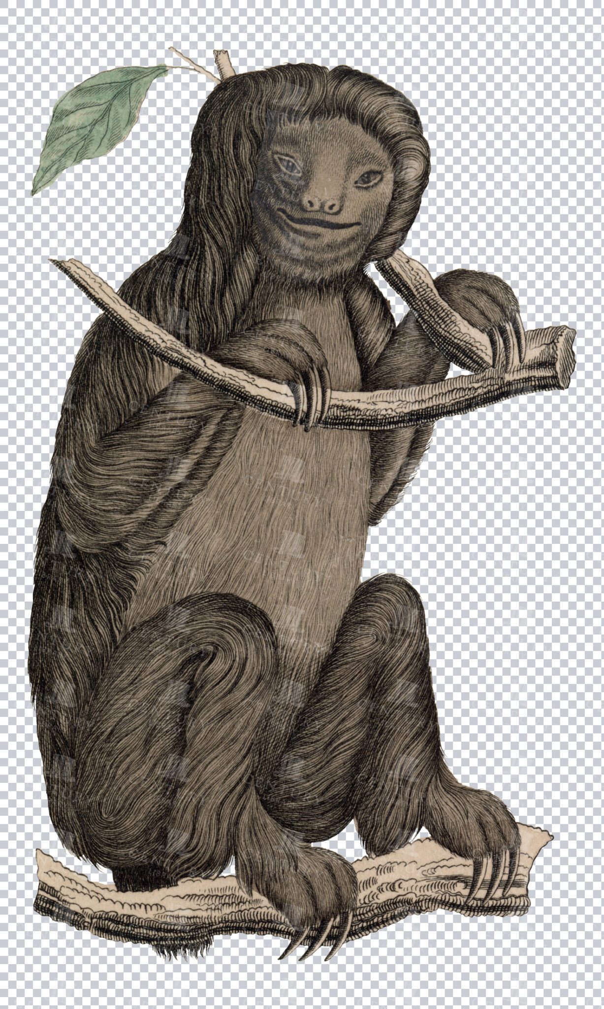
Vintage Engraving of Sloth on Transparent Background
Intricate vintage illustration of a sloth hanging from a branch, showcasing detailed fur and texture on a transparent background. Ideal for educational resources, nature designs, or artistic projects.
- Resolution: 2634 × 4394
- Image Type(s): PNG
- 19th-century
- Animal
- Antique
- Art
- artistic
- Background
- biology
- Black and white
- Branch
- bust
- Carving
- collectible
- Design
- detailed
- Drawing
- education
- Engraving
- Etching
- fauna
- Hanging
- historical
- History
- illustration
- isolated
- Mammal
- monochrome
- natural
- Nature
- old-fashioned
- plastic art
- retro
- scientific
- Sculpture
- Sloth
- slow
- Statue
- Texture
- traditional
- transparent
- Tropical
- unique
- vintage
- Wildlife
- Zoology
From this collection

Antique Map of Vermont and New Hampshire
Detailed antique map showing the states of Vermont and New Hampshire with towns, railroads, rivers, and geographical features. Historical cartography showcasing 19th century state boundaries and infrastructures.
- Resolution: 7276 x 5100
- Image Type(s): JPG
- state lines
- nostalgic
- cartographer
- state boundaries
- infrastructures
- vermont map
- new hampshire map
- reference
- archival
- geographical features
- USA
- railroads
- detailed map
- historical map
- exploration
- old map
- cartography
- vintage map
- American history
- transportation
- states
- towns
- historic
- education
- 19th-century
- collectible
- historical
- heritage
- classic
- vintage
- representation
- Atlantic Ocean
- Antique
- History
- New England
- Vermont
- New Hampshire
- Geography
- Atlas
- Rivers
- Map
- Borders
From this collection

19th Century Map of Spain, Portugal, and Andorra
An antique map from the 19th century detailing the countries of Spain, Portugal, and Andorra, along with surrounding regions. The map features important cities, mountain ranges, and bodies of water, offering a glimpse into the historical geography of the Iberian Peninsula.
- Resolution: 7266 x 5100
- Image Type(s): JPG
- 19th-century
- Andorra
- Antique
- archives
- Atlantic
- Atlas
- Borders
- cartography
- cities
- country
- Europe
- exploration
- Geography
- heritage
- historic map
- historical
- History
- Iberian Peninsula
- landmarks
- Landscape
- Map
- Mediterranean
- Mountains
- old map
- Portugal
- Pyrenees
- reference
- representation
- retro
- Rivers
- settlements
- Spain
- topographic
- vintage
- vintage map
- World
From this collection

1897 Map of Jamaica and the Lesser Antilles
This vintage 1897 map features Jamaica and the Lesser Antilles, highlighting the islands' geography, political boundaries, and colonial possessions. The map provides a historical overview of the Caribbean region, showing the various territories under colonial rule during the late 19th century. Its detailed depiction of the islands offers valuable insight into the Caribbean's colonial past.
- Resolution: 7154 x 5100
- Image Type(s): JPG
From this collection
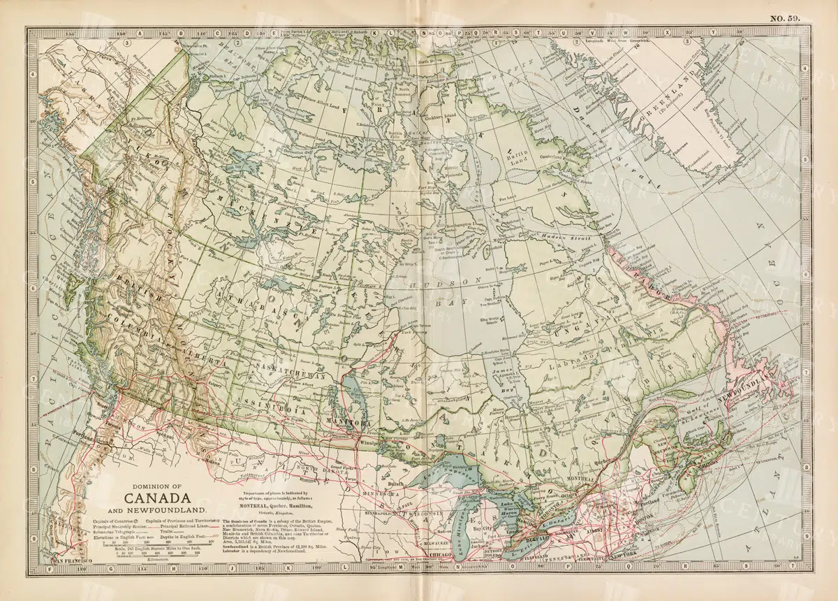
Antique Map of Canada and Newfoundland Highlighting Major Cities and Natural Features
An antique map of Canada and Newfoundland, offering a detailed look at the region's cities, natural landmarks, and geographical features. The map provides insights into the historical significance of the area during the time of its creation.
- Resolution: 7115 x 5100
- Image Type(s): JPG
From this collection

Support the Library
Our supporters and members help us continue collecting and restoring these wonderful pieces of art for the modern creator
Unlock Everything and Become a Member!
While a lot of the library is available for free, some is kept behind closed dusty doors only to be accessed by our lovely members.