

Globe and Clouds Vector Lineart Illustrations – Vintage World and Cloud Clip Art – PNG, SVG, and EPS Vector Formats Included!
You're looking at a unique set of globe and cloud illustrations discovered in a late 1800s design book. These illustrations were extracted from their original backgrounds and converted to the following image formats: SVG (vector), EPS (vector), and, of course, PNG (300dpi raster image with transparent background).
- Image Type(s): EPS, SVG, PNG
Related Images


Victorian Merchant Receipt with Handwriting and Botanical Bird Illustration Overlay
- Image Type(s): PNG
- vintage receipt texture
- floral overlay
- historical invoice
- bird and flower graphic
- transparent overlay texture
- handwritten receipt
- bird among blossoms
- archival paper texture
- collage background
- junk journal paper
- aged paper background
- Botanical Ephemera
- Bird illustration
- Victorian Document
- Antique Handwriting
- representation
- Map
From this collection

Vintage Handwritten Music Sheet Paper Texture – Worn and Aged No.5
- License Info
- Resolution: 6900px x 10000px
From this collection

Decorative Handwritten Letter with RPK Stamp and Transparent Background
This image is part of a curated collection that showcases a diverse range of vintage document designs and typographic art, featuring intricate letterhead logos, ornate receipts, and decorative printed overlays. Each piece captures the elegance of historical print styles—from German heraldic flourishes and British typographic traditions to antique invoices and lottery tickets. Perfect for design enthusiasts, crafters, and historians alike, these images offer a nostalgic glimpse into the artistry of printed communication, blending handwritten and printed text with ornamental details and transparent overlays.
- Resolution: 5166px x 6392px
- Image Type(s): PNG
From this collection

19th Century World Map – Chief Countries and Their Colonies
An antique world map from the 19th century showcasing chief countries and their colonies during the period. The map uses Mercator's projection and highlights the global political landscape, including colonial possessions.
- Resolution: 7272 x 5100
- Image Type(s): JPG
From this collection
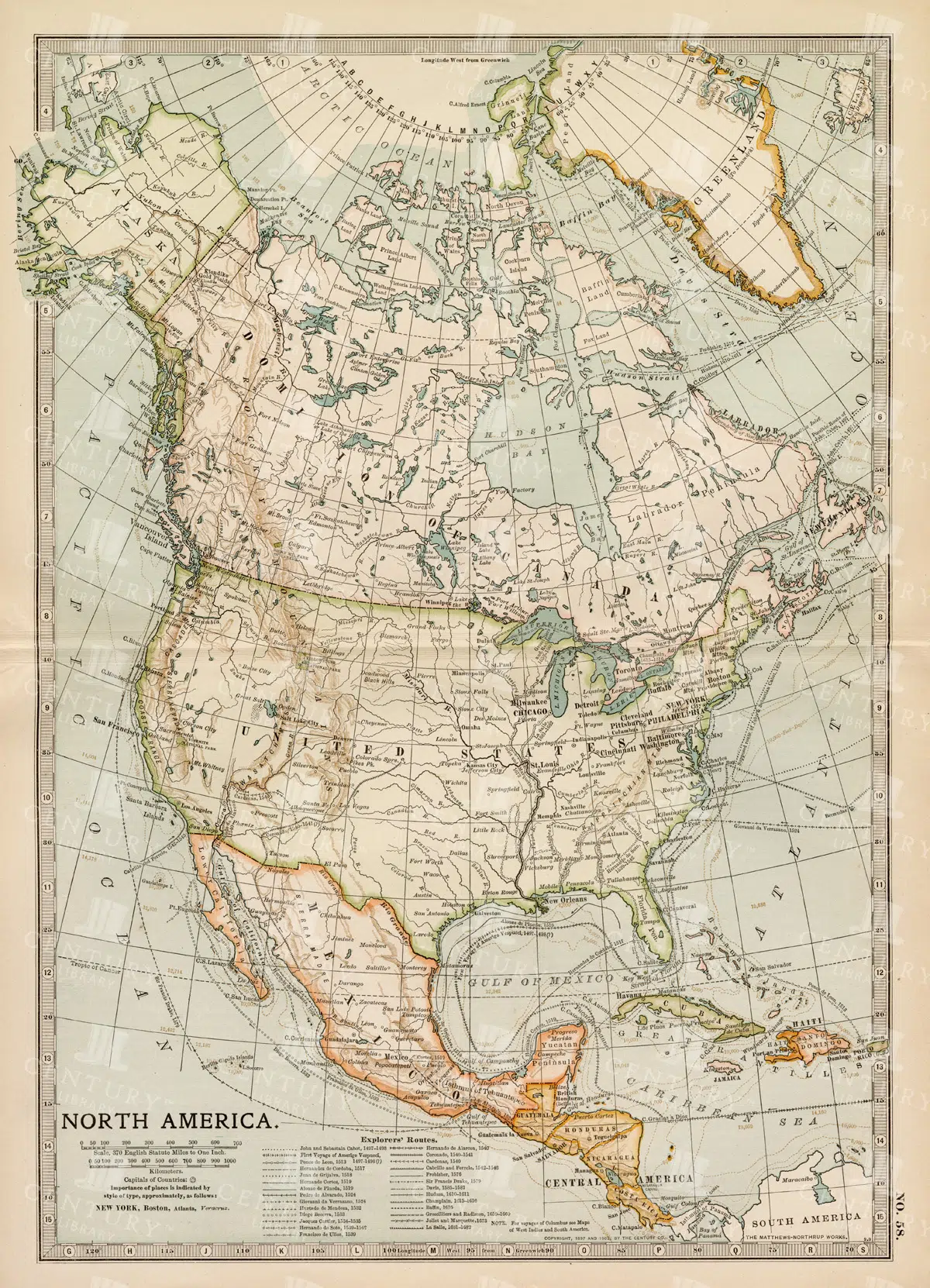
Vintage Map of North America
A historic map of North America, offering a comprehensive view of the continent's geography, including the United States, Canada, and Mexico, from the late 19th century.
- Resolution: 7242 x 5100
- Image Type(s): JPG
From this collection

Vintage Printing Press Letter with Handwritten Typography – Transparent PNG
This image is part of a curated collection that showcases a diverse range of vintage document designs and typographic art, featuring intricate letterhead logos, ornate receipts, and decorative printed overlays. Each piece captures the elegance of historical print styles—from German heraldic flourishes and British typographic traditions to antique invoices and lottery tickets. Perfect for design enthusiasts, crafters, and historians alike, these images offer a nostalgic glimpse into the artistry of printed communication, blending handwritten and printed text with ornamental details and transparent overlays.
- Resolution: 4364px x 5612px
- Image Type(s): PNG
From this collection

Delicate Butterfly Arrangement with Vintage Handwritten Notes
A cluster of butterflies perched on botanical leaves, accented by elegant handwritten text. This piece has a soft, old-world feel that’s ideal for anyone wanting to add a hint of nature and nostalgia to their papercrafts, journals, or art projects.
- Resolution: 3368 × 4762
- Image Type(s): JPG
From this collection

Vintage Handwritten Music Sheet Paper Texture – Worn and Aged No.3
- License Info
- Resolution: 6900px x 10000px
From this collection
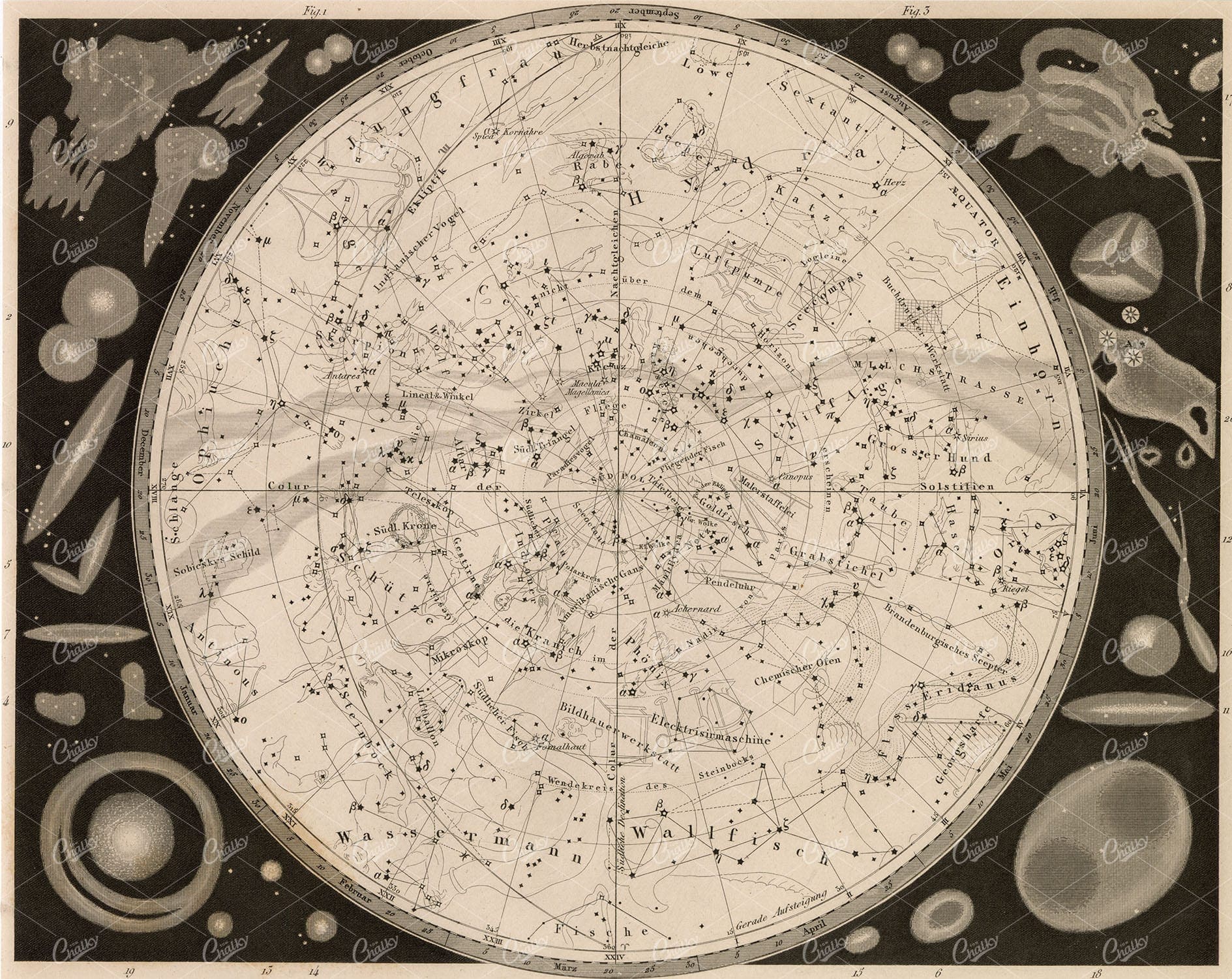
ASTRONOMY – Map of the Southern Heavens – Antique Engraving 1851
You’re looking at a well preserved original plate from Johann Georg Heck's “Iconographic Encyclopedia of Sciences, Literature and Art” published in 1851 by Rudolphe Garrigue in New York. We were extremely fortunate to acquire the full collection of illustrative prints from the series, which after many months of looking, proved to be very difficult!
- License Info
- Resolution: 9192 x 7300 300dpi
- Year of Print: 1851
- Artist: Johann Georg Heck
From this collection
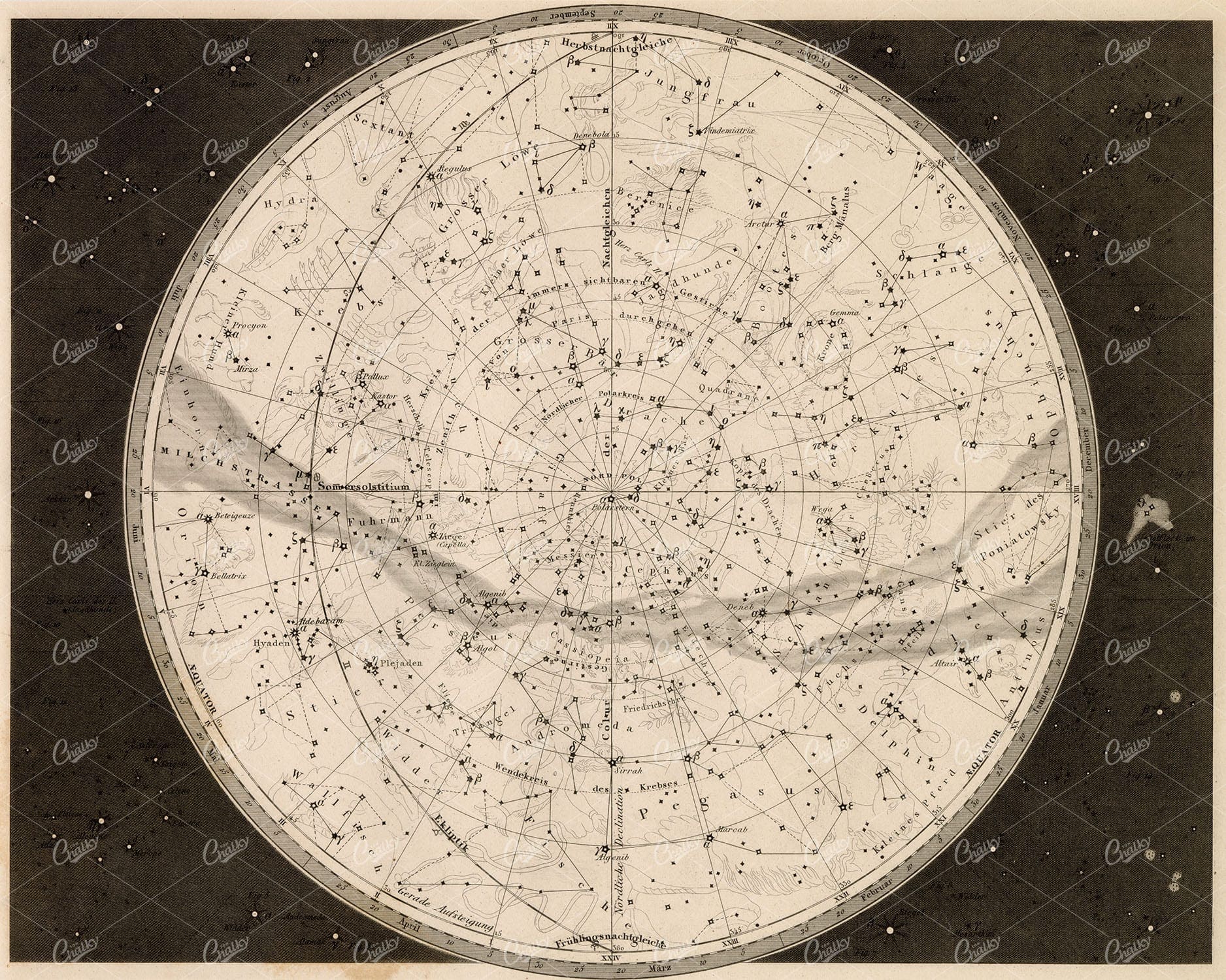
ASTRONOMY – Map of the Northern Heavens – Johann Heck 1851 Print
You’re looking at a well preserved original plate from Johann Georg Heck's “Iconographic Encyclopedia of Sciences, Literature and Art” published in 1851 by Rudolphe Garrigue in New York. We were extremely fortunate to acquire the full collection of illustrative prints from the series, which after many months of looking, proved to be very difficult!
- License Info
- Resolution: 9143 x 7310 300dpi
- Year of Print: 1851
- Artist: Johann Georg Heck
From this collection

WORLD MAP – Rare Antique Print – J. Robins & Co. Albion Press London 1800s
You're looking at an Original pre-1820's Antique Engraving from a rare copy of Abraham Rees' "The Cyclopaedia; or, UNIVERSAL DICTIONARY OF ARTS, SCIENCES, and LITERATURE" (Published 1820 by Longman, Hurst, Rees, Orme)
- License Info
- Resolution: 15400 x 9200 300dpi
- Year of Print: 1800s
- Artist: Abraham Rees
From this collection

ASTRONOMY Antique Solar System Stock Image. 1880 William Mackenzie
An original Antique Plate scan from the National Encyclopaedia: A Dictionary of Universal Knowledge. Published by William Mackenzie in 1880. Click on the Artist's name to see the full collection from this series!
- License Info
- Resolution: 7594 x 10009 300dpi
- Year of Print: 1880
- Artist: William Mackenzie
From this collection

1897 Map of Italy: Comprehensive View Including Rome and Venice
A detailed 1897 map of Italy, encompassing the entire peninsula including key cities like Rome and Venice. This map highlights the topographical features, transportation networks, and regional boundaries of Italy during the late 19th century. It offers a broad view of Italy's geography and historical development, making it a significant resource for historical studies.
- Resolution: 7153 x 5100
- Image Type(s): JPG
From this collection

Three Vintage-Style Butterfly Circles with Antique Handwriting
These three circular designs combine delicate butterflies, pretty plants, and a touch of antique handwriting for a warm, vintage-inspired feel. They’re perfect for turning into coasters, labels, or charming accents in your scrapbooks and journals. If you’re a fan of nature-inspired art with a nostalgic twist, these designs will fit right in with your creative projects.
- Resolution: 2057 x 2057
- Image Type(s): .ZIP (Pngs)
From this collection

Vintage Map of Europe Showing Key Regions and Countries
This vintage map of Europe provides a detailed view of the continent’s countries, regions, and geographical features. The map offers a historical perspective on Europe’s political boundaries and major cities during the time period. Its detailed cartography and vintage aesthetic make it a valuable resource for historians, collectors, and anyone interested in European history. The map includes insets of various regions, adding further detail and context.
- Resolution: 7131 x 5100
- Image Type(s): JPG
- european history
- detailed map
- europe map
- vintage cartography
- european cartography
- old european map
- detailed europe map
- europe vintage
- historical europe
- old europe map
- europe countries
- european regions
- vintage europe
- european geography
- europe regions
- europe geography
- antique europe
- europe cartography
- europe map vintage
- european cities
- regions
- historical geography
- antique map
- historical map
- old map
- countries
- historical
- country
- vintage
- representation
- Geography
- Atlas
- World
- Map
- Europe
- Travel
From this collection

Antique Map of the United States
Detailed antique map of the United States showing states, territories, railroads, and cities, with inset of Alaska. Includes topographical features, rivers, and mountain ranges.
- Resolution: 7275 x 5100
- Image Type(s): JPG
- 19th-century
- Alaska
- America
- america map
- American history
- Antique
- antique map
- archival
- Atlantic Ocean
- Borders
- cartographer
- cartography
- cities
- collectible
- detailed
- education
- exploration
- Geography
- heritage
- historic
- historical
- historical map
- History
- illustration
- Map
- mountain ranges
- nostalgic
- old map
- Pacific Ocean
- railroads
- reference
- Rivers
- state lines
- states
- territories
- topographical
- transportation
- United States
- united states map
- USA
- vintage
- vintage map
From this collection

Vintage Map of Ireland Highlighting Political Boundaries and Topographical Features
This vintage map of Ireland highlights the country's political boundaries and key topographical features, including rivers, mountains, and major cities. The map provides a historical overview of Ireland during the late 19th century, offering insight into the geopolitical landscape and cultural heritage of the island. It includes detailed insets of Dublin and its surrounding areas, reflecting Ireland's rich history and complex political past.
- Resolution: 7149 x 5100
- Image Type(s): JPG
- late 19th century
- geopolitical
- Irish history
- Ireland history
- cultural heritage
- topography
- cities
- historical geography
- antique map
- historical map
- exploration
- old map
- cartography
- political boundaries
- Dublin
- vintage
- representation
- Antique
- History
- Island
- Geography
- Atlas
- World
- Landscape
- Ireland
- Rivers
- Mountains
- Map
- United Kingdom
- Europe
From this collection
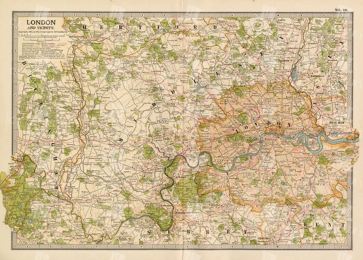
1897 Map of London and Surrounding Areas in the Late 19th Century
A detailed map from 1897 showcasing London and its surrounding areas, including key roads, railways, and landmarks. The map offers a comprehensive view of the city's layout and development during the late 19th century, providing valuable historical insights into London's urban expansion and infrastructure. The vintage aesthetic adds to its charm as a historical document.
- Resolution: 7158 x 5100
- Image Type(s): JPG
From this collection

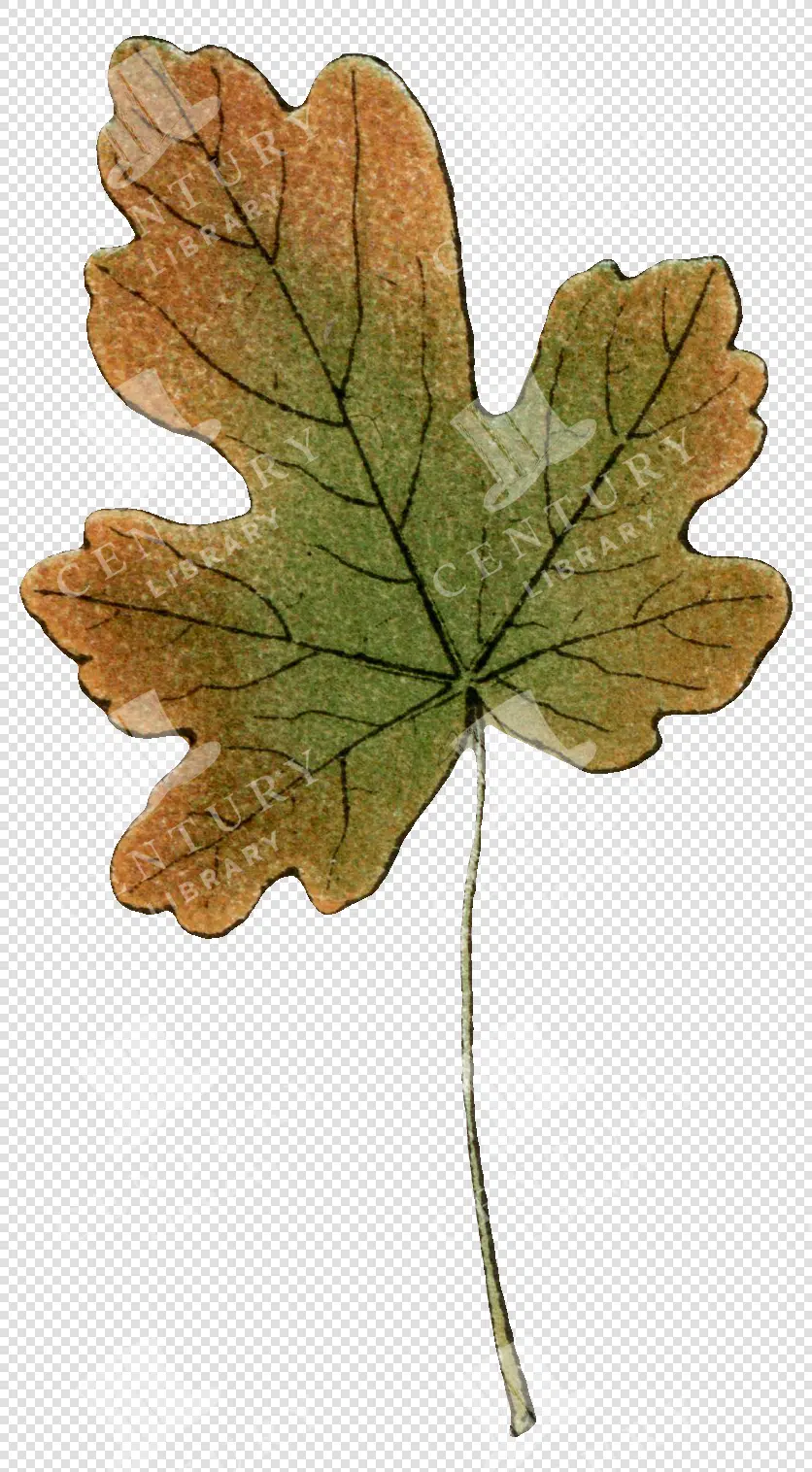
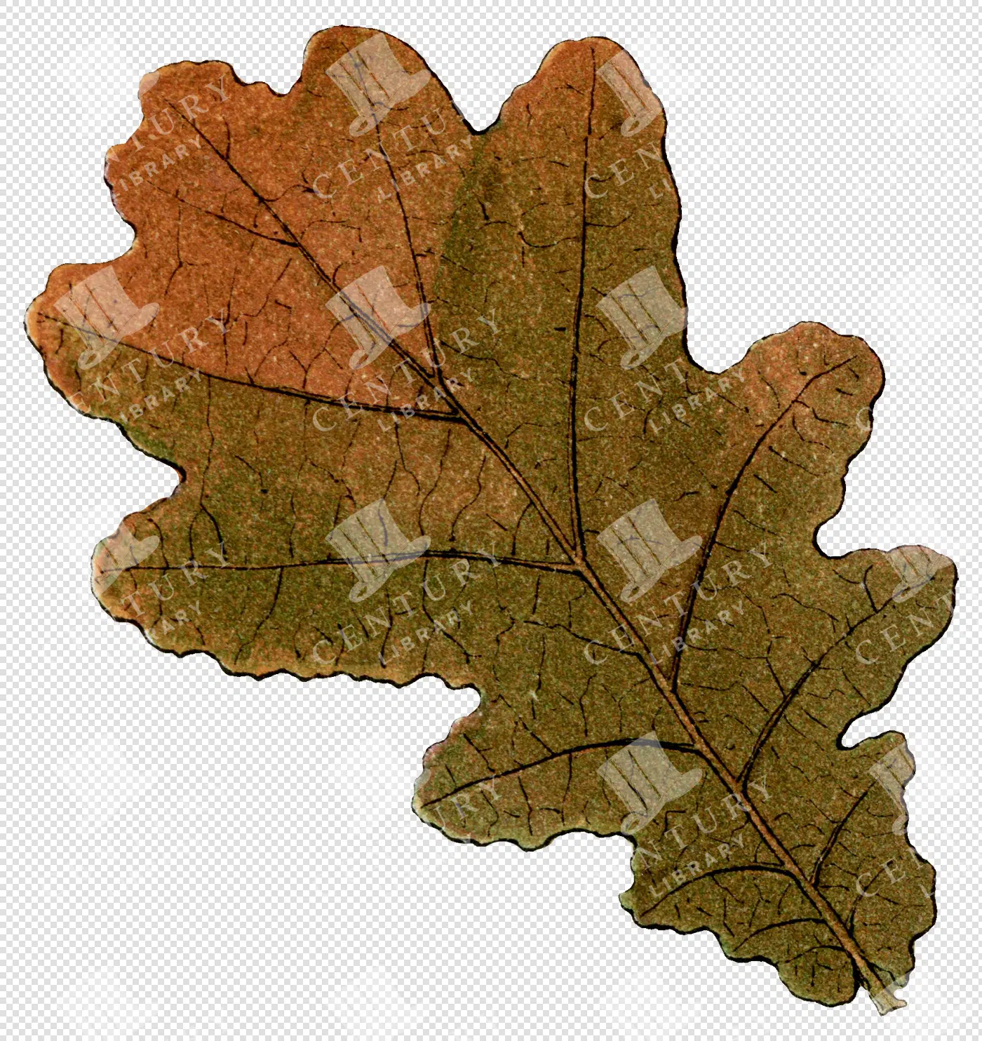
Brown and Green Oak Leaf with Visible Vein Pattern
This image is part of our exquisite collection of vintage autumn leaf illustrations, meticulously revived from antique treasures. Each leaf comes as a high-resolution, transparent PNG file, perfect for graphic designers, illustrators, and creative hobbyists alike. Use these botanical clipart pieces to elevate your projects, whether it’s for invitations, decor, branding, or packaging. Infuse your designs with the graceful charm of nature using these timeless, printable leaf graphics.
- Image Type(s): PNG
From this collection
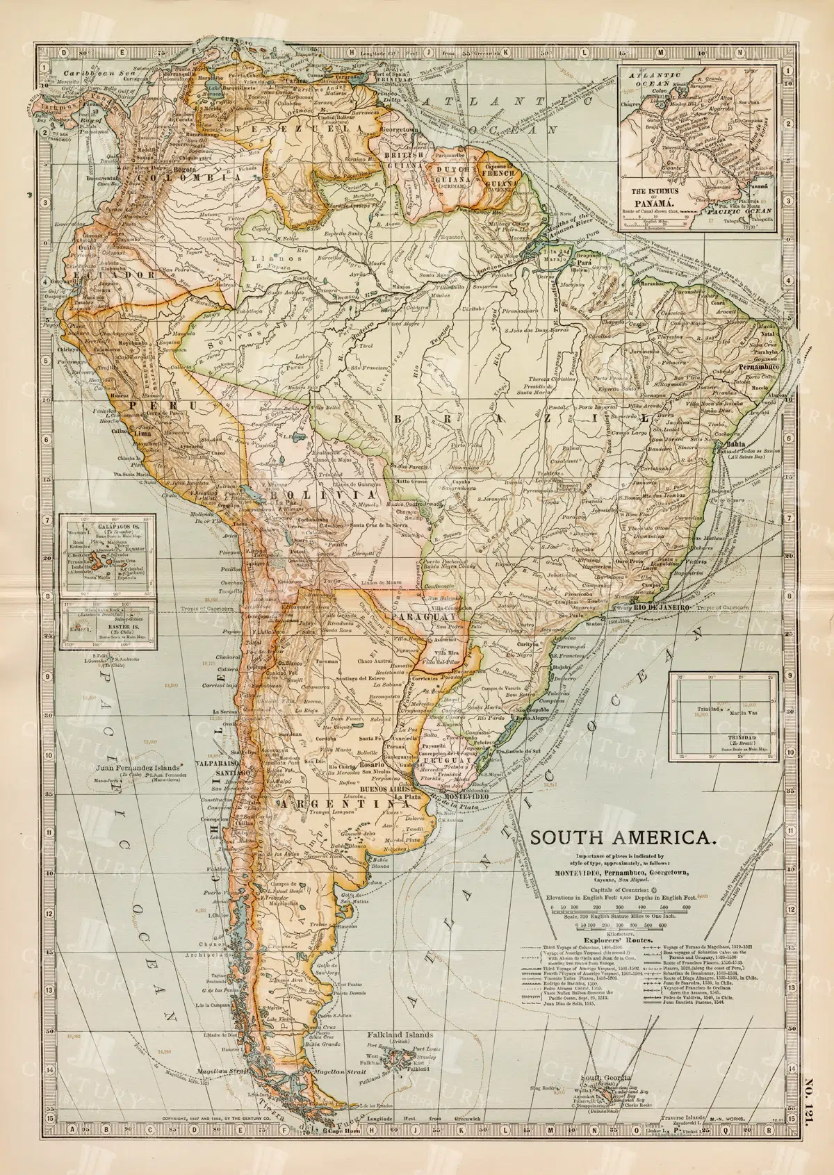
Complete 19th Century Map of South America with Geographical Details
A comprehensive 19th century map of South America, illustrating the continent's countries, cities, and geographical features in great detail. This vintage map provides an overview of the political landscape and natural features of the era.
- Resolution: 7262 x 5100
- Image Type(s): JPG
- 1800s
- 19th-century
- antique cartography
- antique map
- antique paper
- archival
- Atlas
- cartographic history
- cartography
- cities
- complete map
- geographical features
- Geography
- heritage
- historical artifact
- historical document
- historical geography
- historical information
- historical map
- historical records
- history lovers
- Latin America
- Map
- map of South America
- old map
- old South America
- political divisions
- representation
- South America
- South American history
- topography
- vintage
- vintage map
- World
From this collection

ASTRONOMY – Scarce Antique 1791 Engraving – Old Encyclopaedia Plate
You're looking at a scarce, 229 year old, steel plate engraving from the original "The New Encyclopaedia Or Modern Universal Dictionary Of Arts And Sciences On A New And Improved Plan" by Hall, William Henry, Bedford Row, London, published by C Cooke, London.
- License Info
- Resolution: 8300 x 13800 300dpi
- Year of Print: 1791
- Artist: C. Cooke
Related Images

WORLD MAP Physical Map of Mountain-Chains and River Systems. 1880 Stock Image
An original Antique Plate scan from the National Encyclopaedia: A Dictionary of Universal Knowledge. Published by William Mackenzie in 1880. Click on the Artist's name to see the full collection from this series!
- License Info
- Resolution: 7594 x 10009 300dpi
- Year of Print: 1880
- Artist: William Mackenzie
From this collection

Brown and Green Oak Leaf with Visible Vein Texture
This image is part of our exquisite collection of vintage autumn leaf illustrations, meticulously revived from antique treasures. Each leaf comes as a high-resolution, transparent PNG file, perfect for graphic designers, illustrators, and creative hobbyists alike. Use these botanical clipart pieces to elevate your projects, whether it’s for invitations, decor, branding, or packaging. Infuse your designs with the graceful charm of nature using these timeless, printable leaf graphics.
- Image Type(s): PNG
From this collection
Single Autumn Leaf with Green and Brown Botanical Foliage Details
This image is part of our exquisite collection of vintage autumn leaf illustrations, meticulously revived from antique treasures. Each leaf comes as a high-resolution, transparent PNG file, perfect for graphic designers, illustrators, and creative hobbyists alike. Use these botanical clipart pieces to elevate your projects, whether it’s for invitations, decor, branding, or packaging. Infuse your designs with the graceful charm of nature using these timeless, printable leaf graphics.
- Image Type(s): PNG
From this collection

Vintage Illustration of Sea-Horse with Spiny Body and Curled Tail as Transparent PNG
A vintage illustration of a sea-horse, highlighting its spiny body and curled tail. This transparent PNG is perfect for aquatic and marine-themed projects, emphasizing the unique form of the sea-horse.
- Resolution: 1128px x 1763px
- Image Type(s): PNG
Related Images
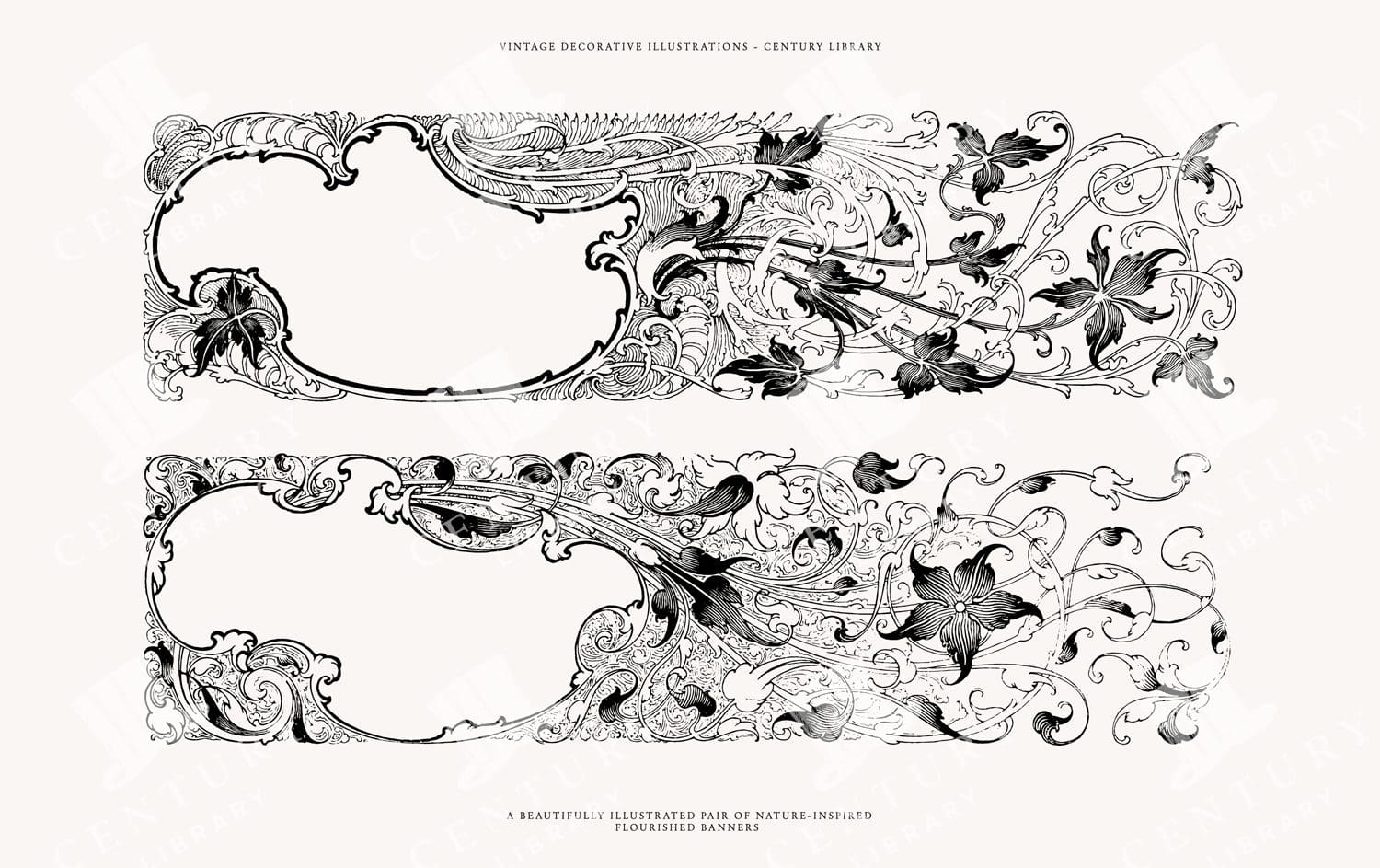
Decorative Floral Banners PNG, SVG, and EPS – Vector Clip Art for Invitations and Design
You're looking at a vintage pair of Victorian floral banners discovered in a late 1800s design book. These illustrations were extracted from their original backgrounds and converted to the following image formats: SVG (vector), EPS (vector), and, of course, PNG (300dpi raster image with transparent background).
- Image Type(s): EPS, SVG, PNG
From this collection
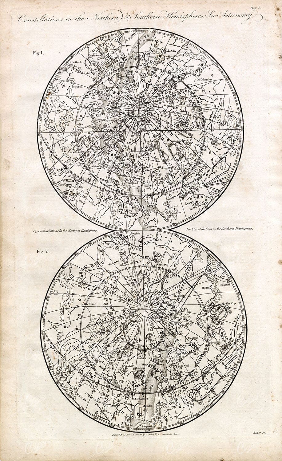
ASTRONOMY – Constellations Northern & Southern Hemispheres – Antique
You're looking at a scarce, 229 year old, steel plate engraving from the original "The New Encyclopaedia Or Modern Universal Dictionary Of Arts And Sciences On A New And Improved Plan" by Hall, William Henry, Bedford Row, London, published by C Cooke, London.
- License Info
- Resolution: 8300 x 13800 300dpi
- Year of Print: 1791
- Artist: C. Cooke
Related Images

Historic Map of Oceanica Including Australia, New Zealand, and Pacific Islands
An extensive historical map of Oceanica, encompassing Australia, New Zealand, and various Pacific Islands. This 19th-century map details major routes, colonial regions, and key geographical features.
- Resolution: 7246 x 5100
- Image Type(s): JPG
From this collection

Antique Map of Florida Highlighting Key Regions and Coastal Areas
This antique map of Florida offers a detailed view of the state’s counties, cities, and coastal regions. The map provides historical insight into Florida’s geography, showcasing key areas such as Jacksonville, Tampa, and Miami. The insets offer additional detail, making this map a valuable resource for collectors and history enthusiasts. Its vintage style and detailed cartography add to its charm and historical significance.
- Resolution: 7132 x 5100
- Image Type(s): JPG
- Antique
- antique geography
- antique map
- Atlas
- cities
- coastal map
- collectible map
- counties
- detailed florida map
- detailed map
- Florida
- florida cartography
- florida coastal map
- florida geography
- florida historical map
- florida history
- florida map
- florida regions
- florida towns
- florida vintage
- Geography
- historical florida map
- historical geography
- historical map
- jacksonville
- Map
- miami
- old florida map
- old map
- regions
- representation
- southern florida
- southern states
- tampa
- vintage
- vintage cartography
- vintage florida
- World
From this collection

Rough and Rustic Handwritten Note – Vintage Handwriting Overlay – Drag and Drop
This image is part of a curated collection that showcases a diverse range of vintage document designs and typographic art, featuring intricate letterhead logos, ornate receipts, and decorative printed overlays. Each piece captures the elegance of historical print styles—from German heraldic flourishes and British typographic traditions to antique invoices and lottery tickets. Perfect for design enthusiasts, crafters, and historians alike, these images offer a nostalgic glimpse into the artistry of printed communication, blending handwritten and printed text with ornamental details and transparent overlays.
- Resolution: 2276px x 2794px
- Image Type(s): PNG
From this collection

Victorian Financial Ledger (1858) – Handwritten Double-Page Account Book Entry #2
This image is part of a curated collection that showcases a diverse range of vintage document designs and typographic art, featuring intricate letterhead logos, ornate receipts, and decorative printed overlays. Each piece captures the elegance of historical print styles—from German heraldic flourishes and British typographic traditions to antique invoices and lottery tickets. Perfect for design enthusiasts, crafters, and historians alike, these images offer a nostalgic glimpse into the artistry of printed communication, blending handwritten and printed text with ornamental details and transparent overlays.
- Resolution: 4938px x 3982px
- Image Type(s): PNG
From this collection

Rustic Toile De Jouy Patterns with Pastoral Scenes, Elegant Figures, and Nature Elements
Vintage Toile de Jouy Patterned Backgrounds – Ornate, Classical, and Full of Charm This wonderful background is from a collection that features a beautiful range of vintage Toile de Jouy-style patternes, carefully restored from antique prints. Packed with intricate scenes of rural life, mythological figures, classical architecture, elegant florals, and decorative motifs, these designs are perfect for adding timeless elegance to your creative projects. You’ll find everything from aristocrats and animals to hot air balloons and garden scenes, all woven into that iconic French toile style. Whether you're working on a junk journal, printable paper pack, or a more refined design project, this bundle is a go-to for vintage lovers looking to add depth, texture, and character to their work.
- Image Type(s): PNG
From this collection

Detailed 19th Century Map of the Netherlands, Belgium, and Luxembourg
A detailed antique map from the 19th century featuring the Netherlands, Belgium, and Luxembourg. The map showcases the geographical and political landscape of the region, including major cities, rivers, and borders.
- Resolution: 7271 x 5100
- Image Type(s): JPG
From this collection

Vintage 1800s Map of Alaska Featuring Detailed Geography and Historical Boundaries – Antique Historical Map
An antique map from the 1800s featuring Alaska, highlighting its detailed geography and historical boundaries. This vintage map offers a glimpse into the early cartographic representation of Alaska, with intricate details of its natural features and political divisions. A perfect addition for those interested in Alaskan history and vintage maps.
- Resolution: 7105 x 5100
- Image Type(s): JPG
From this collection

1897 Map of Japan and Korea Detailing Regional Divisions
An intricate 1897 map of Japan and Korea, illustrating regional divisions, cities, and transportation routes. The map provides a detailed view of the geography and political landscape of East Asia during the late 19th century, highlighting the interconnectedness of Japan and Korea. Its vintage cartography offers a glimpse into the historical context of the region.
- Resolution: 7155 x 5100
- Image Type(s): JPG
From this collection

Antique 19th Century Map of Norway and Sweden with Topographical Details
A beautifully detailed antique map from the 19th century showcasing the countries of Norway and Sweden, with topographical features, major cities, and inset maps of Kristiana and Stockholm.
- Resolution: 7245 x 5100
- Image Type(s): JPG
From this collection

Vintage Map of Southern England and Wales Highlighting Major Cities and Coastal Areas
This vintage map of Southern England and Wales highlights major cities, coastal areas, and important transportation routes. The map provides detailed insights into the region's historical geography and urban development during the period.
- Resolution: 7127 x 5100
- Image Type(s): JPG
From this collection
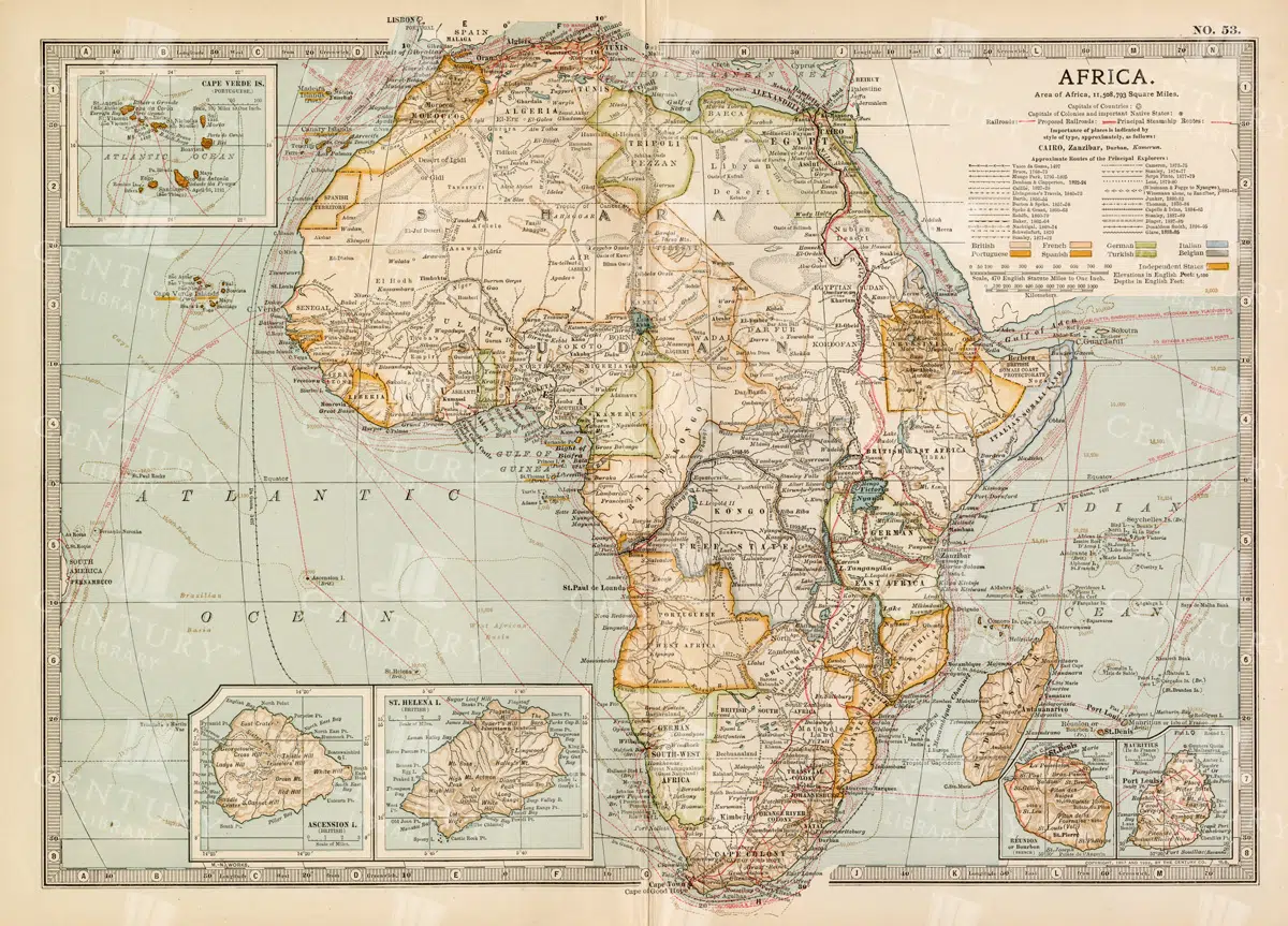
Antique 1800s Map of Africa Showing Entire Continent and Colonial Territories – Vintage Historical Cartography
This comprehensive antique map from the 1800s showcases the entire continent of Africa, highlighting colonial territories and geographical features. The map is a valuable historical document, offering insights into Africa's political and natural landscape during the colonial era. A beautifully detailed piece of vintage cartography.
- Resolution: 7104 x 5100
- Image Type(s): JPG
- 1800s
- Africa
- Africa colonial
- Africa history
- Africa map
- Antique
- antique map
- Atlas
- boundaries
- cartography
- colonial era
- colonial territories
- country
- detailed
- entire continent
- exploration
- Geography
- historical
- historical map
- History
- illustration
- Map
- natural features
- old map
- political map
- preserved
- representation
- retro
- topography
- vintage
- vintage map
- World
From this collection
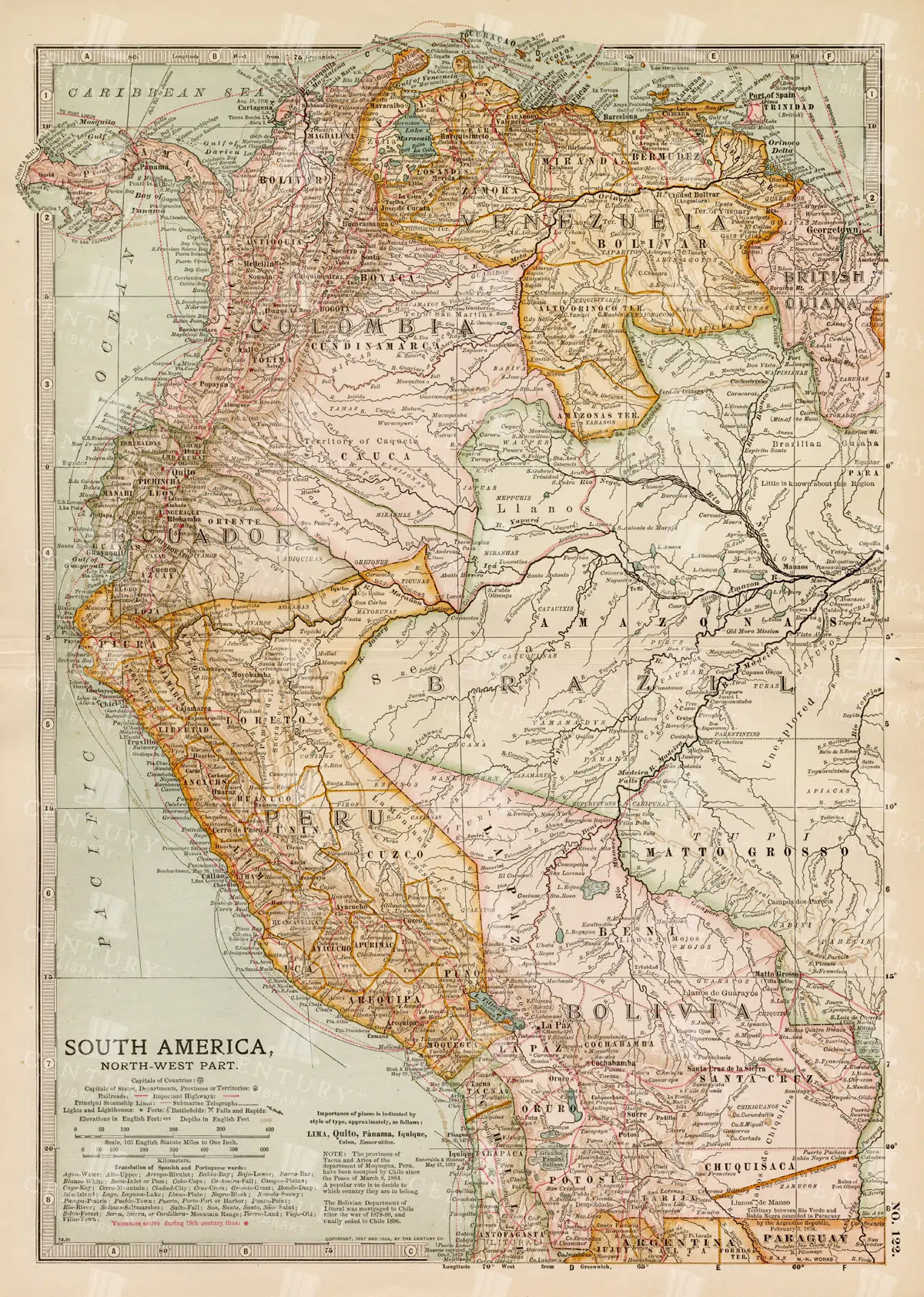
Detailed 19th Century Map of Northwestern South America
A detailed 19th century map illustrating the northwestern part of South America, including countries like Colombia, Venezuela, and Ecuador. This vintage map offers a glimpse into the political and geographical divisions of the era, with detailed insets of major cities and regions.
- Resolution: 7260 x 5100
- Image Type(s): JPG
- 1800s
- 19th-century
- Antique
- antique cartography
- antique map
- antique paper
- archival
- Atlas
- cartographic history
- cartography
- cities
- Colombia
- country
- Ecuador
- geographical features
- Geography
- Globe
- heritage
- historical artifact
- historical document
- historical geography
- historical information
- historical map
- historical records
- history lovers
- Latin America
- Map
- map of Colombia
- Navigation
- Northwestern South America
- old map
- old South America
- political divisions
- representation
- South America
- South American history
- topography
- Travel
- Venezuela
- vintage
- vintage map
- World
From this collection

Antique Map of the West Indies
Historical antique map of the West Indies, showcasing islands like Cuba, Jamaica, and Puerto Rico, with detailed nautical routes, ports, and topography. Includes inset of Bermuda. 19th century cartography.
- Resolution: 7279 x 5100
- Image Type(s): JPG
- nostalgic
- cartographer
- cuba
- puerto rico
- nautical routes
- ports
- bermuda
- islands map
- sea routes
- bermuda map
- west indies map
- island history
- archival
- Caribbean islands
- Caribbean
- detailed map
- maritime
- topography
- historical map
- exploration
- old map
- cartography
- transportation
- 19th-century
- collectible
- historical
- heritage
- classic
- Islands
- country
- vintage
- representation
- Atlantic Ocean
- Antique
- History
- Jamaica
- West Indies
- Geography
- Atlas
- World
- Map
- Nautical
From this collection
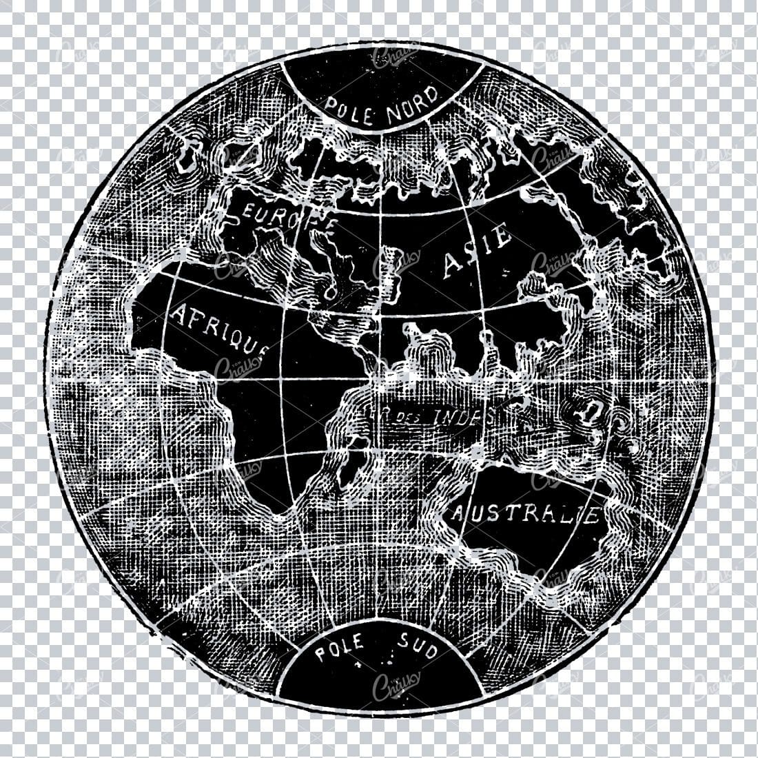
Small Vintage Illustration of the World / Globe Map
- License Info
- Resolution: 1805px x 1780px
Related Images


Central Europe Travel Map Featuring Major Cities Like Paris, Berlin, and Vienna
This travel map of Central Europe highlights major cities such as Paris, Berlin, and Vienna, showcasing detailed routes and geographical features. The map provides a glimpse into the historical and political landscape of Central Europe during the time.
- Resolution: 7117 x 5100
- Image Type(s): JPG
From this collection

19th Century Map of Southern South America Featuring Argentina and Chile
A richly detailed 19th century map of Southern South America, highlighting countries like Argentina and Chile, with special insets of Buenos Aires, Montevideo, and Valparaiso. This vintage map showcases the region's political and geographical landscape during the era.
- Resolution: 7261 x 5100
- Image Type(s): JPG
- 1800s
- 19th-century
- antique cartography
- antique map
- antique paper
- archival
- Argentina
- Atlas
- Buenos Aires
- cartographic history
- cartography
- Chile
- cities
- geographical features
- Geography
- heritage
- historical artifact
- historical document
- historical geography
- historical information
- historical map
- historical records
- history lovers
- Latin America
- Map
- map of Argentina
- Montevideo
- old map
- old South America
- political divisions
- representation
- South America
- South American history
- Southern South America
- topography
- Valparaiso
- vintage
- vintage map
- World
From this collection

1897 Map of Jamaica and the Lesser Antilles
This vintage 1897 map features Jamaica and the Lesser Antilles, highlighting the islands' geography, political boundaries, and colonial possessions. The map provides a historical overview of the Caribbean region, showing the various territories under colonial rule during the late 19th century. Its detailed depiction of the islands offers valuable insight into the Caribbean's colonial past.
- Resolution: 7154 x 5100
- Image Type(s): JPG
From this collection

Antique Map of Northern France Including the English Channel and Paris
This antique map of Northern France illustrates the region’s towns, roads, and geographical features, including Paris and the English Channel. The map provides a detailed representation of the historical geography of the area, showing the connections between key locations. Its vintage aesthetic adds charm, making it a must-have for history enthusiasts and map collectors. Insets highlight additional regions, enhancing the map's utility and appeal.
- Resolution: 7134 x 5100
- Image Type(s): JPG
- english channel map
- northern france
- english channel
- paris geography
- old france map
- france vintage
- french cartography
- france towns
- france regions
- french history
- detailed map
- vintage cartography
- french geography
- historical france map
- vintage france
- france cartography
- french map
- france history
- paris map
- historical geography
- antique map
- historical map
- old map
- northern
- towns
- historical
- Roads
- vintage
- representation
- Paris
- Geography
- Atlas
- World
- France
- Map
From this collection

Historical Map of North-Central France Including the Vicinity of Paris
This historical map of North-Central France features detailed depictions of towns, roads, and geographical features surrounding Paris. It showcases the intricate layout of the region, making it an invaluable resource for historians and map enthusiasts. The vintage style and precise detailing provide insight into the historical geography of France during the period, highlighting key locations and the relationship between Paris and its surrounding areas.
- Resolution: 7133 x 5100
- Image Type(s): JPG
- paris geography
- vintage france map
- old france map
- france vintage
- french cartography
- france towns
- france regions
- french history
- detailed map
- vintage cartography
- french geography
- north-central
- historical france map
- vintage france
- france cartography
- french map
- paris vicinity
- north-central france
- france history
- france geography
- paris map
- historical france
- historical geography
- antique map
- historical map
- old map
- towns
- historical
- Roads
- brass
- vintage
- representation
- Paris
- Geography
- France
- Map
From this collection

Vintage 1800s Map of Asia with Emphasis on Siberia and Central Asia – Antique Historical Map
A vintage map from the 1800s featuring Asia, with special emphasis on Siberia and Central Asia. The antique map showcases the vast geography, political boundaries, and natural features of the region, offering a detailed view of Asia during the 19th century. Perfect for those interested in Asian history and vintage cartography.
- Resolution: 7109 x 5100
- Image Type(s): JPG
From this collection
Brown and Green Oak Leaf with Detailed Vein Structure
This image is part of our exquisite collection of vintage autumn leaf illustrations, meticulously revived from antique treasures. Each leaf comes as a high-resolution, transparent PNG file, perfect for graphic designers, illustrators, and creative hobbyists alike. Use these botanical clipart pieces to elevate your projects, whether it’s for invitations, decor, branding, or packaging. Infuse your designs with the graceful charm of nature using these timeless, printable leaf graphics.
- Image Type(s): PNG
From this collection

19th Century Map of the Balkan Peninsula and Turkey in Europe
An antique map from the 19th century illustrating the Balkan Peninsula and Turkey in Europe, including regions like Bulgaria, Romania, Serbia, and Montenegro. The map offers a detailed view of the historical geography of Southeastern Europe.
- Resolution: 7274 x 5100
- Image Type(s): JPG
From this collection

Support the Library
Our supporters and members help us continue collecting and restoring these wonderful pieces of art for the modern creator
Unlock Everything and Become a Member!
While a lot of the library is available for free, some is kept behind closed dusty doors only to be accessed by our lovely members.