
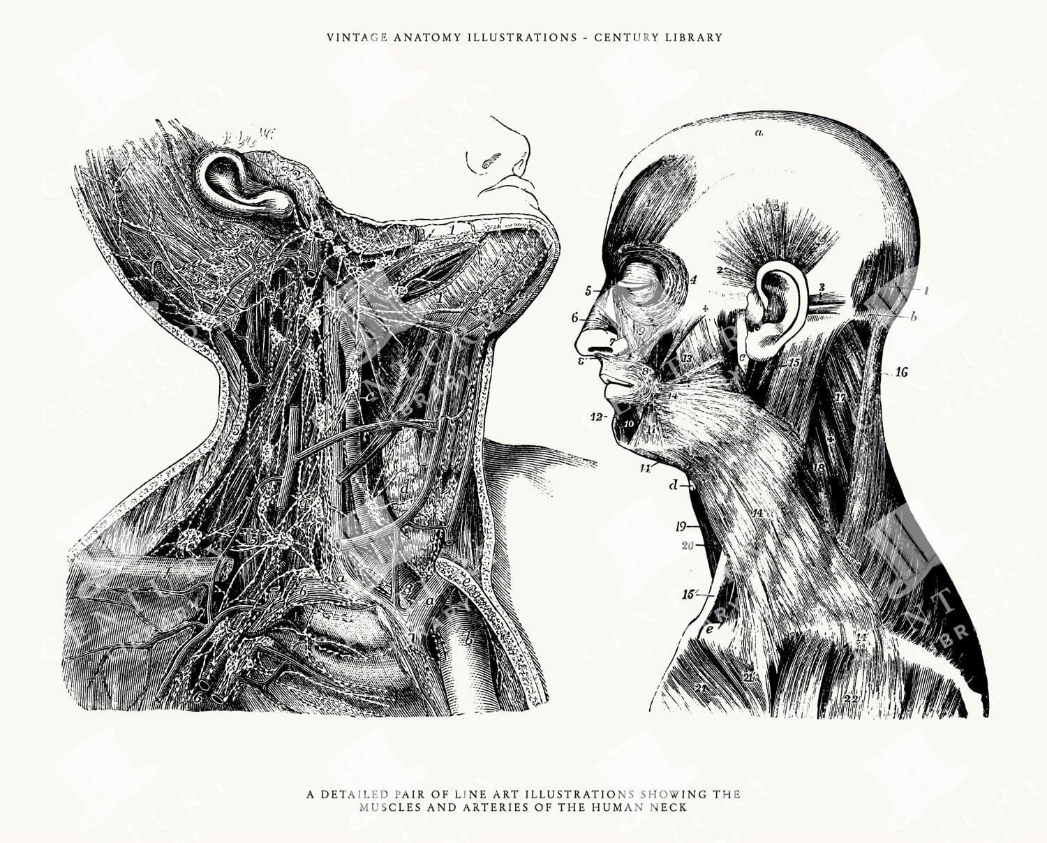
Isolated Human Head Line Art – Anatomy Illustrations in PNG, SVG, and EPS Image Formats
You're looking at a wonderfully restored set of 2 anatomically correct human neck and head illustrations. Each anatomy image was extracted from its original background and converted to the following image formats: SVG (vector), EPS (vector), and, of course, PNG (300dpi raster image with transparent background).
- Image Type(s): EPS, SVG, PNG
From this collection

Set of Human Leg Clipart – Anatomy Illustrations in PNG, SVG, and EPS Image Formats
You're looking at a wonderfully restored set of 4 anatomically correct human leg illustrations. Each anatomy image was extracted from its original background and converted to the following image formats: SVG (vector), EPS (vector), and, of course, PNG (300dpi raster image with transparent background).
- Image Type(s): EPS, SVG, PNG
Related Images
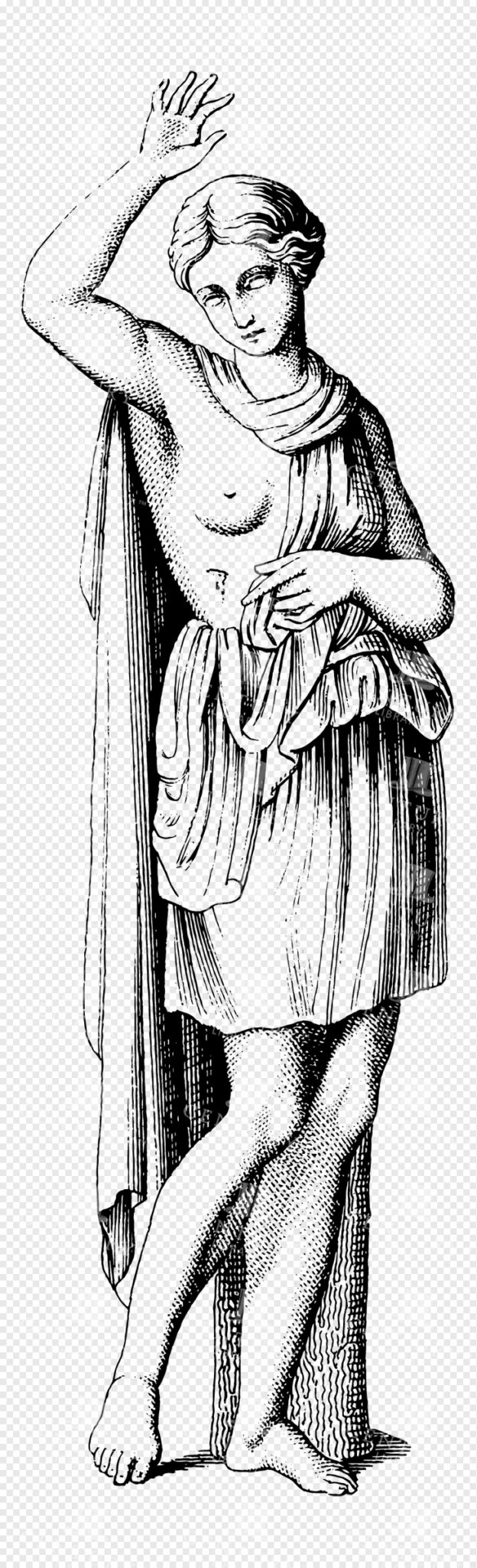
Graceful Greek Goddess Line Art Depiction with Flowing Drapes and Raised Hand
This image is part of our Extensive Collection of 135 Greek, Roman, and Mythology Vintage Line Art Illustrations. Each piece hand-selected from a variety of 19th-century books and ephemera found within our private library.
- Image Type(s): PNG
From this collection

MINERALOGY Types of Crystals Wolfram Gypsum Melonite – 1814 Antique Print
- License Info
- Resolution: 7010 x 9578 300dpi
- Year of Print: 1814
Related Images

Toile De Jouy Print with Rural Scenes, Hunting, and Farm Animals
Vintage Toile de Jouy Patterned Backgrounds – Ornate, Classical, and Full of Charm This wonderful background is from a collection that features a beautiful range of vintage Toile de Jouy-style patternes, carefully restored from antique prints. Packed with intricate scenes of rural life, mythological figures, classical architecture, elegant florals, and decorative motifs, these designs are perfect for adding timeless elegance to your creative projects. You’ll find everything from aristocrats and animals to hot air balloons and garden scenes, all woven into that iconic French toile style. Whether you're working on a junk journal, printable paper pack, or a more refined design project, this bundle is a go-to for vintage lovers looking to add depth, texture, and character to their work.
- Image Type(s): PNG
From this collection

Side Profile of Greek Lady Wearing Robes Sitting Among Thorny Vines Flowers and Leaves with Circular Background
A side profile of a Greek lady in robes surrounded by thorny vines, flowers, and leaves within a circular background, ideal for classical themes and designs.
- Image Type(s): PNG
Related Images

Antique Map of Northern France Including the English Channel and Paris
This antique map of Northern France illustrates the region’s towns, roads, and geographical features, including Paris and the English Channel. The map provides a detailed representation of the historical geography of the area, showing the connections between key locations. Its vintage aesthetic adds charm, making it a must-have for history enthusiasts and map collectors. Insets highlight additional regions, enhancing the map's utility and appeal.
- Resolution: 7134 x 5100
- Image Type(s): JPG
- english channel map
- northern france
- english channel
- paris geography
- old france map
- france vintage
- french cartography
- france towns
- france regions
- french history
- detailed map
- vintage cartography
- french geography
- historical france map
- vintage france
- france cartography
- french map
- france history
- paris map
- historical geography
- antique map
- historical map
- old map
- northern
- towns
- historical
- Roads
- vintage
- representation
- Paris
- Geography
- Atlas
- World
- France
- Map
From this collection

Vintage Palm Reading Illustration – Palm of Hand No.6
- License Info
- Resolution: 3892px x 5628px
From this collection

Vintage Illustration of a Vulture Skeleton with Spread Wings as Transparent PNG
A vintage illustration of a vulture skeleton with spread wings, displaying detailed skeletal structure. This transparent PNG is ideal for educational and wildlife-themed projects, focusing on avian anatomy.
- Resolution: 2032px x 2829px
- Image Type(s): PNG
From this collection

Historical Map of North-Central France Including the Vicinity of Paris
This historical map of North-Central France features detailed depictions of towns, roads, and geographical features surrounding Paris. It showcases the intricate layout of the region, making it an invaluable resource for historians and map enthusiasts. The vintage style and precise detailing provide insight into the historical geography of France during the period, highlighting key locations and the relationship between Paris and its surrounding areas.
- Resolution: 7133 x 5100
- Image Type(s): JPG
- paris geography
- vintage france map
- old france map
- france vintage
- french cartography
- france towns
- france regions
- french history
- detailed map
- vintage cartography
- french geography
- north-central
- historical france map
- vintage france
- france cartography
- french map
- paris vicinity
- north-central france
- france history
- france geography
- paris map
- historical france
- historical geography
- antique map
- historical map
- old map
- towns
- historical
- Roads
- brass
- vintage
- representation
- Paris
- Geography
- France
- Map
From this collection

Toile De Jouy Chinoiserie PNG Illustration with Ornamental Carriage, Decorative Motifs, and Family Scene
The image is 1 of 59 from the following collection: 'Discover Toile De Jouy’s gorgeous style within this meticulously edited collection of 59 isolated PNG illustrations. Inside, you'll discover a wonderfully detailed set of vintage illustrations with a subtle texture applied, making the illustration look like it has been printed with dark blue ink! It’s super effective and looks fantastic on light backgrounds.
- Image Type(s): PNG
From this collection

Central Europe Travel Map Featuring Major Cities Like Paris, Berlin, and Vienna
This travel map of Central Europe highlights major cities such as Paris, Berlin, and Vienna, showcasing detailed routes and geographical features. The map provides a glimpse into the historical and political landscape of Central Europe during the time.
- Resolution: 7117 x 5100
- Image Type(s): JPG
From this collection

Vintage 1800s Map of Asia with Emphasis on Siberia and Central Asia – Antique Historical Map
A vintage map from the 1800s featuring Asia, with special emphasis on Siberia and Central Asia. The antique map showcases the vast geography, political boundaries, and natural features of the region, offering a detailed view of Asia during the 19th century. Perfect for those interested in Asian history and vintage cartography.
- Resolution: 7109 x 5100
- Image Type(s): JPG
From this collection

Vintage Palm Reading Illustration – Palm of Hand No.3
- License Info
- Resolution: 1895px x 3076px
From this collection

Vintage Green Certificate Frame with Complex Border
A vintage green certificate frame with a complex border, ideal for adding elegance to certificates, awards, and other formal recognitions.
- Image Type(s): PNG
From this collection

Detailed Historical Map of the East India Islands Including Malaysia and the Philippines
A detailed historical map of the East India Islands, including regions like Malaysia, the Philippines, and New Guinea. The map highlights important geographical features, cities, and maritime routes, offering a glimpse into the region's colonial history.
- Resolution: 7123 x 5100
- Image Type(s): JPG
From this collection

Chinoiserie-Inspired Ornamental Toile De Jouy Illustration – Decorative PNG Line Art
The image is 1 of 59 from the following collection: 'Discover Toile De Jouy’s gorgeous style within this meticulously edited collection of 59 isolated PNG illustrations. Inside, you'll discover a wonderfully detailed set of vintage illustrations with a subtle texture applied, making the illustration look like it has been printed with dark blue ink! It’s super effective and looks fantastic on light backgrounds.
- Image Type(s): PNG
From this collection

Antique Map of Texas, Western Part with Galveston Bay
A vintage 19th century map depicting the western part of Texas along with a detailed inset of Galveston Bay, Houston, and surrounding areas. The map highlights the state’s development, including railroads, towns, and natural features.
- Resolution: 7270 x 5100
- Image Type(s): JPG
From this collection

Detailed 19th Century Map of Texas, Eastern Part
A detailed map from the 19th century illustrating the eastern part of Texas, USA. The map features various towns, railroads, and natural landmarks, providing a glimpse into the state’s historical geography and development.
- Resolution: 7269 x 5100
- Image Type(s): JPG
From this collection

19th Century Map of Southern South America Featuring Argentina and Chile
A richly detailed 19th century map of Southern South America, highlighting countries like Argentina and Chile, with special insets of Buenos Aires, Montevideo, and Valparaiso. This vintage map showcases the region's political and geographical landscape during the era.
- Resolution: 7261 x 5100
- Image Type(s): JPG
- 1800s
- 19th-century
- antique cartography
- antique map
- antique paper
- archival
- Argentina
- Atlas
- Buenos Aires
- cartographic history
- cartography
- Chile
- cities
- geographical features
- Geography
- heritage
- historical artifact
- historical document
- historical geography
- historical information
- historical map
- historical records
- history lovers
- Latin America
- Map
- map of Argentina
- Montevideo
- old map
- old South America
- political divisions
- representation
- South America
- South American history
- Southern South America
- topography
- Valparaiso
- vintage
- vintage map
- World
From this collection

Antique Map of Georgia Highlighting Counties, Cities, and Key Regions
This antique map of Georgia offers a detailed view of the state, showcasing its counties, major cities, and key geographical features. The map provides a historical perspective on Georgia’s landscape, from its northern mountains to its southern coast. Insets focus on specific areas like Savannah and Chickamauga National Park, providing additional context and detail. This map is perfect for history buffs and collectors.
- Resolution: 7136 x 5100
- Image Type(s): JPG
- Antique
- antique geography
- antique map
- Atlas
- chickamauga national park
- cities
- collectible map
- counties
- detailed georgia map
- detailed map
- Geography
- Georgia
- georgia cartography
- georgia geography
- georgia historical map
- georgia history
- georgia landscape
- georgia map
- georgia regions
- georgia towns
- georgia vintage
- historical
- historical geography
- historical georgia map
- historical map
- Map
- old
- old georgia map
- old map
- regions
- representation
- Savannah
- southern georgia
- southern states
- vintage
- vintage cartography
- vintage georgia
From this collection

HUMAN Body Study – Statues of Rome – Rare Italian STATUE Print 1791
You're looking at a scarce, 229 year old, steel plate engraving from the original "The New Encyclopaedia Or Modern Universal Dictionary Of Arts And Sciences On A New And Improved Plan" by Hall, William Henry, Bedford Row, London, published by C Cooke, London.
- License Info
- Resolution: 8300 x 13800 300dpi
- Year of Print: 1791
- Artist: C. Cooke
Related Images

Toile De Jouy Seamless Pattern – Black and White Vintage Design (Transparent PNG)
This image is part of our Seamless Toile De Jouy Patterns collection; A collection that brings together a charming series of seamless Toile de Jouy patterns, each one lovingly restored and designed for repeat use. Featuring scenic countryside landscapes, pastoral figures, elegant florals, and classic French-inspired detailing, these patterns are ideal for anyone looking to add a vintage touch to their work. You’ll find multiple color variants—including warm sepia tones, timeless black and white, and classic French blue - all available as flat JPGs and transparent PNGs for easy layering and customisation. Perfect for scrapbooking, product packaging, surface design, fabric printing, stationery, or digital backdrops - these seamless vintage patterns are ready to tile and flow effortlessly across your designs.
- Image Type(s): PNG
From this collection
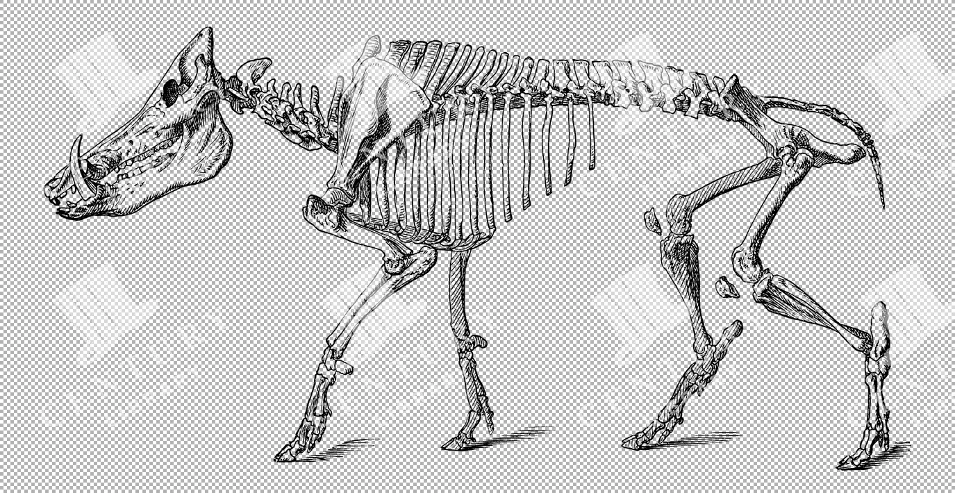
Vintage Illustration of Wild Boar Skeleton with Prominent Tusks as Transparent PNG
A vintage illustration of a wild boar skeleton, highlighting its prominent tusks and robust bone structure. This transparent PNG is perfect for wildlife and educational purposes.
- Resolution: 4507px x 2331px
- Image Type(s): PNG
From this collection

Antique Map of Vermont and New Hampshire
Detailed antique map showing the states of Vermont and New Hampshire with towns, railroads, rivers, and geographical features. Historical cartography showcasing 19th century state boundaries and infrastructures.
- Resolution: 7276 x 5100
- Image Type(s): JPG
- state lines
- nostalgic
- cartographer
- state boundaries
- infrastructures
- vermont map
- new hampshire map
- reference
- archival
- geographical features
- USA
- railroads
- detailed map
- historical map
- exploration
- old map
- cartography
- vintage map
- American history
- transportation
- states
- towns
- historic
- education
- 19th-century
- collectible
- historical
- heritage
- classic
- vintage
- representation
- Atlantic Ocean
- Antique
- History
- New England
- Vermont
- New Hampshire
- Geography
- Atlas
- Rivers
- Map
- Borders
From this collection

19th Century Map of Spain, Portugal, and Andorra
An antique map from the 19th century detailing the countries of Spain, Portugal, and Andorra, along with surrounding regions. The map features important cities, mountain ranges, and bodies of water, offering a glimpse into the historical geography of the Iberian Peninsula.
- Resolution: 7266 x 5100
- Image Type(s): JPG
- 19th-century
- Andorra
- Antique
- archives
- Atlantic
- Atlas
- Borders
- cartography
- cities
- country
- Europe
- exploration
- Geography
- heritage
- historic map
- historical
- History
- Iberian Peninsula
- landmarks
- Landscape
- Map
- Mediterranean
- Mountains
- old map
- Portugal
- Pyrenees
- reference
- representation
- retro
- Rivers
- settlements
- Spain
- topographic
- vintage
- vintage map
- World
From this collection

Antique Map of Philippine Islands and Hawaiian Islands with Inset Maps
A detailed 19th-century map showcasing the Philippine Islands and Hawaiian Islands, complete with inset maps of major cities like Manila and Honolulu. This map is ideal for historical and geographical research.
- Resolution: 7254 x 5100
- Image Type(s): JPG
From this collection

1897 Map of Jamaica and the Lesser Antilles
This vintage 1897 map features Jamaica and the Lesser Antilles, highlighting the islands' geography, political boundaries, and colonial possessions. The map provides a historical overview of the Caribbean region, showing the various territories under colonial rule during the late 19th century. Its detailed depiction of the islands offers valuable insight into the Caribbean's colonial past.
- Resolution: 7154 x 5100
- Image Type(s): JPG
From this collection
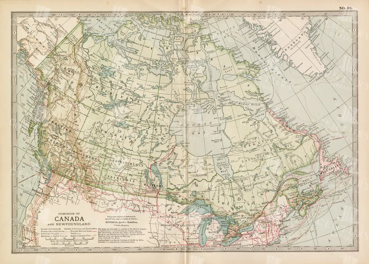
Antique Map of Canada and Newfoundland Highlighting Major Cities and Natural Features
An antique map of Canada and Newfoundland, offering a detailed look at the region's cities, natural landmarks, and geographical features. The map provides insights into the historical significance of the area during the time of its creation.
- Resolution: 7115 x 5100
- Image Type(s): JPG
From this collection
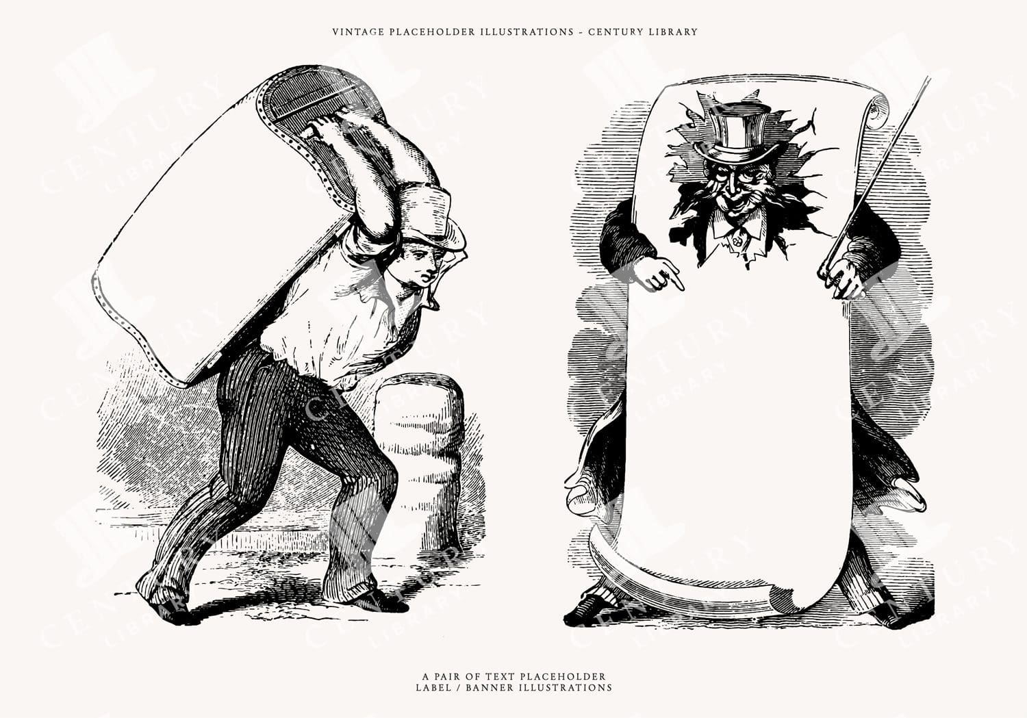
Clipart of People Holding Signs – Advertising Vintage Line Art Illustrations
You're looking at a super useful collection of vintage marketing/advertising design assets discovered within a late 1800s design book. These illustrations were extracted from their original backgrounds and converted to the following image formats: SVG (vector), EPS (vector), and, of course, PNG (300dpi raster image with transparent background).
- Image Type(s): EPS, SVG, PNG
Related Images

SATUES of ROME – Proportions of the Human Body – ANTIQUE Anatomy Print
You're looking at a scarce, 229 year old, steel plate engraving from the original "The New Encyclopaedia Or Modern Universal Dictionary Of Arts And Sciences On A New And Improved Plan" by Hall, William Henry, Bedford Row, London, published by C Cooke, London.
- License Info
- Resolution: 8300 x 13800 300dpi
- Year of Print: 1791
- Artist: C. Cooke
Related Images

Greek Mythological Lineart of Nike Guiding Horsemen, Wearing Helmets and Cloaks
This image is part of our Extensive Collection of 135 Greek, Roman, and Mythology Vintage Line Art Illustrations. Each piece hand-selected from a variety of 19th-century books and ephemera found within our private library.
- Image Type(s): PNG
From this collection

Antique Map of Virginia
Historical antique map of Virginia, showing counties, towns, railroads, rivers, and geographical details. Includes insets of the western part of Virginia and the Norfolk vicinity. 19th century cartography.
- Resolution: 7277 x 5100
- Image Type(s): JPG
- nostalgic
- cartographer
- state boundaries
- geographical details
- virginia map
- western virginia
- norfolk
- virginia counties
- historical regions
- reference
- archival
- USA
- railroads
- detailed map
- historical map
- exploration
- old map
- cartography
- American history
- transportation
- counties
- towns
- historic
- education
- 19th-century
- collectible
- historical
- heritage
- classic
- vintage
- old
- representation
- Atlantic Ocean
- Antique
- History
- Virginia
- Geography
- Atlas
- Rivers
- Map
From this collection

Greek Mythological Lineart of Winged Goddess Nike Pouring Offering with Elegant Grace
This image is part of our Extensive Collection of 135 Greek, Roman, and Mythology Vintage Line Art Illustrations. Each piece hand-selected from a variety of 19th-century books and ephemera found within our private library.
- Image Type(s): PNG
From this collection

19th Century Map of the Balkan Peninsula and Turkey in Europe
An antique map from the 19th century illustrating the Balkan Peninsula and Turkey in Europe, including regions like Bulgaria, Romania, Serbia, and Montenegro. The map offers a detailed view of the historical geography of Southeastern Europe.
- Resolution: 7274 x 5100
- Image Type(s): JPG
From this collection

19th Century Central Scotland Map Featuring Glasgow and Edinburgh
A vintage map from the 19th century depicting central Scotland, highlighting major cities like Glasgow and Edinburgh. This historical map is rich in detail, showcasing the region's topography, transportation routes, and geographical features during the era.
- Resolution: 7258 x 5100
- Image Type(s): JPG
- archival
- historical document
- antique cartography
- historical records
- history lovers
- historical artifact
- historical information
- antique paper
- geographical features
- central Scotland
- Glasgow
- map of Scotland
- Scottish history
- old Britain
- Scottish Highlands
- Lowlands
- transportation routes
- topography
- cities
- historical geography
- antique map
- historical map
- old map
- cartography
- vintage map
- cartographic history
- 1800s
- 19th-century
- heritage
- Edinburgh
- vintage
- representation
- British History
- Geography
- Atlas
- World
- Map
- United Kingdom
- Scotland
From this collection

Flying Fox Bat Hanging – Transparent PNG
A realistic illustration of a flying fox bat hanging from a branch, with wings folded. The transparent PNG format makes this image ideal for projects focused on nocturnal wildlife and bats, emphasizing the bat’s unique anatomy and posture.
- Resolution: 3763px x 4554px
- Image Type(s): PNG
- Animal
- animalia
- Bat
- Branch
- chiroptera
- Claws
- creature
- dark
- Drawing
- Ears
- exotic
- Eyes
- Flying
- Fox
- fruit bat
- fur
- Hanging
- hanging upside
- illustration
- illustration PNG
- isolated
- large
- Mammal
- mega bat
- Nature
- Night
- nocturnal
- perched
- PNG
- rainforest
- representation
- resting
- Silhouette
- sketch
- transparent
- transparent background
- Tree
- tree branch
- Tropical
- Wild
- Wildlife
- Wings
Related Images

1897 Map of New Zealand and Pacific Islands
This vintage 1897 map provides a detailed view of New Zealand and surrounding Pacific islands, including Samoa, Fiji, Tonga, and others. It illustrates the geographical and political boundaries of the region during the late 19th century, offering insight into the exploration and colonization of the Pacific. The map's historical significance is enhanced by its detailed cartography and the representation of various island groups.
- Resolution: 7150 x 5100
- Image Type(s): JPG
From this collection

Antique 1800s Map of North-West Africa Highlighting Morocco, Algeria, and Western Sahara – Vintage Historical Map
This antique map from the 1800s highlights North-West Africa, including Morocco, Algeria, and the Western Sahara. It captures the colonial and geographical landscape of the time, showing intricate details of the region’s political boundaries and natural features. A beautifully preserved piece of history in vintage cartography.
- Resolution: 7102 x 5100
- Image Type(s): JPG
- 1800s
- Africa
- Africa colonial
- Africa map
- Algeria
- Antique
- antique map
- Atlas
- cartography
- colonial
- colonial era
- country
- detailed
- exploration
- Geography
- Globe
- historical
- historical map
- History
- Map
- Morocco
- natural features
- Navigation
- North-West Africa
- old
- old map
- political boundaries
- preserved
- representation
- retro
- topography
- Travel
- vintage
- vintage map
- Western Sahara
- World
From this collection
Vintage Decorative Line Art Illustration – Floral – Border – Frame – Pattern No.13
- License Info
- Resolution: 5106px x 7244px
Related Images


Bald Male Stone Bust Sculpture with Strong Jaw and Intense Expression
- Image Type(s): PNG
From this collection

Antique Map of Eastern India, Burma, Siam, and French Indo-China
This antique map showcases Eastern India, Burma (now Myanmar), Siam (now Thailand), and French Indo-China (Vietnam, Laos, Cambodia), with a focus on the geopolitical boundaries and major cities of the early 20th century. The map provides a detailed view of the region's topographical features, including rivers, mountain ranges, and coastlines, reflecting the historical context of Southeast Asia during this period.
- Resolution: 7143 x 5100
- Image Type(s): JPG
- Antique
- antique map
- Asia
- Atlas
- Burma
- cartography
- cities
- coastlines
- colonial
- country
- cultural heritage
- early 20th century
- Eastern India
- exploration
- French Indo-China
- Geography
- geopolitical boundaries
- historical geography
- historical map
- History
- Landscape
- Map
- mountain ranges
- old map
- representation
- Rivers
- Siam
- Southeast Asia
- topography
- World
From this collection

Historical Map of Cornwall, Devonshire, Dorset, and the Channel Islands
This historical map showcases the regions of Cornwall, Devonshire, Dorset, and the Channel Islands, detailing their towns, roads, and coastal features. The map is an essential resource for those interested in the historical geography of southern England. The vintage style and detailed cartography offer a unique insight into the area’s past, making it a valuable piece for collectors and history enthusiasts alike.
- Resolution: 7130 x 5100
- Image Type(s): JPG
- vintage england
- british geography
- england history
- dorset map
- devonshire map
- cornwall map
- southern england
- channel islands
- dorset
- devonshire
- english cartography
- detailed map
- english geography
- channel islands map
- vintage british map
- southern england map
- british vintage
- old england map
- coastal map
- england regions
- vintage cartography
- cornwall
- historical geography
- antique map
- historical map
- old map
- towns
- historical
- Roads
- vintage
- representation
- British History
- Geography
- Atlas
- World
- Map
From this collection

Vintage Map of Southern England Including London, Brighton, and Major Coastal Cities
A vintage map of Southern England, highlighting major cities like London and Brighton, as well as coastal areas. The map provides detailed insights into the region's historical geography, transportation routes, and urban development.
- Resolution: 7129 x 5100
- Image Type(s): JPG
From this collection
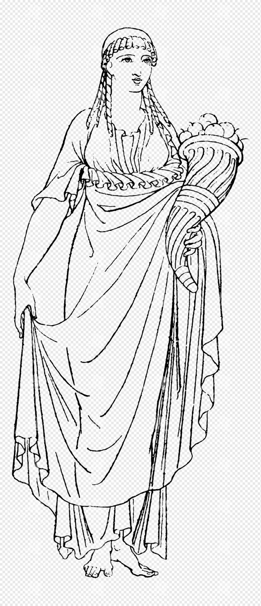
Ancient Greek or Roman Goddess Holding a Cornucopia
This image is part of our Extensive Collection of 135 Greek, Roman, and Mythology Vintage Line Art Illustrations. Each piece hand-selected from a variety of 19th-century books and ephemera found within our private library.
- Image Type(s): PNG
From this collection
Brown Certificate Border with Blank Center
A brown certificate border featuring wavy patterns and a blank center, suitable for awards, diplomas, and official documents.
- Image Type(s): PNG
- Antique
- arabesque
- Art
- artistic
- Award
- blank
- Border
- Brown
- center
- certificate
- classic
- decor
- Decoration
- Decorative
- delicate
- Design
- diploma
- document
- elegant
- embellished
- Engraving
- fine
- formal
- Frame
- Graphic
- heritage
- illustration
- illustrative
- lined
- official
- officialborder
- old
- old-fashioned
- Ornate
- Outline
- Pattern
- Patterned
- Photograph
- representation
- retro
- stylish
- symmetrical
- traditional
- vintage
- wavy
From this collection

Antique Map of West Virginia
Detailed antique map of West Virginia, showing counties, towns, railroads, and geographical features. Historical 19th century cartography with insets of surrounding areas. An educational and collectible piece.
- Resolution: 7280 x 5100
- Image Type(s): JPG
- nostalgic
- cartographer
- state boundaries
- historical regions
- west virginia map
- west virginia counties
- surrounding areas
- heritage map
- vintage west virginia
- state map
- reference
- archival
- geographical features
- USA
- railroads
- detailed map
- topography
- historical map
- exploration
- old map
- cartography
- American history
- transportation
- counties
- towns
- education
- 19th-century
- collectible
- historical
- heritage
- classic
- vintage
- old
- representation
- Antique
- History
- West Virginia
- Geography
- Atlas
- World
- Globe
- Map
From this collection

Antique Map of Northern Ohio with Detailed City and County Lines
A historic map from the late 19th century detailing Northern Ohio, including major cities, counties, and transportation routes. This antique map highlights the region's development and infrastructure.
- Resolution: 7247 x 5100
- Image Type(s): JPG
From this collection

Antique Map of Mexico Showing Topography and Major Cities
An antique map of Mexico displaying the topography, major cities, and transportation routes, with a focus on the geographical diversity and historical boundaries from the early 20th century.
- Resolution: 7163 x 5100
- Image Type(s): JPG
From this collection

Antique Map of Western England and Wales Including Detailed Regional Boundaries
An antique map of Western England and Wales, showcasing detailed regional boundaries and cities like Liverpool and Manchester. The map highlights important geographical features, transportation routes, and historical landmarks in the area.
- Resolution: 7126 x 5100
- Image Type(s): JPG
From this collection

Support the Library
Our supporters and members help us continue collecting and restoring these wonderful pieces of art for the modern creator
Unlock Everything and Become a Member!
While a lot of the library is available for free, some is kept behind closed dusty doors only to be accessed by our lovely members.